Kerman, California
| Kerman, California | ||
|---|---|---|
| City | ||
| City of Kerman | ||
 Kerman's eastern city limit at SR-180 | ||
| ||
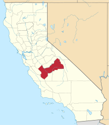
 Location of Kerman in Fresno County, California. | ||
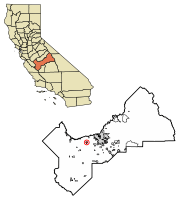
 Kerman, California Location in the United States | ||
| Coordinates: 36°43′25″N 120°03′36″W / 36.72361°N 120.06000°WCoordinates: 36°43′25″N 120°03′36″W / 36.72361°N 120.06000°W | ||
| Country | United States | |
| State | California | |
| County | Fresno | |
| Incorporated | July 2, 1946[1] | |
| Government | ||
| • Mayor | Rhonda Armstrong[2] | |
| • State Senator | Jean Fuller (R)[3] | |
| • State Assembly | Joaquin Arambula (D)[4] | |
| • U. S. Congress | David Valadao (R)[5] | |
| Area[6] | ||
| • Total | 3.27 sq mi (8.46 km2) | |
| • Land | 3.27 sq mi (8.46 km2) | |
| • Water | 0.00 sq mi (0.00 km2) 0% | |
| Elevation[7] | 220 ft (67 m) | |
| Population (2010) | ||
| • Total | 13,544 | |
| • Estimate (2016)[8] | 14,594 | |
| • Density | 4,467.10/sq mi (1,724.64/km2) | |
| Time zone | UTC-8 (PST) | |
| • Summer (DST) | UTC-7 (PDT) | |
| ZIP code | 93630 | |
| Area code(s) | 559 | |
| FIPS code | 06-38226 | |
| GNIS feature IDs | 1658895, 2411536 | |
| Website |
www | |
Kerman (formerly, Collis)[9] is a city at the intersection of State Route 180 and State Route 145 in Fresno County, California, USA. The population was 13,544 at the 2010 census. Kerman is located 15 miles (24 km) west of Fresno,[9] at an elevation of 220 feet (67 m).[7]
History
Around 1891, the Southern Pacific Railroad constructed a new line between Tracy and Fresno. A watering tank and pump on that line was the beginning of Kerman, which was christened Collis in honor of the President of the road, Collis Potter Huntington. The first inhabitant, the caretaker of the pump and tank, kept the tank full of water for the thirsty engines with their long and lumbering trains. After some months, he resigned his job, not because of the work, he said, but because it was too lonesome and he was tired of being a hermit. He said he never saw anyone but the train crews and they were always in too big a hurry to carry on a conversation.
On August 3, 1892, the train bandits Chris Evans, John Sontag, and George Contant robbed a Southern Pacific train at Collis. Contant went to Folsom State Prison for the crime. Evans and John Sontag became fugitives for ten months before they were captured in 1893 in what is called the Battle of Stone Corral. John Sontag died of his wounds in custody, and Chris Evans was also sent to Folsom upon his conviction of the crime.[10]
As a speculative venture, the old and very rich Bank of California purchased a huge tract of land in every County of California. The arid, barren land around Kerman seemed to be a good venture, so that happened to be the allotment for Fresno County.
After the death of its promoter, the bank became insolvent and its property was liquidated. The property here attracted the attention of two Los Angeles capitalists, William G. Kerckhoff and Jacob Mansar, who saw a chance to purchase a plentiful water supply from the newly constructed Enterprise Canal, which had its source in the Kings River. The men combined the first three letters of each of their names and christened the area "Kerman." They pitched the property to Scandinavians and Germans settled in the Midwest.[9]
The Collis post office was opened in 1894, closed in 1899, re-established in 1904, and renamed Kerman in 1906.[9] Kerman incorporated in 1946.[9] The independent Kerman Telephone company retired its four-position manual telephone switchboard, described by a state telephone association as the last of its kind in California, in 1991.[11]
Geography
According to the United States Census Bureau, the city has a total area of 3.2 square miles (8.3 km2), all of it land.
Demographics
| Historical population | |||
|---|---|---|---|
| Census | Pop. | %± | |
| 1950 | 1,563 | — | |
| 1960 | 1,970 | 26.0% | |
| 1970 | 2,667 | 35.4% | |
| 1980 | 4,002 | 50.1% | |
| 1990 | 5,448 | 36.1% | |
| 2000 | 8,551 | 57.0% | |
| 2010 | 13,544 | 58.4% | |
| Est. 2016 | 14,594 | [8] | 7.8% |
| U.S. Decennial Census[12] | |||
2010
The 2010 United States Census[13] reported that Kerman had a population of 13,544. The population density was 4,189.9 people per square mile (1,617.7/km²). The racial makeup of Kerman was 6,860 (50.6%) White, 68 (0.5%) African American, 173 (1.3%) Native American, 1,091 (8.1%) Asian, 14 (0.1%) Pacific Islander, 4,675 (34.5%) from other races, and 663 (4.9%) from two or more races. Hispanic or Latino of any race were 9,711 persons (71.7%).
The Census reported that 13,537 people (99.9% of the population) lived in households, 2 (0%) lived in non-institutionalized group quarters, and 5 (0%) were institutionalized.
There were 3,692 households, out of which 2,160 (58.5%) had children under the age of 18 living in them, 2,248 (60.9%) were opposite-sex married couples living together, 615 (16.7%) had a female householder with no husband present, 272 (7.4%) had a male householder with no wife present. There were 285 (7.7%) unmarried opposite-sex partnerships, and 25 (0.7%) same-sex married couples or partnerships. 460 households (12.5%) were made up of individuals and 208 (5.6%) had someone living alone who was 65 years of age or older. The average household size was 3.67. There were 3,135 families (84.9% of all households); the average family size was 3.97.
The population was spread out with 4,648 people (34.3%) under the age of 18, 1,469 people (10.8%) aged 18 to 24, 3,870 people (28.6%) aged 25 to 44, 2,580 people (19.0%) aged 45 to 64, and 977 people (7.2%) who were 65 years of age or older. The median age was 28.2 years. For every 100 females, there were 99.6 males. For every 100 females age 18 and over, there were 96.9 males.
There were 3,908 housing units at an average density of 1,209.0 per square mile (466.8/km²), of which 3,692 were occupied, of which 2,165 (58.6%) were owner-occupied, and 1,527 (41.4%) were occupied by renters. The homeowner vacancy rate was 3.3%; the rental vacancy rate was 4.9%. 8,215 people (60.7% of the population) lived in owner-occupied housing units and 5,322 people (39.3%) lived in rental housing units.
2000
As of the census[14] of 2000, there were 8,551 people, 2,389 households, and 1,994 families residing in the city. The population density was 1,528.5/km² (3,951.2/mi²). There were 2,462 housing units at an average density of 440.1/km² (1,137.6/mi²). The racial makeup of the city was 42.50% White, 0.36% Black or African American, 1.95% Native American, 8.29% Asian, 0.02% Pacific Islander, 42.38% from other races, and 4.49% from two or more races. 64.93% of the population were Hispanic or Latino of any race.
There were 2,389 households out of which 51.8% had children under the age of 18 living with them, 61.4% were married couples living together, 15.2% had a female householder with no husband present, and 16.5% were non-families. 13.8% of all households were made up of individuals and 7.3% had someone living alone who was 65 years of age or older. The average household size was 3.57 and the average family size was 3.91.
In the city, the population was spread out with 35.3% under the age of 18, 11.4% from 18 to 24, 28.7% from 25 to 44, 16.5% from 45 to 64, and 8.1% who were 65 years of age or older. The median age was 27 years. For every 100 females, there were 97.9 males. For every 100 females age 18 and over, there were 97.9 males.
The median income for a household in the city was $31,188, and the median income for a family was $34,120. Males had a median income of $29,120 versus $21,906 for females. The per capita income for the city was $11,495. 20.2% of the population and 19.1% of families were below the poverty line. 25.1% of those under the age of 18 and 6.3% of those 65 and older were living below the poverty line.
Educational institutions
The Kerman Unified School District is the sole school district serving Kerman and the surrounding areas.[15]
Public
- Kerman High School
- Kerman Middle School
- Enterprise High School (formerly Nova High School)
- Sun Empire Elementary School
- Kerman-Floyd Elementary School
- Goldenrod Elementary School
- Liberty Elementary School
Private:
- Kerman Christian School (On Kerman Covenant Church Campus)
Points of interest
Sister city relations
- Kannami, Shizuoka Prefecture, Japan[16] - since October 12, 1985
References
- ↑ "California Cities by Incorporation Date". California Association of Local Agency Formation Commissions. Archived from the original (Word) on November 3, 2014. Retrieved April 6, 2013.
- ↑ "City Council". City of Kerman. Retrieved 11 July 2017.
- ↑ "Senators". State of California. Retrieved April 6, 2013.
- ↑ "Members Assembly". State of California. Retrieved April 6, 2013.
- ↑ "California's 21st Congressional District - Representatives & District Map". Civic Impulse, LLC. Retrieved April 6, 2013.
- ↑ "2016 U.S. Gazetteer Files". United States Census Bureau. Retrieved Jul 19, 2017.
- 1 2 "Kerman". Geographic Names Information System. United States Geological Survey.
- 1 2 "Population and Housing Unit Estimates". Retrieved June 9, 2017.
- 1 2 3 4 5 Durham, David L. (1998). California's Geographic Names: A Gazetteer of Historic and Modern Names of the State. Clovis, Calif.: Word Dancer Press. ISBN 1-884995-14-4.
- ↑ Thomas Samuel Duke, ‘’Celebrated Criminal Cases of America’’, pp, 277-286. James H. Barry Company, San Francisco, California, 1910. Retrieved November 29, 2012.
- ↑ HILLINGER, CHARLES (8 April 1991). "Pulling the Plug : Phone Company to Replace Last Manual Switchboard". Retrieved 12 April 2018 – via LA Times.
- ↑ "Census of Population and Housing". Census.gov. Archived from the original on May 12, 2015. Retrieved June 4, 2015.
- ↑ "2010 Census Interactive Population Search: CA - Kerman city". U.S. Census Bureau. Retrieved July 12, 2014.
- ↑ "American FactFinder". United States Census Bureau. Retrieved 2008-01-31.
- ↑ "District Profile". Kerman Unified School District. 2013. Retrieved 21 September 2013.
- ↑ "Local Government International Exchange - The Council of Local Authorities for International Relations (CLAIR)". www.clair.or.jp (in Japanese). Archived from the original on 2016-01-13. Retrieved 2017-04-10.
External links
- Official website

- Kerman Photo History Kermanphotos