Cameo, California
Coordinates: 36°45′53″N 119°42′12″W / 36.76472°N 119.70333°W
| Cameo | |
|---|---|
| Unincorporated community | |
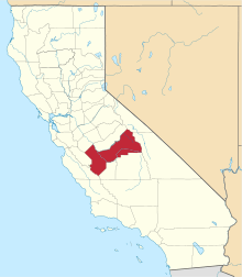
 Cameo Location in California  Cameo Cameo (the US) | |
| Coordinates: 36°45′53″N 119°42′12″W / 36.76472°N 119.70333°W | |
| Country | United States |
| State | California |
| County | Fresno County |
| Elevation[1] | 331 ft (101 m) |
Cameo is an unincorporated community in Fresno County, California.[1] It is located on the Atchison, Topeka and Santa Fe Railroad 4 miles (6.4 km) south of Clovis,[2] at an elevation of 331 feet (101 m).[1]
References
This article is issued from
Wikipedia.
The text is licensed under Creative Commons - Attribution - Sharealike.
Additional terms may apply for the media files.