Kars Parish, New Brunswick
| Kars | |
|---|---|
| Parish | |
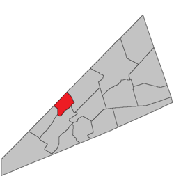 Location within Kings County, New Brunswick. | |
| Coordinates: 45°50′N 64°35′W / 45.84°N 64.59°W | |
| Country |
|
| Province |
|
| County | Kings County |
| Established | 1859 |
| Area[1] | |
| • Land | 75.96 km2 (29.33 sq mi) |
| Population (2011)[1] | |
| • Total | 407 |
| • Density | 5.4/km2 (14/sq mi) |
| • Pop 2006-2011 |
|
| • Dwellings | 346 |
| Time zone | UTC-4 (AST) |
| • Summer (DST) | UTC-3 (ADT) |
Kars Parish is a Canadian parish in Kings County, New Brunswick.
History
Kars Parish erected in 1859 from Kingston Parish: named for the 1855 Siege of Kars in eastern Turkey during the Crimean War.
Delineation
Kars Parish is defined in the Territorial Division Act[2] as being bounded:
- West by the Saint John River; east by the eastern side lines of lots number ten, granted to Richard B. Squires, number one, granted to William McDonald, and number seven, granted to James Peters; and south by Belleisle Bay, including the islands at the mouth of Belleisle Bay.
Governance
The entire parish forms the local service district of the parish of Kars, established in 1968 to assess for fire protection. Recreational facilities were added in 2001 and non-fire related rescue in 2012. First aid and ambulance services (1972—2001) and community services (1986—2001) were formerly included.
Communities
Parish population total does not include incorporated municipalities (in bold):
|
|
Downeyville, New Brunswick[3] Tooleton, New Brunswick[4] Palmer Settlement or Palmer Point[5] Jones Settlement or Jones Corner [6] Paddock[7]
Bodies of water & Islands
This is a list of rivers, lakes, streams, creeks, marshes and Islands that are at least partially in this parish
- Hog Island
Other Islands: Pig Island, Ghost Island
Main Water Sources: Belleisle Bay, Saint John River
Coves: Tennants Cove, Jenkins Cove, Urquharts Cove, Earle Cove
Demographics
Access Routes
Highways and numbered routes that run through the parish, including external routes that start or finish at the parish limits:[10]
See also
References
- 1 2 2011 Statistics Canada Census Profile: Kars Parish, New Brunswick
- ↑ "Territorial Division Act (R.S.N.B. 1973, c. T-3)". Government of New Brunswick website. Retrieved 23 August 2016.
- ↑ http://archives.gnb.ca/Exhibits/Communities/Details.aspx?culture=en-CA&community=1088
- ↑ http://archives.gnb.ca/Exhibits/Communities/Details.aspx?culture=en-CA&community=4073
- ↑ http://archives.gnb.ca/Exhibits/Communities/Details.aspx?culture=en-CA&community=2953
- ↑ http://archives.gnb.ca/Exhibits/Communities/Details.aspx?culture=en-CA&community=1904
- ↑ http://archives.gnb.ca/Exhibits/Communities/Details.aspx?culture=en-CA&community=2949
- ↑ Statistics Canada: 2001, 2006 census
- ↑ Profile: Kars Parish, New Brunswick
- ↑ Atlantic Canada Back Road Atlas ISBN 978-1-55368-618-7
Places adjacent to Kars Parish, New Brunswick | |
|---|---|
| Subdivisions | |
|---|---|
| Cities | |
| Counties | |
| |
Coordinates: 45°37′08″N 65°57′40″W / 45.61881°N 65.961142°W