Kapho District
| Kapho กะพ้อ | |
|---|---|
| Amphoe | |
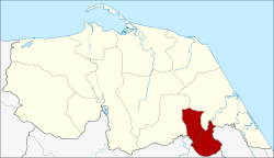 Amphoe location in Pattani Province | |
| Coordinates: 6°33′33″N 101°32′3″E / 6.55917°N 101.53417°ECoordinates: 6°33′33″N 101°32′3″E / 6.55917°N 101.53417°E | |
| Country | Thailand |
| Province | Pattani |
| Seat | Karubi |
| Area | |
| • Total | 93.814 km2 (36.222 sq mi) |
| Population (2005) | |
| • Total | 15,782 |
| • Density | 168.2/km2 (436/sq mi) |
| Time zone | UTC+7 (ICT) |
| Postal code | 94230 |
| Geocode | 9411 |
Kapho (Thai: กะพ้อ, pronounced [kā.pʰɔ́ː]) is a district (amphoe) in Pattani Province, southern Thailand.
History
The minor district (king amphoe) Kapho was formed on 15 March 1982 by splitting the three southern tambon from Sai Buri District.[1] On 4 November 1993 it was upgraded to a full district.[2]
Geography
Neighboring districts are (from the northwest clockwise) Thung Yang Daeng and Sai Buri of Pattani Province, Bacho of Narathiwat Province, and Raman of Yala Province.
Administration
The district is divided into three sub-districts (tambon), which are further subdivided into 22 villages (muban). There are no municipal (thesaban) areas. There are three tambon administrative organizations (TAO).
| No. | Name | Thai name | Villages | Pop.[3] | |
|---|---|---|---|---|---|
| 1. | Karubi | กะรุบี | 9 | 5,048 | |
| 2. | Talo Due Raman | ตะโละดือรามัน | 6 | 4,300 | |
| 3. | Plong Hoi | ปล่องหอย | 7 | 6,434 |
References
- ↑ ประกาศกระทรวงมหาดไทย เรื่อง แบ่งท้องที่อำเภอสายบุรี จังหวัดปัตตานี ตั้งเป็นกิ่งอำเภอกะพ้อ (PDF). Royal Gazette (in Thai). 99 (49 ง): 1139. March 6, 1982.
- ↑ พระราชกฤษฎีกาตั้งอำเภอลำทับ อำเภอร่องคำ อำเภอเวียงแหง อำเภอนาโยง อำเภอแก้งสนามนาง อำเภอโนนแดง อำเภอบ้านหลวง อำเภอกะพ้อ อำเภอศรีบรรพต อำเภอแก่งกระจาน อำเภอหนองสูง อำเภอสบเมย อำเภอเมยวดี อำเภอโคกเจริญ อำเภอทุ่งหัวช้าง อำเภอผาขาว อำเภอวังหิน อำเภอดอนพุด อำเภอบึงโขงหลง และอำเภอห้วยคต พ.ศ. ๒๕๓๖ (PDF). Royal Gazette (in Thai). 110 (179 ก special): 1–3. November 3, 1993.
- ↑ Department of Provincial Administration
External links
This article is issued from
Wikipedia.
The text is licensed under Creative Commons - Attribution - Sharealike.
Additional terms may apply for the media files.