Mayo District
| Mayo มายอ | |
|---|---|
| Amphoe | |
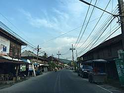 Mayo in 2016. | |
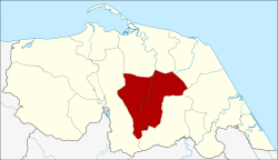 Amphoe location in Pattani Province | |
| Coordinates: 6°43′7″N 101°24′36″E / 6.71861°N 101.41000°ECoordinates: 6°43′7″N 101°24′36″E / 6.71861°N 101.41000°E | |
| Country | Thailand |
| Province | Pattani |
| Area | |
| • Total | 216.1 km2 (83.4 sq mi) |
| Population (2005) | |
| • Total | 53,070 |
| • Density | 245.6/km2 (636/sq mi) |
| Time zone | UTC+7 (ICT) |
| Postal code | 94140 |
| Geocode | 9405 |
Mayo (Thai: มายอ, pronounced [māː.jɔ̄ː]) is a district (amphoe) of Pattani Province, southern Thailand.
History
The area of Mayo was originally part of Yaring District. In 1900 the district was established, then named Rako (ราเกาะ). When in the following year the district office in tambon Mayo was opened the district was renamed after its central tambon.
Geography
Neighboring districts are (from the north clockwise) Yaring, Panare, Thung Yang Daeng, and Yarang.
Administration
The district is divided into 13 sub-districts (tambon), which are further subdivided into 58 villages (muban). Mayo is a township (thesaban tambon) which covers most parts of the tambon Mayo. There are a further 10 Tambon administrative organizations (TAO).
| No. | Name | Thai name | Villages | Pop. | |
|---|---|---|---|---|---|
| 1. | Mayo | มายอ | 3 | 4,468 | |
| 2. | Thanon | ถนน | 4 | 3,495 | |
| 3. | Trang | ตรัง | 4 | 3,014 | |
| 4. | Krawa | กระหวะ | 5 | 3,220 | |
| 5. | Lubo Yirai | ลุโบะยิไร | 8 | 9,880 | |
| 6. | La-nga | ลางา | 7 | 6,146 | |
| 7. | Kraso | กระเสาะ | 5 | 3,490 | |
| 8. | Ko Chan | เกาะจัน | 5 | 4,562 | |
| 9. | Pado | ปะโด | 4 | 4,506 | |
| 10. | Sakho Bon | สาคอบน | 3 | 2,896 | |
| 11. | Sakho Tai | สาคอใต้ | 4 | 1,885 | |
| 12. | Sakam | สะกำ | 4 | 3,880 | |
| 13. | Panan | ปานัน | 2 | 1,628 |
References
External links
- amphoe.com (in Thai)
This article is issued from
Wikipedia.
The text is licensed under Creative Commons - Attribution - Sharealike.
Additional terms may apply for the media files.