Kapan, Nepal
| Kapan, Nepal कपन | |
|---|---|
| Village of Budanilkantha Municipality | |
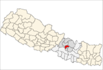
 Kapan, Nepal Location in Nepal | |
| Coordinates: 27°44′N 85°22′E / 27.74°N 85.37°ECoordinates: 27°44′N 85°22′E / 27.74°N 85.37°E | |
| Country |
|
| Province | No. 3 |
| District | Kathmandu District |
| Population (2011) | |
| • Total | 48,463 |
| Time zone | UTC+5:45 (Nepal Time) |
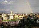
Kapan is a village and former Village Development Committee that is now part of Budanilkantha Municipality in Kathmandu District in Province No. 3 of central Nepal. It is situated in the northern part of Kathmandu. At the time of the 2011 Nepal census it had a population of 48,463 in 12,324 households.[1] Kapan Sangit Sarowar (a platform for musicians), Kapan Monastery (Buddhist temple), Kapan Aani Gumba (Ladies Monks' Monastery) etc. are tourist places situated at Kapan. Kapan consists of several settlements, e. g.: Mahankal, New Colony, Jyotinagar, Saraswatinagar, Golphutar or Baluwakhani. Kapan has recently developed very high number of Paying Guest Houses for local-tourism.
References
- ↑ "Archived copy" (PDF). Archived from the original (PDF) on 2013-09-27. Retrieved 2013-08-22.
Headquarter: Kathmandu | |||
 |  | ||
This article is issued from
Wikipedia.
The text is licensed under Creative Commons - Attribution - Sharealike.
Additional terms may apply for the media files.