Kanarraville, Utah
| Kanarraville, Utah | |
|---|---|
| Town | |
 Location in Iron County and the state of Utah | |
| Coordinates: 37°32′11″N 113°10′57″W / 37.53639°N 113.18250°WCoordinates: 37°32′11″N 113°10′57″W / 37.53639°N 113.18250°W | |
| Country | United States |
| State | Utah |
| County | Iron |
| Settled | 1861 |
| Incorporated | 1933 |
| Named for | Paiute Chief Canarrah (or Quanarrah) |
| Area | |
| • Total | 0.5 sq mi (1.2 km2) |
| • Land | 0.5 sq mi (1.2 km2) |
| • Water | 0.0 sq mi (0.0 km2) |
| Elevation | 5,541 ft (1,689 m) |
| Population (2010) | |
| • Total | 355 |
| • Density | 777/sq mi (300.0/km2) |
| Time zone | UTC-7 (Mountain (MST)) |
| • Summer (DST) | UTC-6 (MDT) |
| ZIP code | 84742 |
| Area code(s) | 435 |
| FIPS code | 49-40030[1] |
| GNIS feature ID | 1429278[2] |
| Website |
www |
Kanarraville (/kəˈnærəvɪl/ kə-NARR-ə-vil) is a town in Iron County, Utah, United States. The population was 355 at the 2010 census.[3]
History
Kanarra, later renamed Kanarraville, on Kanarra Creek, was first settled in 1861 and 1862. It was named for Piute Chief Canarrah or Quanarrah, but settlers spelled it Kanarrah or Kanarra.[4] Its settlers were families driven from Fort Harmony when the fort had to be abandoned after most of its adobe walls were washed away during a month of heavy rains in January and February, during the Great Flood of 1862. New Harmony in Washington County was the other settlement created by refugees from this disaster.[5]:174
Geography
According to the United States Census Bureau, the town has a total area of 0.46 square miles (1.2 km2), all of it land.[3]
Kanarraville is located adjacent to the southwest end of Cedar Valley; it is also at the base of the Hurricane Cliffs, on the town's east border.
Climate
This region experiences warm (but not hot) and dry summers, with no average monthly temperatures above 71.6 °F. According to the Köppen Climate Classification system, Kanarraville has a warm-summer Mediterranean climate, abbreviated "Csb" on climate maps.[6]
Demographics
| Historical population | |||
|---|---|---|---|
| Census | Pop. | %± | |
| 1890 | 282 | — | |
| 1900 | 225 | −20.2% | |
| 1910 | 249 | 10.7% | |
| 1920 | 326 | 30.9% | |
| 1930 | 279 | −14.4% | |
| 1940 | 309 | 10.8% | |
| 1950 | 263 | −14.9% | |
| 1960 | 236 | −10.3% | |
| 1970 | 204 | −13.6% | |
| 1980 | 255 | 25.0% | |
| 1990 | 228 | −10.6% | |
| 2000 | 311 | 36.4% | |
| 2010 | 355 | 14.1% | |
| Est. 2016 | 378 | [7] | 6.5% |
| U.S. Decennial Census[8] | |||
As of the census[1] of 2000, there were 311 people, 125 households, and 96 families residing in the town. The population density was 692.0 people per square mile (266.8/km²). There were 155 housing units at an average density of 344.9 per square mile (133.0/km²). The racial makeup of the town was 95.50% White, 1.61% Native American, 0.96% from other races, and 1.93% from two or more races. Hispanic or Latino of any race were 4.50% of the population.
There were 125 households out of which 24.0% had children under the age of 18 living with them, 68.0% were married couples living together, 8.0% had a female householder with no husband present, and 22.4% were non-families. 21.6% of all households were made up of individuals and 16.0% had someone living alone who was 65 years of age or older. The average household size was 2.49 and the average family size was 2.86.
In the town, the population was spread out with 22.2% under the age of 18, 8.7% from 18 to 24, 19.3% from 25 to 44, 28.3% from 45 to 64, and 21.5% who were 65 years of age or older. The median age was 44 years. For every 100 females, there were 80.6 males. For every 100 females age 18 and over, there were 82.1 males.
The median income for a household in the town was $34,375, and the median income for a family was $38,906. Males had a median income of $25,938 versus $13,750 for females. The per capita income for the town was $14,773. About 10.0% of families and 40% of the population were below the poverty line, including 20% under age 18 and 38% of those age 65 or over.
See also
![]()
References
- 1 2 "American FactFinder". United States Census Bureau. Retrieved 2008-01-31.
- ↑ "US Board on Geographic Names". United States Geological Survey. 2007-10-25. Retrieved 2008-01-31.
- 1 2 "Geographic Identifiers: 2010 Census Summary File 1 (G001): Kanarraville town, Utah". American Factfinder. U.S. Census Bureau. Retrieved April 13, 2018.
- ↑ Van Atta, Dale (Jan 22, 1977). "You name it - there's a town for it". The Deseret News. pp. W6. Retrieved 18 October 2015.
- ↑ Janet Burton Seegmiller, "A History of Iron County, Community Above Self"; Utah Centennial County History Series: The Face and Faces of Iron County; Physical Characteristics; Ancient Peoples; Explorers, Traders, Trappers and Expeditions; Utah State Historical Society, Iron County Commission, 1998
- ↑ Climate Summary for Kanarraville, Utah
- ↑ "Population and Housing Unit Estimates". Retrieved June 9, 2017.
- ↑ "Census of Population and Housing". Census.gov. Archived from the original on May 12, 2015. Retrieved June 4, 2015.
External links
Places adjacent to Kanarraville, Utah | |
|---|---|
Municipalities and communities of Iron County, Utah, United States | ||
|---|---|---|
| Cities | 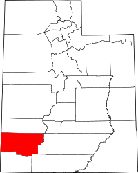 | |
| Towns | ||
| CDPs | ||
| Unincorporated communities | ||
| Ghost town | ||
| Indian reservation | ||
| Footnotes | ‡This populated place also has portions in an adjacent county or counties | |