Kamikitayama, Nara
| Kamikitayama 上北山村 | |||
|---|---|---|---|
| Village | |||
 Kamikitayama Village | |||
| |||
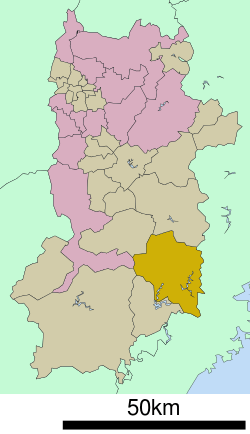 Location of Kamikitayama in Nara Prefecture | |||
 Kamikitayama Location in Japan | |||
| Coordinates: 34°8′N 136°0′E / 34.133°N 136.000°ECoordinates: 34°8′N 136°0′E / 34.133°N 136.000°E | |||
| Country | Japan | ||
| Region | Kansai | ||
| Prefecture | Nara Prefecture | ||
| District | Yoshino | ||
| Area | |||
| • Total | 274.05 km2 (105.81 sq mi) | ||
| Population (October 1, 2016) | |||
| • Total | 486 | ||
| • Density | 1.8/km2 (4.6/sq mi) | ||
| Symbols | |||
| • Tree | Zelkova serrata (Japanese elm) | ||
| • Flower | Lilium auratum (mountain lily) | ||
| • Bird | Lesser cuckoo (Cuculus poliocephalus) | ||
| Time zone | UTC+9 (JST) | ||
| City hall address |
330 Kawai, Kamikitayama-mura, Nara-ken 639-3701 | ||
| Website |
vill | ||


Kamikitayama (上北山村 Kamikitayama-mura) is a village located in Yoshino District, Nara Prefecture, Japan.
As of October 1, 2016, the village has an estimated population of 486. The total area is 274.05 km2.
The village has an aging population. Between 2002 and 2007 the population declined by 15.6%. This trend has continued.
Neighboring municipalities
Education
- Primary Schools
- Kamikitayama Elementary School
- Junior High Schools
- Kamikitayama Junior High School
As of 2012 the two schools have a combined student population of 27. Even with such a small student body, in 2009 the village began employing an ALT(Assistant Language Teacher) of English from the JET Programme to live and work in village.
Notable places
- Yoshino-Kumano National Park
- Mount Ōdaigahara
- Sakamoto Dam
- Higashinokawa Post Office
External links

- Kamikitayama official website (in Japanese)
| Core city | ||
|---|---|---|
| Cities | ||
| Districts | ||
This article is issued from
Wikipedia.
The text is licensed under Creative Commons - Attribution - Sharealike.
Additional terms may apply for the media files.