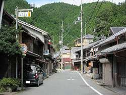
Higashiyoshino, Nara
| Higashiyoshino 東吉野村 | |||
|---|---|---|---|
| Village | |||
 Higashiyoshino Village | |||
| |||
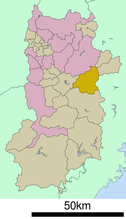 Location of Higashiyoshino in Nara Prefecture | |||
 Higashiyoshino Location in Japan | |||
| Coordinates: 34°24′N 135°58′E / 34.400°N 135.967°ECoordinates: 34°24′N 135°58′E / 34.400°N 135.967°E | |||
| Country | Japan | ||
| Region | Kansai | ||
| Prefecture | Nara Prefecture | ||
| District | Yoshino | ||
| Area | |||
| • Total | 131.60 km2 (50.81 sq mi) | ||
| Population (October 1, 2016) | |||
| • Total | 1,661 | ||
| • Density | 13/km2 (33/sq mi) | ||
| Time zone | UTC+9 (JST) | ||
| City hall address |
99 Ōaza Ogawa, Higashiyoshino-mura, Yoshino-gun, Nara-ken 633-2492 | ||
| Website |
www | ||


Higashiyoshino (東吉野村 Higashiyoshino-mura) is a village located in Yoshino District, Nara Prefecture, Japan.
As of October 1, 2016, the village has an estimated population of 1,661 and a density of 13 persons per km². The total area is 131.60 km².
Geography
Located in central Nara Prefecture, the majority of the town is mountainous. Mount Kunimi, at 1419 m, is the highest mountain in the village. There are other mountains, such as Mount Takami, at 1248 m, situated in western portion of Higashiyoshino.[1]
- Rivers:Yoshino River
- Mountains:Mount Kunimi, Mount Takami
Surrounding municipalities
Sister cities

- Sakai, Osaka (October 18, 1986)
References
- ↑ 考える社会科地図 Kangaeru Shakaika Chizu. 四谷大塚出版 Yotsuya-Ōtsuka Shuppan. 2005. p. 36.
External links

- Higashiyoshino official website (in Japanese)
| Core city | ||
|---|---|---|
| Cities | ||
| Districts | ||
This article is issued from
Wikipedia.
The text is licensed under Creative Commons - Attribution - Sharealike.
Additional terms may apply for the media files.