Kalungu, Uganda
| Kalungu | |
|---|---|
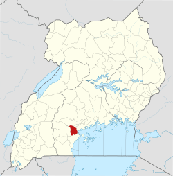
 Kalungu Map of Uganda showing the location of Kalungu. | |
| Coordinates: 00°10′05″S 31°45′36″E / 0.16806°S 31.76000°E | |
| Country |
|
| Region | Central Uganda |
| District | Kalungu District |
| Elevation | 1,300 m (4,300 ft) |
| Time zone | UTC+3 (EAT) |
Kalungu is a town in the Central Region of Uganda. It is the chief municipal, administrative, and commercial center in Kalungu District.
Location
Kalungu is approximately 21 kilometres (13 mi), by road, northeast of Masaka, the largest metropolitan center in the sub-region.[1] This is approximately 130 kilometres (81 mi), by road, southwest of Kampala, the capital of Uganda and its largest city.[2] The coordinates of the town are 00 10 05S, 31 45 36E (Latitude:-0.1680; Longitude:31.7600).[3]
Landmarks
The landmarks within the town limits or close to the edges of town include:
- offices of Kalungu Town Council
- headquarters of Kalungu District Administration
- Kalungu central market
External links
See also
References
- ↑ Road Distance Between Masaka And Kalungu With Map
- ↑ Rod Distance Between Kampala And Kalungu With Map
- ↑ Google (13 July 2015). "Location of Kalungu At Google Maps" (Map). Google Maps. Google. Retrieved 13 July 2015.
Coordinates: 00°10′05″S 31°45′36″E / 0.16806°S 31.76000°E
Capital: Kalungu | ||
| Towns and villages |
|  |
| Geography | ||
| Transport | ||
| Health | ||
| Education |
| |
| Notable people | ||
This article is issued from
Wikipedia.
The text is licensed under Creative Commons - Attribution - Sharealike.
Additional terms may apply for the media files.