Kalongo
| Kalongo | |
|---|---|
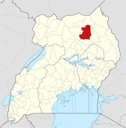
 Kalongo Map of Uganda showing the location of Kalongo | |
| Coordinates: 03°02′24″N 33°22′16″E / 3.04000°N 33.37111°ECoordinates: 03°02′24″N 33°22′16″E / 3.04000°N 33.37111°E | |
| Country |
|
| Region | Northern Region of Uganda |
| Sub-region | Acholi sub-region |
| District | Agago District |
| Elevation | 1,100 m (3,600 ft) |
| Population (2011 Estimate) | |
| • Total | 15,000 |
| Time zone | UTC+3 (EAT) |
Kalongo is a town in the Northern Region of Uganda. It is one of the urban centers in Agago District.
Location
Kalongo is located in the Acholi sub-region. It is approximately 78 kilometres (48 mi) southeast of Kitgum, the nearest large town.[1] This is approximately 155 kilometres (96 mi), by road, northeast of Gulu, the largest city in the sub-region.[2] The coordinates of Kalongo, Uganda are 3° 2' 24.00"N, 33° 22' 16.00"E (Latitude:3.04000; Longitude:33.37111).[3]
Population
The 2002 national population census estimated the town's population at 9,700. In 2010, the Uganda Bureau of Statistics (UBOS) estimated the population at 14,300. In 2011, UBOS estimated the mid-year population at 15,000.[4]
Points of interest
The following points of interest are found in the town of Kalongo, or near the edges of the town:
- offices of Kalongo Town Council
- Kalongo central market
- Dr. Ambrosoli Memorial Hospital, a 350-bed community hospital administered by the Roman Catholic Archdiocese of Gulu[5]
- Kalongo School of Nursing & Midwifery, a nursing and midwifery school affiliated with and administered by the Dr. Ambrosoli Memorial Hospital
- Mount Kalongo, a solid rock formation that rises to a peak of 1,600 metres (5,200 ft) above sea-level, towering approximately 400 metres (1,300 ft) to the northwest of town
- St. Charles Lwanga College, a mixed, boarding, secondary school (S1 - S6) affiliated with the Catholic Church
- Kalongo Airstrip, a private airstrip owned and administered by the Dr. Ambrosoli Memorial Hospital
- St. Mary's School of Midwivery, affiliated with the Dr. Ambrosoli Memorial Hospital, with 120 students in 2011
See also
References
- ↑ "Distance Between Kitgum And Kalongo With Map". Globefeed.com. Retrieved 4 June 2014.
- ↑ "Map Showing Gulu And Kalongo With Distance Marker". Globefeed.com. Retrieved 4 June 2014.
- ↑ Google (11 July 2015). "Location of Kalongo At Google Maps" (Map). Google Maps. Google. Retrieved 11 July 2015.
- ↑ UBOS. "Estimated Population of Kalongo In 2002, 2010 And 2011" (PDF). Uganda Bureau of Statistics (UBOS). Archived from the original (PDF) on 7 July 2014. Retrieved 4 June 2014.
- ↑ Agaba, John (20 March 2013). "Japan Donates USh1.6 Billion for Education And Health". The New Times (Rwanda) via In2eastafrica.net. Retrieved 4 June 2014.
External links
Capital: Agago | ||
| Counties and sub-counties |
|  |
| Towns and villages | ||
| Economy | ||
| Notable landmarks |
| |
| Energy | ||
| Education |
| |
| Notable people | ||