Adilang
| Adilang | |
|---|---|
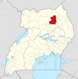
 Adilang Map of Uganda showing the location of Adilang. | |
| Coordinates: 02°44′24″N 33°28′48″E / 2.74000°N 33.48000°E | |
| Country |
|
| Region | Northern Region of Uganda |
| Sub-region | Acholi sub-region |
| District | Agago District |
| Elevation | 1,100 m (3,600 ft) |
| Time zone | UTC+3 (EAT) |
Adilang is a town in the Northern Region of Uganda.
Location
The town is in Adilang sub-county, Agago District, Acholi sub-region. It is approximately 40 kilometres (25 mi) southeast of Agago, where the district headquarters are located.[1] This is approximately 170 kilometres (110 mi), directly east of Gulu, the largest urban center in the Northern Region.[2] The coordinates of Adilang are:2° 44' 24.00"N, 33° 28' 48.00"E (Latitude:2.7400; Longitude:33.4800).[3]
Overview
Adilang is an urban center and administered by the Adilang Town Council, an urban local government.
Points of interest
The following points of interest are located inside the town or near its edges:
See also
References
- ↑ GFC, . (11 July 2015). "Map Showing Agago And Pader With Route Marker". Globefeed.com (GFC). Retrieved 11 July 2015.
- ↑ GFC, . (11 July 2015). "Road Distance Between Gulu And Adilang With Map". Globefeed.com (GFC). Retrieved 11 July 2015.
- ↑ Google (11 July 2015). "Location of Adilang At Google Maps" (Map). Google Maps. Google. Retrieved 11 July 2015.
External links
Coordinates: 02°44′24″N 33°28′48″E / 2.74000°N 33.48000°E
Capital: Agago | ||
| Counties and sub-counties |
|  |
| Towns and villages | ||
| Economy | ||
| Notable landmarks |
| |
| Energy | ||
| Education |
| |
| Notable people | ||
This article is issued from
Wikipedia.
The text is licensed under Creative Commons - Attribution - Sharealike.
Additional terms may apply for the media files.