K-244 (Kansas highway)
| ||||
|---|---|---|---|---|
| Route information | ||||
| Maintained by KDOT | ||||
| Length | 3.940 mi[1] (6.341 km) | |||
| Existed | June 12, 1964[2] – present | |||
| Major junctions | ||||
| West end | Milford Lake Road northwest of Junction City | |||
| East end |
| |||
| Location | ||||
| Counties | Geary | |||
| Highway system | ||||
| ||||

K-244 is a state highway in the U.S. state of Kansas that is just under four miles (6.4 km) in length. It is east–west spur route that serves Milford Lake in north-central Kansas. It was designated in 1964 as a connector between the lake and the state highway system.
Route description
K-244 begins at Milford Lake Road northwest of Junction City. It heads to the east east near the southern shore of Milford Lake. Near the end, K-244 Spur connects to northbound K-57. K-244 ends as it merges into southbound K-57 near an intersection with US-77.[3]
History
K-244 was created by a resolution adopted by the State Highway Commission of Kansas on June 12, 1964. It was created as the most direct route between the existing state highway system and Milford Lake.[2] It was shortened to its present course three years later when K-57 and K-244 Spur were designated.[4]
Major intersections
The entire route is in Smoky Hill Township, Geary County.
| mi[1] | km | Destinations | Notes | ||
|---|---|---|---|---|---|
| 0.000 | 0.000 | Begin state maintenance; road continues west for one mile (1.6 km) toward county line, then continues into Dickinson County as 3200 Avenue | |||
| 2.229 | 3.587 | Southern terminus of K-244 Spur | |||
| 3.940 | 6.341 | West end of K-57 concurrency; no eastbound access to K-57 north, no westbound access from K-57 south | |||
| 4.306 | 6.930 | Eastern terminus; east end of K-57 concurrency; road continues as K-57 south | |||
1.000 mi = 1.609 km; 1.000 km = 0.621 mi
| |||||
Related route
| |
|---|---|
| Location | Milford Lake |
| Length | 0.800 mi[1] (1.287 km) |
K-244 Spur is a 4⁄5-mile-long (1.3 km), north–south marked spur that links to K-57 just before the park offices and the Milford Lake dam.[1][5] K-244 Spur was created, in its present location, in 1967 when K-57 was designated in the Milford Lake area.[4]
Gallery
 Western end
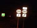 K-244/K-244 spur split
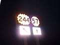 Eastern end
References
- 1 2 3 4 "PMIS Query". Kansas Department of Transportation. Retrieved August 18, 2013.
- 1 2 "Resolution for Location and Designation of Road in Geary County". Kansas State Highway Commission. June 12, 1964. Retrieved August 18, 2013.
- ↑ Google (August 18, 2013). "K-244 main route" (Map). Google Maps. Google. Retrieved August 18, 2013.
- 1 2 "Resolution for Location and Designation of Road Using State-Wide Funds in Geary County". Kansas State Highway Commission. May 10, 1967. Retrieved August 18, 2013.
- ↑ Google (August 18, 2013). "K-244 spur route" (Map). Google Maps. Google. Retrieved August 18, 2013.
External links