Jorge Wilstermann International Airport
| Jorge Wilstermann International Airport | |||||||||||||||
|---|---|---|---|---|---|---|---|---|---|---|---|---|---|---|---|
 | |||||||||||||||
| Summary | |||||||||||||||
| Airport type | Public / Military | ||||||||||||||
| Operator | Abertis Airports | ||||||||||||||
| Serves | Cochabamba, Bolivia | ||||||||||||||
| Elevation AMSL | 8,360 ft / 2,548 m | ||||||||||||||
| Coordinates | 17°25′15″S 66°10′37″W / 17.42083°S 66.17694°WCoordinates: 17°25′15″S 66°10′37″W / 17.42083°S 66.17694°W | ||||||||||||||
| Map | |||||||||||||||
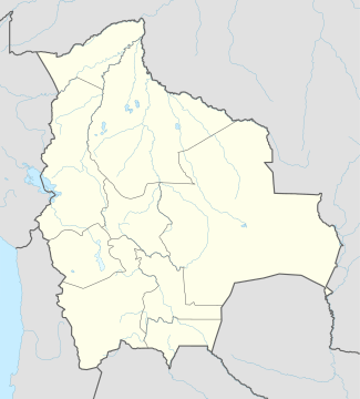
 CBB Location of airport in Bolivia | |||||||||||||||
| Runways | |||||||||||||||
| |||||||||||||||
| Statistics (2013) | |||||||||||||||
| |||||||||||||||
Jorge Wilstermann International Airport (Spanish: Aeropuerto Internacional Jorge Wilstermann) (IATA: CBB, ICAO: SLCB) is a high elevation international airport serving Cochabamba, the capital of the Cochabamba Department of Bolivia. The facility is named in honor of Jorge Wilstermann, an early Bolivian commercial aviator.
The Cochabamba VOR-DME (Ident: CBA) and non-directional beacon (Ident: CBB) are located on the field.[4][5]
Runways 14, 22, and 32 have displaced thresholds that reduce usable landing length. Cochabamba is within a basin in the Cordillera Real mountains, and there is distant mountainous terrain in all quadrants.[6]
Operators
On 1 March 1997 the Government of Bolivia entered into a 25-year contract with Airport Group International to operate the three largest airports in Bolivia – El Alto International Airport in La Paz, Jorge Wilstermann Airport and Viru Viru International Airport in Santa Cruz de la Sierra. Servicios de Aeropuertos Bolivianos Sociedad Anonima (SABSA) was created to operate the concession. In 1999 Airport Group International was purchased by TBI plc and, in 2004, Spain's Abertis/AENA purchased TBI.
Airlines and destinations

| Airlines | Destinations |
|---|---|
| Amaszonas | Sucre, Santa Cruz-Viru Viru |
| Boliviana de Aviación | Chimore,[7] Cobija, La Paz, Potosi, Santa Cruz-Viru Viru, São Paulo-Guarulhos, Sucre, Tarija, Trinidad Seasonal: Buenos Aires-Ezeiza, Madrid, Miami |
| EcoJet | Cobija, Guayaramerín, Riberalta, Sucre, Tarija, Trinidad |
| Transporte Aéreo Militar | La Paz, Santa Cruz de la Sierra, Sucre, Tarija, Trinidad |
See also
References
- ↑ "Aeropuertos Controlados" (in Spanish). Administración de Aeropuertos y Servicios Auxliares a la Navegación Aérea (AASANA). Archived from the original on 2008-06-23.
- ↑ Airport information for SLCB
- ↑ Airport information for Cochabamba at Great Circle Mapper.
- ↑ Cochabamba VOR
- ↑ Cochabamba NDB
- ↑ Google Maps - Cochabamba
- ↑ http://www.routesonline.com/news/38/airlineroute/269987/boa-adds-cochabamba-chimore-service-from-nov-2016/