Jerrawa
| Jerrawa New South Wales | |||||||||||||||
|---|---|---|---|---|---|---|---|---|---|---|---|---|---|---|---|
 | |||||||||||||||
|
Jerrawa Location in New South Wales | |||||||||||||||
| Coordinates | 34°46′46″S 149°04′27″E / 34.77944°S 149.07417°ECoordinates: 34°46′46″S 149°04′27″E / 34.77944°S 149.07417°E | ||||||||||||||
| Population | 73 (2016 census)[1] | ||||||||||||||
| Postcode(s) | 2582 | ||||||||||||||
| Location |
| ||||||||||||||
| LGA(s) | Upper Lachlan Shire | ||||||||||||||
| Region | Southern Tablelands | ||||||||||||||
| County | King | ||||||||||||||
| Parish | Jerrawa | ||||||||||||||
| State electorate(s) | Goulburn | ||||||||||||||
| Federal Division(s) | Hume | ||||||||||||||
| |||||||||||||||
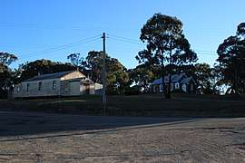
Jerrawa is a locality in the Upper Lachlan Shire, New South Wales, Australia.[2] It lies on the north side of the Hume Highway about 30 km to the east of Yass and was served by Jerrawa railway station on the Main Southern line between Sydney and Melbourne between 1876 and 1975.[3] At the 2016 census, it had a population of 73.[1]
References
- 1 2 Australian Bureau of Statistics (27 June 2017). "Jerrawa". 2016 Census QuickStats. Retrieved 3 August 2017.

- ↑ "Jerrawa". Geographical Names Register (GNR) of NSW. Geographical Names Board of New South Wales. Retrieved 3 August 2017.
- ↑ "Jerrawa Station". Retrieved 3 August 2017.
| Towns | |
|---|---|
| Localities and rural places |
|
Main Article: Local government areas of New South Wales | |
This article is issued from
Wikipedia.
The text is licensed under Creative Commons - Attribution - Sharealike.
Additional terms may apply for the media files.