Jalaur River
| Jalaur River | |
| Jalaud River | |
| River | |
| Country | |
|---|---|
| Region | Western Visayas |
| Tributaries | |
| - left | Passi river, San Enrique river |
| - right | Laglag river, Suage river |
| City | Passi City |
| Source | Central Panay Mountain Range |
| - location | Mount Baloy, Lambunao, Iloilo |
| - elevation | 1,909 m (6,263 ft) |
| Mouth | Guimaras strait |
| - location | Dumangas, iloilo |
| - elevation | 0 m (0 ft) |
| Length | 123 km (76.43 mi) |
| Basin | 1,503 km2 (580.31 sq mi) |
| Discharge | for Guimaras Strait |
| - average | 40.29 m3/s (1,422.83 cu ft/s) |
| - max | 50.17 m3/s (1,771.74 cu ft/s) |
| - min | 30.42 m3/s (1,074.27 cu ft/s) |
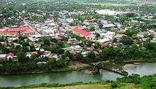
Jalaur River,[1] also known as Jalaud River, is the second longest river in Panay island and the second largest by drainage basin, only Panay River in Capiz has the longest and the largest river system in Panay. Jalaur river ranked 17th largest river system in the Philippines in terms of drainage basin size. It has an estimated drainage area of 1,503 square kilometers ( 580 square miles ) and travels 123 kilometers ( 76 miles ) from its source to its mouth in the Guimaras Strait. It drains the eastern portion of the island and traverses through Passi City and the towns of Leganes, Zarraga, Dumangas, Barotac Nuevo, Pototan, Dingle, San Enrique, Duenas, and Calinog.[2]
The river is of great economic importance to the province of Iloilo. It provides irrigation to farmlands in the province as well as providing a source of potable water for its inhabitants.[3]
Geography
Discharge
The river has an annual average discharge of 40.29 m³/second.[4]
Flooding
The lower reached of Jalaur River experiences seasonal flooding. When there is heavy downpour, during the months of June–September, the river overflows and floods the surrounding area. Panay island is also located within the typhoon belt, which experiences several typhoons annually, is also a major factor of flooding of the river.[5]
Municipalities/Cities
Cities
Municipalities
Economic Importance
Jalaur River is used in irrigating 15,519 hectares in the province of Iloilo through the Jalaur River Irrigation System.[3]
The Metro Iloilo Water District Services, the potable water provider for Iloilo City also source out some of their water requirement from the river.
References
- ↑ "Iloilo - General Features (Water Resources)". Archived from the original on 2008-03-31. Retrieved 2008-09-12.
- ↑ "Western Visayas Regional Development Plan 2004-2010" (PDF). National Economic Development Authority (NEDA) - Region 6. 2004. p. 13. Retrieved 2008-09-13.
- 1 2 "Iloilo Province - Water Facilities". Archived from the original on 2008-04-05. Retrieved 2008-09-12.
- ↑ "River Discharge Database - Jalaur River". Center For Sustainability & Global Environment, University of Wisconsin. September 3, 2008. Retrieved 2008-09-13.
- ↑ "Rains leave heavy crop damage in Capiz, Iloilo". Manila Times. January 14, 2007. Retrieved 2008-09-13.