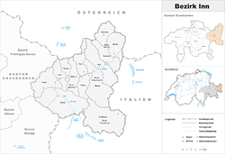
Inn District, Switzerland
| Inn District Bezirk Inn District d'En | |
|---|---|
| District | |
 | |
| Country |
|
| Canton |
|
| Capital | Scuol |
| Area | |
| • Total | 1,196.56 km2 (461.99 sq mi) |
| Population (2016) | |
| • Total | 9,350 |
| • Density | 7.8/km2 (20/sq mi) |
| Time zone | UTC+1 (CET) |
| • Summer (DST) | UTC+2 (CEST) |
| Municipalities | 7 |
Inn District (Romansh: ![]()
It consisted of four Kreise (sub-districts) and seven municipalities:
| Ramosch (Remüs) sub-district | ||||
|---|---|---|---|---|
| Municipality | Population (31 December 2016)[2] |
Area (km²) | ||
| Samnaun | 758 | 56.18 | ||
| Valsot | 876 | 158.96 | ||
| Val Müstair | ||||
|---|---|---|---|---|
| Municipality | Population (31 December 2016)[2] |
Area (km²) | ||
| Val Müstair | 1,538 | 198.65 | ||
Mergers and name changes
- In 2009 Fuldera, Lü, Müstair, Santa Maria Val Müstair, Tschierv and Valchava merged to form the municipality of Val Müstair.[3]
- On 1 January 2013 the municipalities of Romosch and Tschlin merged to form the new municipality of Valsot.[4]
- On 1 January 2015 the former municipalities of Ardez, Guarda, Tarasp, Ftan and Sent merged into the municipality of Scuol.[5]
Languages
Along with Surselva, the district of Inn is predominantly Romansh-speaking, with a large German-speaking minority. Except for the municipality of Samnaun, all of the municipalities of the district has both Romansh and German as their language, although the latter has an unofficial status in most of the municipalities.
| Languages of Inn District, GR | ||||||
| Languages | Census 2000 | |||||
| Number | Percent | |||||
| German | 3,177 | 35.7% | ||||
| Romansh | 5,144 | 57.9% | ||||
| Italian | 194 | 2.2% | ||||
| TOTAL | 8,888 | 100% | ||||
References
- ↑ Swiss Federal Statistical Office - Amtliches Gemeindeverzeichnis der Schweiz - Mutationsmeldungen 2016 accessed 16 February 2017
- 1 2 3 4 Swiss Federal Statistical Office - STAT-TAB, online database – Ständige und nichtständige Wohnbevölkerung nach institutionellen Gliederungen, Geburtsort und Staatsangehörigkeit (in German) accessed 30 August 2017
- ↑ Amtliches Gemeindeverzeichnis der Schweiz published by the Swiss Federal Statistical Office (in German) accessed 23 September 2009
- ↑ Amtliches Gemeindeverzeichnis der Schweiz published by the Swiss Federal Statistical Office (in German) accessed 2 January 2013
- ↑ Amtliches Gemeindeverzeichnis der Schweiz published by the Swiss Federal Statistical Office (in German) accessed 27 April 2016
This article is issued from
Wikipedia.
The text is licensed under Creative Commons - Attribution - Sharealike.
Additional terms may apply for the media files.