Engiadina Bassa/Val Müstair Region
| Engiadina Bassa/Val Müstair Region Region Engiadina Bassa/Val Müstair | |
|---|---|
| District | |
 | |
| Country |
|
| Canton |
|
| Area | |
| • Total | 1,196.55 km2 (461.99 sq mi) |
| Population (2016) | |
| • Total | 9,476 |
| • Density | 7.9/km2 (21/sq mi) |
| Time zone | UTC+1 (CET) |
| • Summer (DST) | UTC+2 (CEST) |
| Municipalities | 5 |
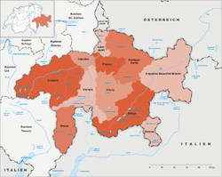
Engiadina Bassa/Val Müstair Region is one of the eleven administrative districts in the canton of Graubünden in Switzerland. It had an area of 1,196.55 square kilometers (461.99 sq mi) and a population of 9,476 (as of 31 December 2016).[1]. It was created on 1 January 2017 as part of a reorganization of the Canton.[2]
References
- 1 2 Swiss Federal Statistical Office - STAT-TAB, online database – Ständige und nichtständige Wohnbevölkerung nach institutionellen Gliederungen, Geburtsort und Staatsangehörigkeit (in German) accessed 30 August 2017
- ↑ Swiss Federal Statistical Office - Amtliches Gemeindeverzeichnis der Schweiz - Mutationsmeldungen 2016 accessed 16 February 2017
- ↑ Arealstatistik Standard - Gemeindedaten nach 4 Hauptbereichen
This article is issued from
Wikipedia.
The text is licensed under Creative Commons - Attribution - Sharealike.
Additional terms may apply for the media files.