Hyde Park (CDP), New York
| Hyde Park, New York | |
|---|---|
| Census-designated place | |
 Location of Hyde Park, New York | |
| Coordinates: 41°47′05″N 73°55′59″W / 41.78472°N 73.93306°WCoordinates: 41°47′05″N 73°55′59″W / 41.78472°N 73.93306°W | |
| Country | United States |
| State | New York |
| County | Dutchess |
| Town | Hyde Park |
| Area | |
| • Total | 1.2 sq mi (3.1 km2) |
| • Land | 1.2 sq mi (3.1 km2) |
| • Water | 0.0 sq mi (0.0 km2) |
| Elevation | 187 ft (57 m) |
| Population (2010) | |
| • Total | 1,908 |
| • Density | 1,582/sq mi (611.0/km2) |
| Time zone | UTC-5 (Eastern (EST)) |
| • Summer (DST) | UTC-4 (EDT) |
| ZIP code | 12538 |
| Area code(s) | 845 |
| FIPS code | 36-37198 |
| GNIS feature ID | 0953559 |
Hyde Park is a hamlet and census-designated place (CDP) in the town of Hyde Park, Dutchess County, New York, United States.[1] Its population was 1,908 as of the 2010 census.[2]
The hamlet of Hyde Park is on the western side of the town of Hyde Park, bordered on the west by the Hudson River. The northern edge of the hamlet is Crum Elbow Creek, a tributary of the Hudson. On the north side of the creek, just outside the hamlet, is the Vanderbilt Mansion National Historic Site. The Springwood Estate, preserved as the Home of Franklin D. Roosevelt National Historic Site, is just outside the hamlet to the south.
U.S. Route 9 passes through the center of the hamlet, leading north 5 miles (8 km) to Staatsburg and south 6 miles (10 km) to Poughkeepsie, the county seat.
According to the U.S. Census Bureau, the Hyde Park CDP has an area of 1.2 square miles (3.1 km2), all of it land.[2]
References
- ↑ U.S. Geological Survey Geographic Names Information System: Hyde Park (CDP), New York
- 1 2 "Geographic Identifiers: 2010 Demographic Profile Data (G001): Hyde Park CDP, New York". U.S. Census Bureau, American Factfinder. Retrieved November 19, 2015.
Municipalities and communities of Dutchess County, New York, United States | ||
|---|---|---|
| Cities | 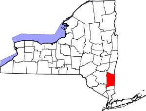 | |
| Towns | ||
| Villages | ||
| CDPs | ||
| Other hamlets | ||
| Footnotes | ‡This populated place also has portions in an adjacent county or counties | |