Huntington Center Historic District
|
Huntington Center Historic District | |
 Huntington Congregational Church | |
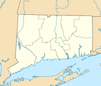  | |
| Location | Roughly along Church and Huntington Sts., from Ripton Rd. to the Farmill River, Shelton, Connecticut |
|---|---|
| Coordinates | 41°17′29″N 73°8′39″W / 41.29139°N 73.14417°WCoordinates: 41°17′29″N 73°8′39″W / 41.29139°N 73.14417°W |
| Area | 60 acres (24 ha) |
| Architectural style | Colonial, Federal |
| NRHP reference # | 00000296[1] |
| Added to NRHP | March 31, 2000 |
The Huntington Center Historic District is a historic district in the city of Shelton, Connecticut. The district encompasses the original colonial settlement of Shelton, which was first known as Huntington. It is a linear district about 0.75 miles (1.21 km) in length, centered on the Huntington Green and Cemetery, and extending north along Church Street and south along Huntington Street. The district is predominantly residential, although it has two churches. The green was laid out in 1717, and many of the district's historic buildings were built over the next 150 years.[2]
Significant properties in the district include:[2]
- Huntington Green, 1717
- Josiah Wheeler House
- DeForest-Rudd House, c. 1770, Colonial
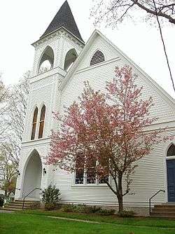
- Huntington Congregational Church, c. 1890, Gothic Revival
- St. Paul's Episcopal Church, 1812, Federal
See also
References
- ↑ National Park Service (2009-03-13). "National Register Information System". National Register of Historic Places. National Park Service.
- 1 2 Jan Cunningham (September 20, 1998). "National Register of Historic Places Inventory-Nomination: Huntington Center Historic District". National Park Service. and Accompanying 18 photos, from 1998 (captions on p. 20 of text document)
| Topics | |
|---|---|
| Lists by states |
|
| Lists by insular areas | |
| Lists by associated states | |
| Other areas | |
| |
Municipalities and communities of Fairfield County, Connecticut, United States | ||
|---|---|---|
| Cities |  | |
| Towns | ||
| Borough | ||
| CDPs | ||
| Other communities | ||
| Ghost town | ||
| Indian reservation | ||
| Footnotes | ‡This populated place also has portions in an adjacent county or counties | |
This article is issued from
Wikipedia.
The text is licensed under Creative Commons - Attribution - Sharealike.
Additional terms may apply for the media files.