Wilton Center, Connecticut
| Wilton Center, Connecticut | |
|---|---|
| Census-designated place | |
 Location in Fairfield County and the state of Connecticut | |
| Country |
|
| State |
|
| County | Fairfield |
| Town | Wilton |
| Time zone | UTC-5:00 (Eastern) |
| • Summer (DST) | UTC-4:00 (Eastern) |
| Area code(s) | 203 |
Wilton Center is a neighborhood/section and census-designated place (CDP) in the town of Wilton in Fairfield County, Connecticut, United States.[1] As of the 2010 census it had a population of 732.[2] The CDP partially overlaps the Wilton Center Historic District.
The CDP extends from Ridgefield Road (Connecticut Route 33) in the north to Wolfpit Road in the south, and is bordered to the east by the Metro-North Railroad Danbury Branch line. The western edge of the CDP is an irregular line about 0.3 miles (0.48 km) west of the Metro-North line.[3] The historic district is largely along Ridgefield Road at the north end of the CDP. The Norwalk River flows from north to south through the eastern side of the CDP.
References
- ↑ U.S. Geological Survey Geographic Names Information System: Wilton Center, Connecticut
- ↑ "Geographic Identifiers: 2010 Census Summary File 1 (G001), Wilton Center CDP, Connecticut". American FactFinder. U.S. Census Bureau. Retrieved April 24, 2016.
- ↑ TIGERweb, U.S. Census Bureau
Municipalities and communities of Fairfield County, Connecticut, United States | ||
|---|---|---|
| Cities | 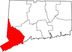 | |
| Towns | ||
| Borough | ||
| CDPs | ||
| Other communities | ||
| Ghost town | ||
| Indian reservation | ||
| Footnotes | ‡This populated place also has portions in an adjacent county or counties | |
Coordinates: 41°11′25″N 73°25′55″W / 41.19028°N 73.43194°W