Eurelia
| Eurelia South Australia | |||||||||||||||
|---|---|---|---|---|---|---|---|---|---|---|---|---|---|---|---|
.jpg) Hundred of Eurelia, 1889, which shows the proposed extent of the government town in the bottom right hand corner | |||||||||||||||
 Eurelia | |||||||||||||||
| Coordinates | 32°33′16″S 138°33′41″E / 32.55436°S 138.561329°ECoordinates: 32°33′16″S 138°33′41″E / 32.55436°S 138.561329°E[1] | ||||||||||||||
| Population | 14 (2016 census)[2] | ||||||||||||||
| Established |
12 September 1878 (town) 16 December 1999 (locality)[3][4] | ||||||||||||||
| Postcode(s) | 5431[5] | ||||||||||||||
| Elevation | 525 m (1,722 ft)(railway station)[6] | ||||||||||||||
| Time zone | ACST (UTC+9:30) | ||||||||||||||
| • Summer (DST) | ACDT (UTC+10:30) | ||||||||||||||
| Location | |||||||||||||||
| LGA(s) | District Council of Orroroo Carrieton[1] | ||||||||||||||
| Region | Yorke and Mid North[1] | ||||||||||||||
| County | Dalhousie[1] | ||||||||||||||
| State electorate(s) | Stuart[7] | ||||||||||||||
| Federal Division(s) | Grey[8] | ||||||||||||||
| |||||||||||||||
| |||||||||||||||
| Footnotes |
Locations[5][1] Adjoining localities[1] | ||||||||||||||
Eurelia is a town and locality in the Australian state of South Australia located on the east side of the Flinders Ranges about 264 kilometres (164 mi) north of the state capital of Adelaide and about 20 kilometres (12 mi) from the municipal seat of Orroroo.[5][1]
The town was surveyed in July 1878 and was gazetted as a government town on 12 September 1878.[1][3] The locality's boundaries were created on 16 December 1999 for the “long established name” and includes the site of the Government Town of Eurelia.[1][4]
Eurelia's name comes from the local Jadliaura language and translates to "place of the ear". It is thought that local Dreamtime stories associated with the Ranges locates Eurelia as an "ear" of a prostrate man.[10] The pronunciation of the town's name gives rise to some long standing jokes. One joke[11] has two railway porters at each end of the platform and as each train pulls in one would call out "You're a liar! You're a liar", and the other would reply "You really are! You really are!". (I.e. the town's name sounds like either "you're a liar" or "you really are", depending on which syllable the stress falls). The "correct" pronunciation is "you really are"[10]
The District Council of Carrieton, based in adjacent Carrieton, was known as the District Council of Eurelia for the first six years of its existence, from 1888 to 1894.[12]
Land use within the locality is ’primary production’ and is concerned with “agricultural production and the grazing of stock on relatively large holdings.”[13]
Eurelia is located within the federal division of Grey, the state electoral district of Stuart and the local government area of the District Council of Orroroo Carrieton.[8][1][7]
Railways
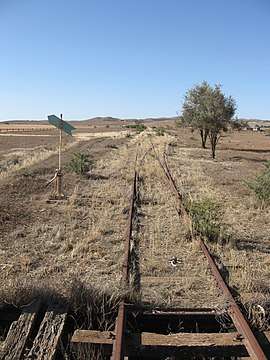
Eurelia was on the Peterborough–Quorn railway line, built in 1881, and ceased regular use by the 1980s. It then became the northern terminus of operations of the Steamtown Peterborough Railway Preservation Society running trains from Peterborough between 1981 and 2002.
Eurelia had two dams, the first built when the railway was constructed by C & E Miller. The original dam held 20 million gallons. This dam was later supplemented when a new dam of 20 million gallons capacity was built to the north of the original dam, with the intent that the old dam would act as a settling pond. Construction started in 1948 and was completed in 1952. The dam remained empty until 1958 when, after heavy rains in the region, both dams filled.
Water from the dams was shipped across the SAR during times of drought.[14]
References
- 1 2 3 4 5 6 7 8 9 10 "Search results for 'Eurelia, LOCB' with the following datasets being selected - 'Suburbs and Localities', 'Postcode', 'Counties', 'Hundreds', "Government Towns', 'Local Government Areas', 'SA Government Regions', 'Land Development Plan Zone Categories' and 'Gazetteer'". Location SA Map Viewer. Government of South Australia. Retrieved 13 February 2018.
- ↑ Australian Bureau of Statistics (27 June 2017). "State Suburb of Eurelia". 2016 Census QuickStats. Retrieved 13 February 2018.

- 1 2 Morgan, William (12 September 1878). "untitled proclamation (the Town of Eurelia)" (PDF). The South Australian Government Gazettee. South Australian government. p. 729. Retrieved 12 February 2018.
- 1 2 "GEOGRAPHICAL NAMES ACT 1991, Notice to Assign Boundaries and Names to Places" (PDF), The South Australian Government Gazette: 3429, 16 December 1999, retrieved 27 December 2017
- 1 2 3 "Postcode for Eurelia, South Australia". Postcodes Australia. Retrieved 13 February 2018.
- ↑ "Search results for 'Eurelia Railway Station' with the following datasets being selected - 'Suburbs and Localities' and 'Gazetteer'". Location SA Map Viewer. Government of South Australia. Retrieved 13 February 2018.
- 1 2 "Electoral district of Stuart". Electoral Commission SA. Retrieved 12 February 2018.
- 1 2 "Federal electoral division of Grey" (PDF). Australian Electoral Commission. Retrieved 12 February 2018.
- 1 2 3 "Monthly climate statistics: Summary statistics Summary statistics YONGALA (nearest weather station)". Commonwealth of Australia , Bureau of Meteorology. Retrieved 27 December 2017.
- 1 2 Manning, G; 1990 Manning's Place Names of South Australia ISBN 05437687505
- ↑ Tom Burton, Words in Your Ear, Wakefield Press, 1999, ISBN 1-86254-475-1, page 101, relating a joke told to him by Alan Brissenden
- ↑ Marsden, Susan (2012). "A History of South Australian Councils to 1936" (PDF). Local Government Association of South Australia. p. 11. Retrieved 30 October 2015.
- ↑ "Development Plan - Orroroo Carrieton Council, Consolidated – 22 November 2012" (PDF). Government of South Australia. pp. 105 and 127. Retrieved 27 December 2017.
- ↑ Doncaster, N (as Editor) - Eurelia Dams - The Partyline No67 Autumn 1997; Steamtown Peterborough Railway Preservation Society (the article notes the material has been drawn from; Shepard, M; Ups and Downs of Eurelia 1876 to 1976