Horizon Guyot
| Horizon Guyot | |
|---|---|
.png) | |
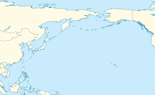
| Location | |
| Coordinates | 19°07.9′N 169°27.6′W / 19.1317°N 169.4600°W[1] |
Horizon Guyot is a presumably Cretaceous guyot or tablemount in the Mid-Pacific Mountains, Pacific Ocean. It is an over 300 kilometres (190 mi) long elongated ridge that stretches in northeast-southwest direction and has two flat tops; it rises 4.3 kilometres (2.7 mi) to a minimum depth 1,443 metres (4,734 ft). The Mid-Pacific Mountains and thus also Horizon Guyot lie west of Hawaii and northeast of the Line Islands.
It was probably formed by a hotspot, but evidence is conflicting. Volcanic activity has been dated to have occurred 82-88 million years ago and formed a volcanic island; a second volcanic episode occurred during the Turonian-Cenomanian eras. Between these volcanic episodes, carbonate deposition from lagoonal and reefal environments set in and formed limestone. Islands developed on Horizon Guyot as well and were colonized by plants.
Horizon Guyot became a seamount during the Coniacian-Campanian time. Since then, pelagic ooze has accumulated on the seamount, forming a thick layer that is further altered by ocean currents and by various organisms that live on the seamount. Ferromanganese crusts were deposited on the exposed rocks of Horizon Guyot, which has also been affected by sediment landslides.
Name and research history
The seamount is named after the research vessel RV Horizon[2] and is also known as Horizon Ridge.[3] During the Deep Sea Drilling Project, the drill cores called Site 171 and Site 44 were taken on Horizon Guyot in 1971 and 1969, respectively;[4][5] a further drill core was taken north of the seamount at Site 313.[6] This seamount is the best studied seamount of the Mid-Pacific Mountains[7] and more is known about its morphology than at any other seamount of the Mid-Pacific Mountains.[8]
Geography and geology
Local setting
Horizon Guyot lies west of Hawaii[1] and is part of the Mid-Pacific Mountains.[9] Unlike conventional island chains in the Pacific Ocean,[10] the Mid-Pacific Mountains are a group of oceanic plateaus with guyots[11] (also known as tablemounts[12]) that become progressively younger towards the east.[13] Other guyots in the Mid-Pacific Mountains are Sio South, Darwin, Thomas, Heezen, Allen, Caprina, Jacqueline and Allison.[14] South of Horizon Guyot, deep water in the "Horizon passage" leads into the Line Islands[15][16] and Horizon Guyot is sometimes considered to be a member of that chain.[17]
The seamount rises 3.4 kilometres (2.1 mi) to a minimum depth of 1,443 metres (4,734 ft)[18]-1,440 metres (4,720 ft). It is a 35 kilometres (22 mi)[19]-70 kilometres (43 mi) wide and over 300 kilometres (190 mi) long ridge.[3] Horizon Guyot trends in southwest-northeast direction[20] with an orientation matching that of other structures in the region[21] such as fracture zones on the seafloor.[22] Faulting has been observed on the western side of the seamount.[23]
Two summit platforms lie on the ridge.[3] The eastern one is the largest of these platforms[24] and the western oval-shaped platform lies close to the western end of the ridge.[2] These platforms are relatively flat, and are surrounded by a slope break beyond which the guyot falls off steeply to the surrounding abyssal plain.[3] This appearance characterizes Horizon Guyot as a guyot[25] although the elongated shape is unlike that of most guyots in the region which have one circular summit platform.[26] The summit platform of Horizon Guyot is the largest in the Mid-Pacific Mountains.[27] At the margin of the platform lie terraces which are up to 3 kilometres (1.9 mi) wide and up to 100 metres (330 ft) high that discontinuously surround the summit platform;[28] the flat surfaces of the terraces may be former fringing reefs.[29] On the eastern summit platform there are buried terraces beneath the sediment cover on the eastern summit platform.[30]
Sediment layers cover almost the entire summit of Horizon Guyot[20] and consist mainly of sand, with clay and silt making up a minor part.[31] Features on the sedimented seafloor are flat areas, hummocks, ripples and sediment waves.[32] Seismic transects have observed[30] a relief of about 150 metres (490 ft) in the underlying basement[29] and the presence of a central peak.[30] Material obtained in drill cores includes chalk, chert, hyaloclastite, limestone, ooze and sandstone;[33] basalt and chert crop out in some places.[34] In some areas boulders and cobbles cover the seafloor;[35] ferromanganese crusts cover exposed rocks.[36]
The seamount shows evidence of repeated mass failures, including hummocky terrain, scarps and slump blocks,[37] which are on average 30 metres (98 ft) thick.[38] Landsliding is probably triggered by earthquakes;[37] after the failure the landslides either stay coherent and do not travel far but some advance quickly and far.[39] Talus blocks up to 5 metres (16 ft) size cover the seafloor[36] around Horizon Guyot.[19]
Regional setting
The Pacific Ocean seafloor contains many guyots of Mesozoic age that developed in unusually shallow seas.[14] These are submarine mountains which are characterized by a a flat top and usually the presence of carbonate platforms that rose above the sea surface during the middle Cretaceous. During the Second World War, it was discovered that the seafloor of the Western Pacific Ocean was dotted with numerous flat-topped seamounts. These were promptly identified as sunken islands; at first it was believed that they had sunk below the water in the Precambrian before the presence of Cretaceous reefs on many of them.[40] About 6% of the Pacific seafloor is covered with almost one million seamounts.[41]
While there are some differences to present-day reef systems,[42][43] many of these seamounts were formerly atolls, which today still exist. All these structures originally formed as volcanoes in the Mesozoic ocean. Fringing reefs may have developed on the volcanoes, which then became barrier reefs as the volcano subsided and turned into an atoll,[44] and which surround a lagoon or tidal flat.[45] The crust underneath these seamounts tends to subside as it cools, and thus the islands and seamounts sink.[46] Continued subsidence balanced by upward growth of the reefs led to the formation of thick carbonate platforms.[47] Sometimes volcanic activity continued even after the formation of the atoll or atoll-like structure, and during episodes where the carbonate platforms rose above sea level erosional features such as channels and blue holes developed.[48]
The formation of many such seamounts has been explained with the hotspot theory, which describes the formation of chains of volcanoes which get progressively older along the length of the chain,[49] with an active volcano only at one end of the system. This volcano lies on a spot of the lithosphere heated from below; as the plate moves the volcano is moved away from the heat source and volcanic activity ceases, producing a chain of volcanoes that get progressively older away from the currently active one.[50] With some exceptions, radiometric dating of the Mid-Pacific Mountains has yielded evidence of an eastward movement of volcanism which is consistent with the hotspot theory.[51] However, in the case of Horizon Guyot, volcanism may have migrated southwestward which is not entirely consistent with the hotspot theory.[52] When it formed, Horizon Guyot may have been located close to a spreading center.[53]
Composition
Volcanic rocks dredged from Horizon Guyot are of basaltic composition and define a tholeiitic suite. Augite,[3] labradorite,[24] olivine, plagioclase and pyroxene form phenocrysts while pigeonite is found in the groundmass.[54] Other guyots and samples from the Mid-Pacific Mountains have similar compositions to these found on Horizon Guyot.[55] Some volcanic rocks occur in the form of hyaloclastite which contains palagonite and sideromelane.[24]
Dredged volcanic rocks are heavily altered;[2] alteration of the basaltic rock and the olivine contained therein has given rise to analcime, augite, calcite, clay, clinoptilolite,[56][57] iddingsite,[58] ilmenite, labradorite, magnetite[56] iron oxides and talc.[24]
Carbonates are found as limestone and siltstone;[33] some limestones are of biogenic origin.[59] The carbonates are at one point in drill cores found mixed with volcanic rocks; presumably this is a place where hyaloclastite accumulated and was reworked by sea currents.[57] The limestone contains fossils of algae,[57] bryozoans, echinoids, foraminiferans, molluscs and ostracods;[60] dinoflagellates, pollen and scolecodonts are also found.[33] Limestones have been modified by silicification and phosphatization.[61]
Clinoptilolite, pyrite, radiolarian fossils and yellow glass shards are found in the ooze.[33] Some volcanic rocks and manganese rocks are cemented by indurated ooze.[62] Other materials found on Horizon Guyot are analcime,[57][9] barite,[63] calcite, celadonite,[57][9] cristobalite,[63] glauconite,[64] gypsum,[65] ironstone,[66] kaolinite, mica, montmorillonite, mudstone, quartz,[63] sapropel,[33] smectite and zeolite are found in the rocks.[57][9] Ferromanganese[67] and phosphorite crusts coat rocks.[24] These ferromanganese crusts consist of iron oxides and manganese oxides and are related to manganese nodules[68] and might become targets of future mining efforts.[35]
Geologic history
Horizon Guyot is at least of Albian age, perhaps as much as 120 million years old.[24] Radiometric dating has yielded ages of 88.1 ± 0.4 million years ago and more recently of 82.5 ± 0.4 million years ago; this may reflect either prolonged volcanism or the older date may be incorrect.[69] The formation of Horizon Guyot may thus coincide with a pulse of volcanism between about 100 and 80 million years ago in the Pacific Ocean.[70]
Volcanism
Basalt lava flows formed on Horizon Guyot during the Cretaceous,[1] before or during the Albian.[71] A second volcanic phase occurred during the Turonian and Cenomanian;[72] thus volcanic activity on Horizon Guyot was recurrent.[73] The first volcanic phase erupted typical ocean island basalts while the rocks of the second episode resemble mid-ocean ridge basalts.[57] Hyaloclastites which crop out at the margin of the summit platform[26] indicate the occurrence of submarine eruptions.[24]
Eruptions probably occurred on aligned vents, explaining the elongated shape of Horizon Guyot.[74] At first the formation of the terraces was also attributed to volcanic activity as an origin as a carbonate platform[75] or as wave cut terraces was considered to be unlikely;[76] then a wave cut origin of the terraces was proposed again when it was found that Horizon Guyot had risen above sea level in the Cretaceous.[77]
Carbonate island phase and renewed volcanism
During the Cretaceous, carbonates accumulated on Horizon Guyot[60] while it subsided, forming a carbonate deposit 134 metres (440 ft) thick in one drill core. At this time, Horizon Guyot featured lagoonal environments with algal reefs.[78] The carbonates accumulated directly on the previous volcano[51] and reefs started growing when volcanic activity was still underway.[79] Horizon Guyot was close to the sea surface for at least 6 million years;[80] prior to 1973 there was no evidence that Horizon Guyot had ever formed an island.[81]
During the late Cretaceous, a second volcanic episode took place on Horizon Guyot[82] and produced volcanites and volcanic sediments[60] which bury older limestones.[72] At that time, volcanic activity was underway not only on this seamount but also in the Line Islands;[82] on Horizon Guyot this phase occurred perhaps as much as 30 million years after the previous volcanic stage.[71]
Before this volcanic phase, Horizon Guyot had emerged from the sea and erosion had reworked some older rocks;[83] also, plants grew on the now exposed island.[24] Shallow water deposition in Coniacian or Santonian to Maastrichtian time has been inferred from the presence of unstable coccoliths of these ages in drill cores.[84]
Drowning and sedimentation
Horizon Guyot was emergent at least until the Cenomanian,[85] unlike other Mid-Pacific Mountains guyots which drowned during the Albian.[86] Plant remnants are found in rocks of Turonian and Coniacian age,[72] implying that Horizon Guyot was still emergent at that time;[83] but by the Coniacian, Horizon Guyot was submerging.[25] It is not known why Horizon Guyot drowned but the burial of the reefs by volcanic activity may have played a role.[87]
Pelagic sedimentation commenced in the Campanian[72] when Horizon Guyot had already sunk to 1,500 metres (4,900 ft) depth.[88] Since the Miocene, sedimentation rates appear to have decreased as the guyot moved away from waters with high biological productivity and the onset of Cenozoic glaciation led to the development of cold bottom waters and strong bottom currents which trigger erosion.[89]
Pelagic sediments accumulate on some guyots after they have drowned. A dome-shaped[18] cap of pelagic ooze accumulated on top of Horizon Guyot during the Tertiary,[90] reaching a maximum thickness of 110 metres (360 ft)[18]-160 metres (520 ft) in some places.[32] In the saddle between the summit platforms it is about 500 metres (1,600 ft) thick;[19] an unconformity separates it from Cretaceous deposits.[91] The sediment layers span the Eocene to Quaternary with gaps in the sediment sequence between the Cretaceous and the Eocene and between the Eocene and the Oligocene.[64] During the Eocene and Oligocene older foraminifera were redeposited,[91] there is evidence that sediments were actively eroded.[64] During sea level lowstands, sea currents swept sediments off the surface of Horizon Guyot,[92] with fine sediments being particularly affected.[90]
Present state
Almost all the upper slopes of Horizon Guyot are covered by sediments.[93] Chert[1] and chalk are found within the sediments,[91] the former forms seismically reflective layers within the sediment cap.[19] These layers crop out at the margin of the sediment platform.[26]
Sea currents are unusually strong on the top of Horizon Guyot,[32] probably due to the interaction of the slopes of Horizon Guyot with tidal currents.[94] The seamount induces its own semidiurnal tide and the sea currents reach their maximum at the margin of the summit platform where 20 centimetres per second (7.9 in/s) have been measured.[95] Scour marks have been observed.[37]
The currents sweep down the seamount slopes and may act to remove sediment from the seamount surface;[96] this also results in sediments accumulating to form steep slopes that undergo landsliding.[97] Most of the sediments however are transported upslope;[26] these which do end up at the bottom of the seamount form talus deposits around Horizon Guyot.[38]
Ecology and environment
Fish found on Horizon Guyot include batfish, bathypteroids, chimeras, morids, sharks and synaphobranchid eels.[98] The surfaces of Horizon Guyot are inhabited by many organisms.[93] Brittle stars, chaetognatha (Arrow worms), copepods, corals, crustaceans, hydroids, loricifera, molluscs, nematodes, nemertinea, ophiuroids, ostracods, polychaetes, sipuncula, squat lobsters, vermes[35][99] and xenophyophorans make up the bulk of the fauna on Horizon Guyot today.[100] At least 29 macrofaunal species have been found.[67] Other lifeforms presently active on the seamount are barnacles, crinoids,[101] echiurids, enteropneusts (Acorn worms),[102] gorgonians,[101] holothuroids (Sea cucumbers), pennatulids (Sea pens),[102] sponges[101] and starfish.[102] Unidentified stalk or twig-like creatures have also been observed on the platform, in fact they are among the most common lifeform there.[101] Finally, bacteria are found in the sediment.[103]
Biological activity has left traces on the sediments such as mounds, pits and trails in the surface.[104] There is a certain zonation in the ecology of Horizon Guyot; for example suspension feeders live on the margin of the summit platform.[105] Genetic differences between individuals of a given species who live on the top and these who live at the foot of the guyot have been noted.[106] Some ostracods found on Horizon Guyot such as Cytherelloidea appear to have evolved from Cretaceous shallow water species as the seamount sank into colder waters.[107]
Water temperatures on the summit of Horizon Guyot have been measured to be 3.1 °C (37.6 °F).[108] The seamount lies in a region of the Pacific with nutrient poor surface waters.[109]
References
- 1 2 3 4 Bukry 1973, p. 877.
- 1 2 3 Hamilton 1956, p. 5.
- 1 2 3 4 5 Heezen et al. 1973, p. 667.
- ↑ Winterer, E.L. (August 1973), "Introduction", Initial Reports of the Deep Sea Drilling Project, 17 (PDF), Initial Reports of the Deep Sea Drilling Project, 17, U.S. Government Printing Office, p. 5, doi:10.2973/dsdp.proc.17.101.1973, retrieved 2018-10-05
- ↑ Krasheninnikov 1981, p. 365.
- ↑ Krasheninnikov 1981, p. 371.
- ↑ Kayen et al. 1989, p. 1817.
- ↑ Ladd & Newman 1973, p. 1502.
- 1 2 3 4 Bass 1976, p. 428.
- ↑ Winterer & Sager 1995, p. 508.
- ↑ Baker, P.E.; Castillo, P.R.; Condliffe, E. (May 1995), "Petrology and Geochemistry of Igneous Rocks from Allison and Resolution Guyots, Sites 865 and 866", Proceedings of the Ocean Drilling Program, 143 Scientific Results (PDF), Proceedings of the Ocean Drilling Program, 143, Ocean Drilling Program, p. 245, doi:10.2973/odp.proc.sr.143.216.1995, retrieved 2018-09-30
- ↑ Bouma, Arnold H. (September 1990). "Naming of undersea features". Geo-Marine Letters. 10 (3): 121. doi:10.1007/bf02085926. ISSN 0276-0460.
- ↑ Röhl & Strasser 1995, p. 198.
- 1 2 McNutt, M. K.; Winterer, E. L.; Sager, W. W.; Natland, J. H.; Ito, G. (July 1990). "The Darwin Rise: A Cretaceous superswell?". Geophysical Research Letters. 17 (8): 1101. doi:10.1029/gl017i008p01101. ISSN 0094-8276.
- ↑ Winterer 1976, p. 731.
- ↑ Edmond, John M.; Chung, Y.; Sclater, J. G. (20 November 1971). "Pacific Bottom Water: Penetration east around Hawaii". Journal of Geophysical Research. 76 (33): 8089–8097. doi:10.1029/jc076i033p08089. ISSN 0148-0227.
- ↑ Davis et al. 2002, p. 3.
- 1 2 3 Karig, Peterson & Short 1970, p. 373.
- 1 2 3 4 Hein et al. 1985, p. 35.
- 1 2 Karig, Peterson & Short 1970, p. 374.
- ↑ Winterer 1976, p. 739.
- ↑ Davis et al. 2002, p. 16.
- ↑ Winterer & Metzler 1984, p. 9971.
- 1 2 3 4 5 6 7 8 Heezen et al. 1973, p. 668.
- 1 2 Schwab et al. 1988, p. 1.
- 1 2 3 4 Lonsdale, Normark & Newman 1972, p. 289.
- ↑ Wilson, Smith & Rosenblatt 1985, p. 1243.
- ↑ Lonsdale, Normark & Newman 1972, p. 301.
- 1 2 Karig, Peterson & Short 1970, p. 377.
- 1 2 3 Karig, Peterson & Short 1970, p. 375.
- ↑ Levin & Thomas 1989, p. 1907.
- 1 2 3 Levin & Thomas 1989, p. 1898.
- 1 2 3 4 5 The Shipboard Scientific Party 1973, p. 287.
- ↑ Kayen et al. 1989, p. 1825.
- 1 2 3 Kelley, Elliott; Mashkoor, Malik (2017). "Okeanos Explorer ROV dive summary, EX1706, July 13, 2017". NOAA: 3.
- 1 2 Kayen et al. 1989, p. 1821.
- 1 2 3 Kayen et al. 1989, p. 1819.
- 1 2 Kayen et al. 1989, p. 1820.
- ↑ Kayen et al. 1989, p. 1831.
- ↑ Heezen et al. 1973, p. 653.
- ↑ Levin & Thomas 1989, p. 1897.
- ↑ Iryu, Yasufumi; Yamada, Tsutomu (December 1999). "Biogeochemical contrasts between mid-Cretaceous carbonate platforms and Cenozoic reefs". The Island Arc. 8 (4): 475–490. doi:10.1046/j.1440-1738.1999.00250.x. ISSN 1038-4871.
- ↑ Röhl & Strasser 1995, p. 211.
- ↑ Pringle et al. 1993, p. 359.
- ↑ Röhl & Ogg 1996, p. 596.
- ↑ Röhl & Ogg 1996, pp. 595-596.
- ↑ Strasser, A.; Arnaud, H.; Baudin, F.; Rohl, U. (May 1995), "Small-Scale Shallow-Water Carbonate Sequences of Resolution Guyot (Sites 866, 867, and 868)", Proceedings of the Ocean Drilling Program, 143 Scientific Results (PDF), Proceedings of the Ocean Drilling Program, 143, Ocean Drilling Program, p. 119, doi:10.2973/odp.proc.sr.143.228.1995, retrieved 2018-09-30
- ↑ Pringle et al. 1993, p. 360.
- ↑ Winterer & Sager 1995, p. 498.
- ↑ Sleep, N H (May 1992). "Hotspot Volcanism and Mantle Plumes". Annual Review of Earth and Planetary Sciences. 20 (1): 19. doi:10.1146/annurev.ea.20.050192.000315.
- 1 2 Winterer & Sager 1995, p. 504.
- ↑ Moberly, R.; Larson, R.L. (August 1975), "Synthesis of Deep Sea Drilling Results from Leg 32 in the Northwestern Pacific Ocean", Initial Reports of the Deep Sea Drilling Project, 32 (PDF), Initial Reports of the Deep Sea Drilling Project, 32, U.S. Government Printing Office, p. 954, doi:10.2973/dsdp.proc.32.140.1975, retrieved 2018-10-03
- ↑ Hein et al. 1985, p. 50.
- ↑ Heezen et al. 1973, pp. 667-668.
- ↑ Heezen et al. 1973, p. 669.
- 1 2 Hamilton 1956, p. 75.
- 1 2 3 4 5 6 7 The Shipboard Scientific Party 1973, p. 288.
- ↑ Davis et al. 2002, p. 24.
- ↑ McKenzie, J.; Bernoulli, D.; Schlanger, S.O. (1980), "Shallow-Water Carbonate Sediments from the Emperor Seamounts: Their Diagenesis and Paleogeographic Significance", Initial Reports of the Deep Sea Drilling Project, 55 (PDF), Initial Reports of the Deep Sea Drilling Project, 55, U.S. Government Printing Office, p. 415, doi:10.2973/dsdp.proc.55.115.1980, retrieved 2018-10-03
- 1 2 3 The Shipboard Scientific Party 1973, p. 284.
- ↑ Lonsdale, Normark & Newman 1972, p. 304.
- ↑ Hamilton 1956, p. 33.
- 1 2 3 Rex, R.W.; Eklund, W.A.; Jamieson, I.M. (February 1971), "X-Ray Mineralogy Studies - Leg 6" (PDF), Initial Reports of the Deep Sea Drilling Project, U.S. Government Printing Office, p. 753, doi:10.2973/dsdp.proc.6.124.1971, retrieved 2018-10-06
- 1 2 3 The Shipboard Scientific Party 1973, p. 285.
- ↑ Zemmels, I.; Cook, H.E. (1973), "X-Ray Mineralogy of Sediments from the Central Pacific Ocean", Initial Reports of the Deep Sea Drilling Project, 17 (PDF), Initial Reports of the Deep Sea Drilling Project, 17, U.S. Government Printing Office, p. 518, doi:10.2973/dsdp.proc.17.118.1973, retrieved 2018-10-03
- ↑ Hein et al. 1994, p. 182.
- 1 2 Kaufmann, Wakefield & Genin 1989, p. 1865.
- ↑ Hein et al. 1985, pp. 25-26.
- ↑ Davis et al. 2002, p. 10.
- ↑ Davis et al. 2002, pp. 17-18.
- 1 2 The Shipboard Scientific Party 1973, p. 295.
- 1 2 3 4 Schlanger, S.O.; Premoli Silva, I. (August 1981), "Tectonic, Volcanic, and Paleogeographic Implications of Redeposited Reef Faunas of Late Cretaceous and Tertiary Age from the Nauru Basin and the Line Islands", Initial Reports of the Deep Sea Drilling Project, 61 (PDF), Initial Reports of the Deep Sea Drilling Project, 61, U.S. Government Printing Office, p. 822, doi:10.2973/dsdp.proc.61.136.1981, retrieved 2018-10-03
- ↑ Lancelot, Y.; Larson, R.L. (August 1975), "Sedimentary and Tectonic Evolution of Northwestern Pacific", Initial Reports of the Deep Sea Drilling Project, 32 (PDF), Initial Reports of the Deep Sea Drilling Project, 32, U.S. Government Printing Office, p. 930, doi:10.2973/dsdp.proc.32.138.1975, retrieved 2018-10-03
- ↑ Ladd & Newman 1973, p. 1501.
- ↑ Lonsdale, Normark & Newman 1972, p. 306.
- ↑ Lonsdale, Normark & Newman 1972, p. 312.
- ↑ Ladd & Newman 1973, pp. 1501-1502.
- ↑ The Shipboard Scientific Party 1973, p. 290.
- ↑ Hein et al. 1994, p. 179.
- ↑ The Shipboard Scientific Party (November 1981), "Site 463: Western Mid-Pacific Mountains", Initial Reports of the Deep Sea Drilling Project, 62 (PDF), Initial Reports of the Deep Sea Drilling Project, 62, U.S. Government Printing Office, p. 35, doi:10.2973/dsdp.proc.62.102.1981, retrieved 2018-10-03
- ↑ The Shipboard Scientific Party 1973, p. 283.
- 1 2 Vallier, T.L.; Jefferson, W.S. (November 1981), "Volcanogenic Sediments from Hess Rise and the Mid-Pacific Mountains, Deep Sea Drilling Project Leg 62", Initial Reports of the Deep Sea Drilling Project, 62 (PDF), Initial Reports of the Deep Sea Drilling Project, 62, U.S. Government Printing Office, p. 556, doi:10.2973/dsdp.proc.62.119.1981, retrieved 2018-10-03
- 1 2 The Shipboard Scientific Party 1973, p. 293.
- ↑ Bukry 1973, p. 878.
- ↑ Winterer & Metzler 1984, p. 9973.
- ↑ Winterer & Metzler 1984, p. 9978.
- ↑ Rougerie, Francis; Fagerstrom, J.A. (December 1994). "Cretaceous history of Pacific Basin guyot reefs: a reappraisal based on geothermal endo-upwelling". Palaeogeography, Palaeoclimatology, Palaeoecology. 112 (3–4): 254. doi:10.1016/0031-0182(94)90075-2. ISSN 0031-0182. (Subscription required (help)).
- ↑ Douglas 1973, p. 620.
- ↑ Schwab et al. 1988, pp. 1-2.
- 1 2 Israelson, C.; Buchardt, B.; Haggerty, J.A.; Pearson, P.N. (December 1995), "Carbonate and Pore-Water Geochemistry of Pelagic Caps at Limalok and Lo-En Guyots, Western Pacific", Proceedings of the Ocean Drilling Program, 144 Scientific Results (PDF), Proceedings of the Ocean Drilling Program, 144, Ocean Drilling Program, p. 737, doi:10.2973/odp.proc.sr.144.050.1995, retrieved 2018-10-03
- 1 2 3 Krasheninnikov 1981, p. 370.
- ↑ Heezen et al. 1973, p. 700.
- 1 2 Hein et al. 1985, p. 36.
- ↑ Levin & Thomas 1989, p. 1899.
- ↑ Genin, Noble & Lonsdale 1989, p. 1812.
- ↑ Genin, Noble & Lonsdale 1989, p. 1813.
- ↑ Kayen et al. 1989, p. 1838.
- ↑ Wilson, Smith & Rosenblatt 1985, pp. 1245-1246.
- ↑ Levin & Thomas 1989, p. 1908.
- ↑ Levin & Thomas 1989, p. 1911.
- 1 2 3 4 Kaufmann, Wakefield & Genin 1989, p. 1872.
- 1 2 3 Levin & Thomas 1989, p. 1912.
- ↑ Smith, Baldwin & Edelman 1989, p. 1923.
- ↑ Kaufmann, Wakefield & Genin 1989, p. 1879.
- ↑ Kaufmann, Wakefield & Genin 1989, p. 1881.
- ↑ Shank, Timothy (1 March 2010). "Seamounts: Deep-Ocean Laboratories of Faunal Connectivity, Evolution, and Endemism". Oceanography. 23 (1): 116. doi:10.5670/oceanog.2010.65.
- ↑ Boomer, I.; Whatley, R. (May 1995), "Cenozoic Ostracoda from Guyots in the Western Pacific: Holes 865B and 866B (Leg 143)", Proceedings of the Ocean Drilling Program, 143 Scientific Results (PDF), Proceedings of the Ocean Drilling Program, 143, Ocean Drilling Program, doi:10.2973/odp.proc.sr.143.249.1995, retrieved 2018-10-03
- ↑ Smith, Baldwin & Edelman 1989, p. 1920.
- ↑ Smith, Baldwin & Edelman 1989, p. 1918.
Sources
- Bass, M.N. (1976), "Secondary Minerals in Oceanic Basalts, with Special Reference to Leg 34, Deep Sea Drilling Project", Initial Reports of the Deep Sea Drilling Project, 34 (PDF), Initial Reports of the Deep Sea Drilling Project, 34, U.S. Government Printing Office, doi:10.2973/dsdp.proc.34.128.1976, retrieved 2018-10-03
- Bukry, D. (August 1973), "Phytoplankton Stratigraphy, Central Pacific Ocean, Deep Sea Driling Project, Leg 17", Initial Reports of the Deep Sea Drilling Project, 17 (PDF), Initial Reports of the Deep Sea Drilling Project, 17, U.S. Government Printing Office, doi:10.2973/dsdp.proc.17.125.1973, retrieved 2018-10-03
- Davis, A. S.; Gray, L. B.; Clague, D. A.; Hein, J. R. (March 2002). "The Line Islands revisited: New Ar/Ar geochronologic evidence for episodes of volcanism due to lithospheric extension". Geochemistry, Geophysics, Geosystems. 3 (3): 1–28. doi:10.1029/2001GC000190.
- Douglas, R.G. (1973), "Benthonic Foraminerfal Biostratigraphy in the Central North Pacific, Leg 17, Deep Sea Drilling Project", Initial Reports of the Deep Sea Drilling Project, 17 (PDF), Initial Reports of the Deep Sea Drilling Project, 17, U.S. Government Printing Office, doi:10.2973/dsdp.proc.17.121.1973, retrieved 2018-10-03
- Genin, Amatzia; Noble, Marlene; Lonsdale, Peter F. (December 1989). "Tidal currents and anticyclonic motions on two North Pacific seamounts". Deep Sea Research Part A. Oceanographic Research Papers. 36 (12): 1803–1815. doi:10.1016/0198-0149(89)90113-1. ISSN 0198-0149. (Subscription required (help)).
- Hamilton, Edwin L. (March 1956), "Sunken Islands of the Mid-Pacific Mountains", 64 : Sunken Islands of the Mid-Pacific Mountains, Geological Society of America Memoirs, 64, Geological Society of America, pp. 1–92, doi:10.1130/mem64-p1, retrieved 2018-10-05
- Heezen, B.C.; Matthews, J.L.; Catalano, R.; Natland, J.; Coogan, A.; Tharp, M.; Rawson, M. (November 1973), "Western Pacific Guyots", Initial Reports of the Deep Sea Drilling Project, 20 (PDF), Initial Reports of the Deep Sea Drilling Project, 20, U.S. Government Printing Office, doi:10.2973/dsdp.proc.20.132.1973, retrieved 2018-10-03
- Hein, James R.; Manheim, Frank T.; Schwab, William C.; Davis, Alice S. (December 1985). "Ferromanganese crusts from Necker Ridge, Horizon Guyot and S.P. Lee Guyot: Geological considerations". Marine Geology. 69 (1–2): 25–54. doi:10.1016/0025-3227(85)90132-X. ISSN 0025-3227. (Subscription required (help)).
- Hein, James R; Hsueh-Wen, Yeh; Gunn, Susan H; Gibbs, Ann E; Chung-ho, Wang (January 1994). "Composition and origin of hydrothermal ironstones from central Pacific seamounts". Geochimica et Cosmochimica Acta. 58 (1): 179–189. doi:10.1016/0016-7037(94)90455-3. ISSN 0016-7037. (Subscription required (help)).
- Karig, D.E.; Peterson, M.N.A.; Short, G.G. (April 1970). "Sediment-capped guyots in the Mid-Pacific mountains". Deep Sea Research and Oceanographic Abstracts. 17 (2): 373–378. doi:10.1016/0011-7471(70)90029-X. ISSN 0011-7471. (Subscription required (help)).
- Kaufmann, Ronald S.; Wakefield, W. Waldo; Genin, Amatzia (December 1989). "Distribution of epibenthic megafauna and lebensspuren on two central North Pacific seamounts". Deep Sea Research Part A. Oceanographic Research Papers. 36 (12): 1863–1896. doi:10.1016/0198-0149(89)90116-7. ISSN 0198-0149.
- Kayen, R.E.; Schwab, W.C.; Lee, H.J.; Torresan, M.E.; Hein, J.R.; Quinterno, P.J.; Levin, L.A. (December 1989). "Morphology of sea-floor landslides on Horizon Guyot: application of steady-state geotechnical analysis". Deep Sea Research Part A. Oceanographic Research Papers. 36 (12): 1817–1839. doi:10.1016/0198-0149(89)90114-3. ISSN 0198-0149. (Subscription required (help)).
- Krasheninnikov, V.A. (November 1981), "Paleogene Planktonic Foraminifers from Deep Sea Drilling Project Leg 62 Sites and Adjacent Areas of the Northwest Pacific", Initial Reports of the Deep Sea Drilling Project, 62 (PDF), Initial Reports of the Deep Sea Drilling Project, 62, U.S. Government Printing Office, doi:10.2973/dsdp.proc.62.109.1981, retrieved 2018-10-03
- Ladd, Harry S.; Newman, William A. (1973). "Geologic History of Horizon Güyot, Mid-Pacific Mountains: Discussion". Geological Society of America Bulletin. 84 (4): 1501. doi:10.1130/0016-7606(1973)84<1501:GHOHGM>2.0.CO;2.
- Levin, Lisa A.; Thomas, Cynthia L. (December 1989). "The influence of hydrodynamic regime on infaunal assemblages inhabiting carbonate sediments on central Pacific seamounts". Deep Sea Research Part A. Oceanographic Research Papers. 36 (12): 1897–1915. doi:10.1016/0198-0149(89)90117-9. ISSN 0198-0149. (Subscription required (help)).
- Lonsdale, Peter; Normark, William R.; Newman, W. A. (1972). "Sedimentation and Erosion on Horizon Guyot". Geological Society of America Bulletin. 83 (2): 289. doi:10.1130/0016-7606(1972)83[289:SAEOHG]2.0.CO;2. (Subscription required (help)).
- Pringle, Malcolm S.; Sager, William W.; Sliter, William V.; Stein, Seth, eds. (1993). The Mesozoic Pacific: Geology, Tectonics, and Volcanism: A Volume in Memory of Sy Schlanger. Geophysical Monograph Series. 77. doi:10.1029/gm077. ISBN 978-0-87590-036-0. ISSN 0065-8448.
- Röhl, Ursula; Ogg, James G. (October 1996). "Aptian-Albian sea level history from Guyots in the western Pacific". Paleoceanography. 11 (5): 595–624. doi:10.1029/96pa01928. ISSN 0883-8305.
- Röhl, U.; Strasser, A. (May 1995), "Diagenetic Alterations and Geochemical Trends in Early Cretaceous Shallow-Water Limestones of Allison and Resolution Guyots (Sites 865 to 868)", Proceedings of the Ocean Drilling Program, 143 Scientific Results (PDF), Proceedings of the Ocean Drilling Program, 143, Ocean Drilling Program, doi:10.2973/odp.proc.sr.143.224.1995, retrieved 2018-09-30
- Schwab, W.C.; Hein, J.R.; Smith, K.L.; de Moustier, C. P.; Levin, L.A.; Genin, Amatzia; Wakefield, W.W.; Baldwin, R.J. (1988). "Maps showing the Seabeam bathymetry and sedimentologic and biologic sample locations on Horizon Guyot, Mid-Pacific Mountains and a summary of existing data". Open-File Report. doi:10.3133/ofr88298. ISSN 2331-1258.
- The Shipboard Scientific Party (August 1973), "Site 171", Initial Reports of the Deep Sea Drilling Project, 17 (PDF), Initial Reports of the Deep Sea Drilling Project, 17, U.S. Government Printing Office, doi:10.2973/dsdp.proc.17.109.1973, retrieved 2018-10-03
- Smith, K.L.; Baldwin, R.J.; Edelman, J.L. (December 1989). "Supply of and demand for organic matter by sediment communities on two central North Pacific seamounts". Deep Sea Research Part A. Oceanographic Research Papers. 36 (12): 1917–1932. doi:10.1016/0198-0149(89)90118-0. ISSN 0198-0149. (Subscription required (help)).
- Wilson, Raymond R.; Smith, Kenneth L.; Rosenblatt, Richard H. (October 1985). "Megafauna associated with bathyal seamounts in the central North Pacific Ocean". Deep Sea Research Part A. Oceanographic Research Papers. 32 (10): 1243–1254. doi:10.1016/0198-0149(85)90007-X. ISSN 0198-0149. (Subscription required (help)).
- Winterer, E.L. (February 1976), "Bathymetry and Regional Tectonic Setting of the Line Islands Chain", Initial Reports of the Deep Sea Drilling Project, 33 (PDF), Initial Reports of the Deep Sea Drilling Project, 33, U.S. Government Printing Office, doi:10.2973/dsdp.proc.33.125.1976, retrieved 2018-10-03
- Winterer, Edward L.; Metzler, Christopher V. (10 November 1984). "Origin and subsidence of Guyots in Mid-Pacific Mountains". Journal of Geophysical Research: Solid Earth. 89 (B12): 9969–9979. doi:10.1029/jb089ib12p09969. ISSN 0148-0227.
- Winterer, E.L.; Sager, W.W. (May 1995), "Synthesis of Drilling Results from the Mid-Pacific Mountains: Regional Context and Implications", Proceedings of the Ocean Drilling Program, 143 Scientific Results (PDF), Proceedings of the Ocean Drilling Program, 143, Ocean Drilling Program, doi:10.2973/odp.proc.sr.143.245.1995, retrieved 2018-10-03
External links
- NOAA videos
- "Horizon Guyot". Seamount Catalog. Retrieved 5 October 2018.