Homer Township, Benton County, Iowa
| Homer Township | |
|---|---|
| Township | |
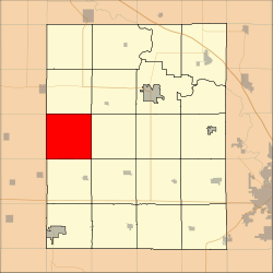 Location in Benton County | |
| Coordinates: 42°04′25″N 92°13′55″W / 42.07361°N 92.23194°WCoordinates: 42°04′25″N 92°13′55″W / 42.07361°N 92.23194°W | |
| Country |
|
| State |
|
| County | Benton |
| Area | |
| • Total | 92.72 km2 (35.8 sq mi) |
| • Land | 92.72 km2 (35.8 sq mi) |
| • Water | 0 km2 (0 sq mi) 0% |
| Elevation | 279 m (915 ft) |
| Population (2000) | |
| • Total | 222 |
| • Density | 2.4/km2 (6.2/sq mi) |
| Time zone | UTC-6 (CST) |
| • Summer (DST) | UTC-5 (CDT) |
| ZIP codes | 52224, 52225, 52229, 52249 |
| GNIS feature ID | 0468049 |
Homer Township is one of twenty townships in Benton County, Iowa, USA. As of the 2000 census, its population was 222.[1]
Geography
According to the United States Census Bureau, Homer Township covers an area of 35.8 square miles (92.72 square kilometers).
Unincorporated towns
(This list is based on USGS data and may include former settlements.)
Adjacent townships
- Monroe Township (north)
- Jackson Township (northeast)
- Big Grove Township (east)
- Union Township (southeast)
- Kane Township (south)
- York Township, Tama County (southwest)
- Oneida Township, Tama County (west)
- Clark Township, Tama County (northwest)
Cemeteries
The township contains these two cemeteries: Houghton and Twogood.
School districts
- Benton Community School District
- Union Community School District
- Vinton-Shellsburg Community School District
Political districts
- Iowa's 3rd congressional district
- State House District 39
- State Senate District 20
References
External links
| Wikimedia Commons has media related to Homer Township, Benton County, Iowa. |
Municipalities and communities of Benton County, Iowa, United States | ||
|---|---|---|
| Cities | ||
| Townships | ||
| CDP | ||
| Unincorporated communities | ||
| Footnotes | ‡This populated place also has portions in an adjacent county or counties | |
This article is issued from
Wikipedia.
The text is licensed under Creative Commons - Attribution - Sharealike.
Additional terms may apply for the media files.