Hingham, Wisconsin
| Hingham, Wisconsin | |
|---|---|
| Census-designated place | |
 Hingham, Wisconsin | |
| Coordinates: 43°38′20″N 87°54′51″W / 43.63889°N 87.91417°WCoordinates: 43°38′20″N 87°54′51″W / 43.63889°N 87.91417°W | |
| Country | United States |
| State | Wisconsin |
| County | Sheboygan |
| Area | |
| • Total | 2.786 sq mi (7.22 km2) |
| • Land | 2.695 sq mi (6.98 km2) |
| • Water | 0.091 sq mi (0.24 km2) |
| Elevation | 804 ft (245 m) |
| Population (2010 census) | |
| • Total | 886 |
| • Density | 320/sq mi (120/km2) |
| Time zone | UTC-6 (Central (CST)) |
| • Summer (DST) | UTC-5 (CDT) |
| ZIP code | 53031 |
| Area code(s) | 920 |
| GNIS feature ID | 1566481[1] |
Hingham is an unincorporated census-designated place located in the town of Lima, in Sheboygan County, Wisconsin, United States. Hingham is northeast of Adell and southeast of Waldo. Hingham has a post office with ZIP code 53031.[2] As of the 2010 census, its population was 886.[3]
History
Hingham was platted on Sept. 5, 1850, by Edward Hobart.[4] The land was acquired from Mrs. David Giddings, who had bought it from the U.S. government in 1846. A Hingham resident, Lemuel Tibbitts, who was a deputy county surveyor, did the platting. Streets on the original plat included Water, Center, Spring, South and Main Streets. The name "Hingham" was chosen after the town in Massachusetts.[4]
References
- ↑ U.S. Geological Survey Geographic Names Information System: Hingham, Wisconsin
- ↑ ZIP Code Lookup
- ↑ "American FactFinder". U.S. Census Bureau. Retrieved 5 April 2011.
- 1 2 Gustave W. Buchen. Historic Sheboygan County. Sheboygan, Wis.: Author, 1976, pp. 265-266.
Municipalities and communities of Sheboygan County, Wisconsin, United States | ||
|---|---|---|
| Cities | 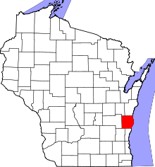 | |
| Villages | ||
| Towns | ||
| CDPs | ||
| Unincorporated communities | ||
| Ghost towns/neighborhoods | ||
| Footnotes | ‡This populated place also has portions in an adjacent county or counties | |
This article is issued from
Wikipedia.
The text is licensed under Creative Commons - Attribution - Sharealike.
Additional terms may apply for the media files.