Hilliar Township, Knox County, Ohio
| Hilliar Township, Knox County, Ohio | |
|---|---|
| Township | |
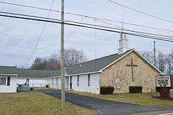 Church outside of Centerburg | |
 Location of Hilliar Township in Knox County. | |
| Coordinates: 40°18′20″N 82°41′48″W / 40.30556°N 82.69667°WCoordinates: 40°18′20″N 82°41′48″W / 40.30556°N 82.69667°W | |
| Country | United States |
| State | Ohio |
| County | Knox |
| Area | |
| • Total | 26.1 sq mi (67.5 km2) |
| • Land | 26.0 sq mi (67.5 km2) |
| • Water | 0.0 sq mi (0.1 km2) |
| Elevation[1] | 1,207 ft (368 m) |
| Population (2010) | |
| • Total | 3,715 |
| • Density | 142.3/sq mi (55.0/km2) |
| Time zone | UTC-5 (Eastern (EST)) |
| • Summer (DST) | UTC-4 (EDT) |
| FIPS code | 39-35462[2] |
| GNIS feature ID | 1086399[1] |
Hilliar Township is one of the twenty-two townships of Knox County, Ohio, United States. The 2010 census found 3,715 people in the township, 1,942 of whom lived in the unincorporated portions of the township.[3]
Geography
Located in the southwestern corner of the county, it borders the following townships:
- South Bloomfield Township, Morrow County - north
- Liberty Township - northeast corner
- Milford Township - east
- Bennington Township, Licking County - southeast corner
- Hartford Township, Licking County - south
- Trenton Township, Delaware County - southwest corner
- Porter Township, Delaware County - west
- Bennington Township, Morrow County - northwest corner
The village of Centerburg is located in central Hilliar Township.
The farthest west township in Knox County, it is the only township that borders Delaware County.
Name and history
Hilliar Township was established in 1818. It was named for Dr. Richard Hilliar, a pioneer settler and landowner.[4]
It is the only Hilliar Township statewide.[5]
Government
The township is governed by a three-member board of trustees, who are elected in November of odd-numbered years to a four-year term beginning on the following January 1. Two are elected in the year after the presidential election and one is elected in the year before it. There is also an elected township fiscal officer,[6] who serves a four-year term beginning on April 1 of the year after the election, which is held in November of the year before the presidential election. Vacancies in the fiscal officership or on the board of trustees are filled by the remaining trustees.
References
- 1 2 "US Board on Geographic Names". United States Geological Survey. 2007-10-25. Retrieved 2008-01-31.
- ↑ "American FactFinder". United States Census Bureau. Archived from the original on 2013-09-11. Retrieved 2008-01-31.
- ↑ "American FactFinder". United States Census Bureau. Retrieved 26 July 2018.
- ↑ Graham, Albert Adams (1881). History of Knox County, Ohio: Its Past and Present, Containing a Condensed, Comprehensive History of Ohio. A. A. Graham & Company. pp. 479–480.
- ↑ "Detailed map of Ohio" (PDF). United States Census Bureau. 2000. Retrieved 2007-02-16.
- ↑ §503.24, §505.01, and §507.01 of the Ohio Revised Code. Accessed 4/30/2009.
External links
Municipalities and communities of Knox County, Ohio, United States | ||
|---|---|---|
| City | 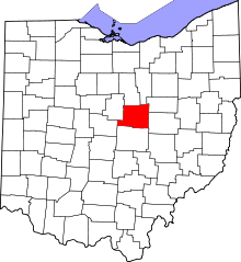 | |
| Villages | ||
| Townships | ||
| CDPs | ||
| Unincorporated communities | ||
| Ghost town | ||
| Footnotes | ‡This populated place also has portions in an adjacent county or counties | |