Bennington Township, Morrow County, Ohio
| Bennington Township, Morrow County, Ohio | |
|---|---|
| Township | |
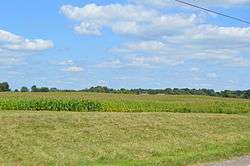 Fields east of Marengo | |
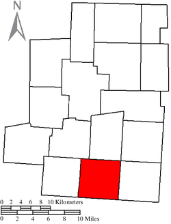 Location of Bennington Township in Morrow County | |
| Coordinates: 40°23′3″N 82°47′41″W / 40.38417°N 82.79472°WCoordinates: 40°23′3″N 82°47′41″W / 40.38417°N 82.79472°W | |
| Country | United States |
| State | Ohio |
| County | Morrow |
| Area | |
| • Total | 25.3 sq mi (65.4 km2) |
| • Land | 25.2 sq mi (65.4 km2) |
| • Water | 0.0 sq mi (0.1 km2) |
| Elevation[1] | 1,181 ft (360 m) |
| Population (2010) | |
| • Total | 3,102 |
| • Density | 122.6/sq mi (47.4/km2) |
| Time zone | UTC-5 (Eastern (EST)) |
| • Summer (DST) | UTC-4 (EDT) |
| FIPS code | 39-05508[2] |
| GNIS feature ID | 1086697[1] |
Bennington Township is one of the sixteen townships of Morrow County, Ohio, United States. The 2010 census found 3,102 people in the township, 342 of whom lived in the village of Marengo.
Geography
Located in the southern part of the county, it borders the following townships:
- Harmony Township - north
- Chester Township - northeast corner
- South Bloomfield Township - east
- Hilliar Township, Knox County - southeast corner
- Porter Township, Delaware County - south
- Kingston Township, Delaware County - southwest corner
- Peru Township - west
- Lincoln Township - northwest
The village of Marengo is located in northwestern Bennington Township.
Name and history
Bennington Township was organized in 1817, and named after Bennington, Vermont, the native home of a first settler.[3] Statewide, the only other Bennington Township is located in Licking County.[4]
Government
The township is governed by a three-member board of trustees, who are elected in November of odd-numbered years to a four-year term beginning on the following January 1. Two are elected in the year after the presidential election and one is elected in the year before it. There is also an elected township fiscal officer,[5] who serves a four-year term beginning on April 1 of the year after the election, which is held in November of the year before the presidential election. Vacancies in the fiscal officership or on the board of trustees are filled by the remaining trustees.
References
- 1 2 "US Board on Geographic Names". United States Geological Survey. 2007-10-25. Retrieved 2008-01-31.
- ↑ "American FactFinder". United States Census Bureau. Archived from the original on 2013-09-11. Retrieved 2008-01-31.
- ↑ History of Morrow County and Ohio: Containing a Brief History of the State of Ohio. O.L. Baskin & Company. 1880. p. 493.
- ↑ "Detailed map of Ohio" (PDF). United States Census Bureau. 2000. Retrieved 2007-02-16.
- ↑ §503.24, §505.01, and §507.01 of the Ohio Revised Code. Accessed 4/30/2009.
External links
Municipalities and communities of Morrow County, Ohio, United States | ||
|---|---|---|
| City | 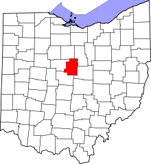 | |
| Villages | ||
| Townships | ||
| CDPs | ||
| Unincorporated communities | ||
| Ghost towns | ||
| Footnotes | ‡This populated place also has portions in an adjacent county or counties | |