Highway 90 (Israel)
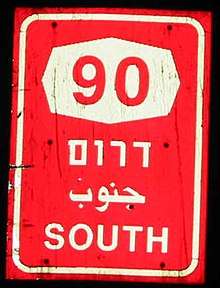
Route 90 is the longest Israeli road, at about 480 kilometres (300 mi), and stretches from Metula and the northern border with Lebanon, along the western side of the Sea of Galilee, through the Jordan River Valley, along the western bank of the Dead Sea (making it the world's lowest road), through the Arabah valley, and until Eilat and the southern border with Egypt on the Red Sea. The central section of the road traverses the West Bank; while it passes near the city of Jericho, it runs through Area C and does not enter areas controlled by the Palestinian Authority.
Route
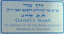
The section of route 90 passing through the Jordan Valley was dedicated as Derekh Gandi (Gandhi's Road) after the late Rehavam Zeevi, an assassinated Israeli Minister of Tourism, who was nicknamed after Mahatma Gandhi.
The section of Route 90 passing the Dead Sea is named Dead Sea Highway, and it is this location that is the lowest road in the world. It is along this stretch of road that Masada, Ein Gedi nature reserve, Ein Gedi Spa, Qumran Caves, and Ahava (company) are located. It is here that Route 90 intersects with Route 1, making it a major international tourism artery for travellers between the Sea of Galilee, Jerusalem and the Dead Sea.[1]
There is no actual four-way intersection with Route 1. When traveling south along 90 from the Jordan Valley, the road intersects the eastern end of Route 1 at Beit HaArava Junction. Route 90 continues by making a left turn at the junction, then again turns south. A short distance later, Route 90 continues via a right turn at Lido Junction.
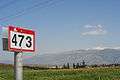
The section of Route 90 passing through the Arabah is named Arava Highway. The Arabah section of the proposed Railway to Eilat, if and when built, will be located nearby the Arava Highway in many places along the route.
History
Until the 1960s, a series of separate roads existed where the highway is today. After the Six-Day War, a section in the northern Dead Sea area was completed, making these roads contiguous. In the early 1980s, the road was assigned the number 90. The northernmost section of the highway, from Tiberias to Metula, is the oldest, having existed since the Ottoman period.
Construction activity
The Arava Highway is the main link from the resort and port city of Eilat towards the center of the country and at times handles a heavy mix of local, tourist and commercial trucking traffic on the two-lane road (one lane in each direction). That, coupled with the monotone nature of the desert landscape around it and the lack of a physical barrier between the opposing lanes of traffic, makes the road particularly prone to traffic accidents, which often occur at high speeds - earning it the nickname of "The Red Road".[2] In October 2007, Israeli Transport Minister Shaul Mofaz announced that the 170km section of Route 90 between Arava Junction and Eilat would be renovated, widening and repaving in stages to a four lane configuration with a physical barrier in the middle and rest stops every 45 kilometres.[2] Initial announced funding was NIS125 million; the total project budget for all stages of renovations is NIS2.3 billion (equivalent to over US$650 million). As of the fall of 2013, 40 km of the highway had been widened by the National Roads Company, from Eilat to Yotvata.[3] As of March 2015, this work remained uncompleted.[4]
Checkpoints
Route 90 has two checkpoints: the Beit She'an-Bardala checkpoint in the north, near Sdei Trumot and the Bezeq Stream, and one in the south just north of Ein Gedi. Palestinians living in the West Bank are not allowed to pass these checkpoints unless permits from the Israeli authorities are obtained.[1] Both checkpoints are permanently staffed around the clock by the Israeli military and private security companies.[5] At the Beit She'an-Bardala checkpoint, during certain agricultural seasons, Palestinian trucks transporting agricultural produce are allowed to cross twice a week.[5]
Attempts to block
While in Israel blocking a route is a criminal offense, some attempts to block the road had been made during recent years.
- During March 2011 Israeli social workers' demonstrations, an attempt was made to block route 90.[6]
- In April 2011, a group of extreme right-wing activists attempted to cycle from Nablus to Jericho, partially on road 90, as a celebration of Israeli rule over the West Bank.[7][8]
- On 14 April 2012, a group of approximately 200 cyclists tried to join the road and were stopped by Lt. Col. Eisner. The incident became an international scandal resulting in Eisner being suspended.[9][10]
 Route 90 near Kfar Giladi, in the Hula valley and below Mt. Hermon
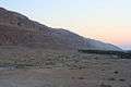 Route 90 along the Dead Sea
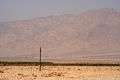 Route 90 in the Arava, just north of Eilat
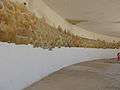 Wall painting in abandoned restaurant near Lido junction
External links
| Wikimedia Commons has media related to B90 (Israel). |
References
- 1 2 Kool, Jeroen (2016). Sustainable Development in the Jordan Valley: Final Report of the Regional NGO Master Plan. Springer. p. 28.
|access-date=requires|url=(help) - 1 2 "Arava Highway to get safety upgrades". The Jerusalem Post. 23 October 2007. Retrieved 1 June 2018.
- ↑ "כביש 90 - כביש הערבה" [Highway 90 - Arabah Road project page]. National Roads Company of Israel. Retrieved 7 October 2013.
- ↑ Pantorin, Avi (10 March 2015). ""Only private sector can free Israel's traffic jams"". Globes, Israel Business News. Retrieved 1 June 2018.
- 1 2 "Lists of checkpoints and forbidden Roads". B'Tselem. Retrieved 1 June 2018.
- ↑ Idan Avni; Rami Shani (6 March 2011). "מחאת העובדים הסוציאליים: הפגנות בצפון ובדרום" [Protest of social workers: demonstrations in the north and south] (in Hebrew). Walla!.
- ↑ Ohad Hemo; Natalie Tsfati (21 April 2011). "שלושה עצורים ב"מסע אופניים" של פעילי ימין לשכם ויריחו" [Three detainees in a 'bicycle trip' of right-wing activists to Nablus and Jericho] (in Hebrew). Mako.
- ↑ "Archived copy". Archived from the original on 2016-03-04. Retrieved 2012-04-26. demonstration poster
- ↑ "The blow heard 'round the world". Retrieved 2017-10-31.
- ↑ "Lt. Col. Shalom Eisner removed from post". Retrieved 2017-10-31.
| Roads |
| ||||
|---|---|---|---|---|---|
| Bus operators | |||||
| Rail transport |
| ||||
| Sea ports | |||||
| Aviation |
| ||||
| Cable cars | |||||
| By city | |||||
| Smart cards | |||||
Coordinates: 31°22′24″N 35°23′02″E / 31.37333°N 35.38389°E