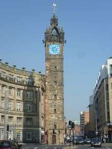
High Street, Glasgow
High Street is the oldest, and one of the most historically significant, streets in Glasgow, Scotland. Originally the city's main street in medieval times, it formed a direct north-south artery between the Cathedral of St. Mungo (later Glasgow Cathedral) in the north, to Glasgow Cross and the banks of the River Clyde. The High Street now stops at Glasgow Cross, with the southern continuation being the Saltmarket.[1]
History
From 1460 to 1870, the original buildings of the University of Glasgow were located at the junction of High Street and Duke Street, before moving to Hillhead in the West End.[2] The site was then turned into the College Goods yard by the City of Glasgow Union Railway before it was closed in 1968 in the wake of the Beeching Axe.[3] The derelict wall of the goods warehouse still faces onto this section of Duke Street as it was incorporated into the Collegelands development.[4]
When the Industrial Revolution in Victorian times triggered the massive growth in Glasgow's size, the importance of High Street diminished as the administrative functions of the city moved westward into what is now known as the Merchant City area, whilst the medieval part of the city was left behind. The original City Chambers at the foot of High Street was closed and moved to the present building which stands overlooking George Square in the late 19th century.
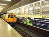
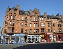
As the 20th century progressed, many areas of High Street fell into dereliction. However, in the early 21st Century, the fortunes of High Street have enjoyed a renaissance with Glasgow's growing economy. Although much of the derelict land has been redeveloped, Aldi and badly designed, poorly built student housing has ruined the vista of what was once, Glasgow's most prominent street. Some developers have created upmarket apartment buildings and there are plans to develop empty sites into new student residences for the adjacent University of Strathclyde.[4] The former railway lands next to High Street railway station has been developed into a Moxy Hotel and another scheme is awaiting funding, a site called 17 acres. The railway station itself will be substantially remodelled if the Glasgow Crossrail scheme is approved by the Scottish Government.
References
- ↑ Loney, Gillian (3 June 2016). "Is Glasgow's historic High Street being left to ruin?". glasgowlive. Retrieved 11 July 2017.
- ↑ "Glasgow, High Street, Old College". canmore.org.uk. Retrieved 11 July 2017.
- ↑ "TheGlasgowStory: College Goods Station". www.theglasgowstory.com. Retrieved 11 July 2017.
- 1 2 "New Collegelands business and residential site to open in city centre". STV News. 2 February 2012. Retrieved 11 July 2017.
Coordinates: 55°51′32″N 4°14′30″W / 55.85881°N 4.24174°W