Lake Hibara
| Lake Hibara | |
|---|---|
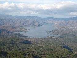 Lake Hibara viewed from north of Mount Bandai | |
| Location | Kitashiobara |
| Coordinates | 37°41′0″N 140°3′20″E / 37.68333°N 140.05556°ECoordinates: 37°41′0″N 140°3′20″E / 37.68333°N 140.05556°E |
| Basin countries | Japan |
| Surface area | 10.7 km2 (4.1 sq mi) |
| Max. depth | 30.5 m (100 ft) |
| Water volume | 0.13 km3 (110,000 acre⋅ft) |
| Shore length1 | 31.5 km (19.6 mi) |
| Surface elevation | 822.0 m (2,696.9 ft) |
| 1 Shore length is not a well-defined measure. | |
| Wikimedia Commons has media related to Lake Hibara. |
Lake Hibara (桧原湖 Hibara-ko) is a lake located in Yama District, Fukushima, Japan. It is a part of the Bandai-Asahi National Park and is the largest of the lakes in the Bandai-kōgen highlands.[1]
Formation
A mesotrophic lake, Lake Hibara was formed as a result of the July 15, 1888 eruption of Mount Bandai. The resulting debris avalanche created a natural dam that then filled with water, submerging Hibara Village (桧原村 Hibara-mura). The remains of Hibara Village still lie at the bottom of the lake.[2]
Recreation
A tourist industry has built up around Lake Hibara, offering hiking trails, pleasure cruises, and campgrounds and other lodging. In the winter, ice fishing is popular.
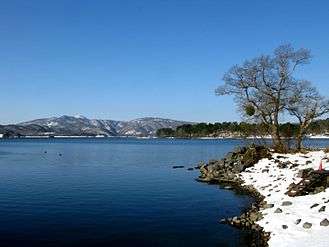
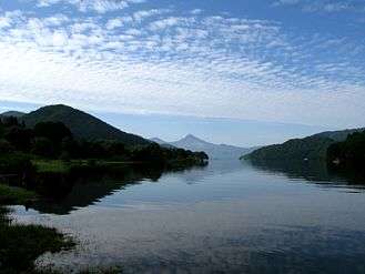
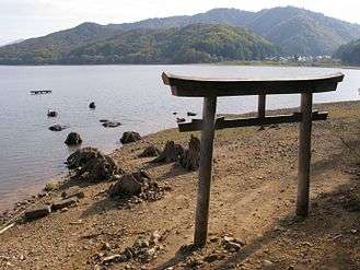
Gallery
|
Notes
- ↑ Takeda T., page 174.
- ↑ 裏磐梯を代表する湖沼群 (in Japanese). 裏磐梯観光協会. Retrieved June 30, 2011.
References
- Takeda, Toru; Hishinuma, Tomio; Kamieda, Kinuyo; Dale, Leigh; Oguma, Chiyoichi (August 10, 1988). "Hello! Fukushima - International Exchange Guide Book" (1988 ed.). Fukushima City: Fukushima Mimpo Press
This article is issued from
Wikipedia.
The text is licensed under Creative Commons - Attribution - Sharealike.
Additional terms may apply for the media files.