Havelange
| Havelange | |||
|---|---|---|---|
| Municipality | |||
 | |||
| |||
 Havelange Location in Belgium
Location of Havelange in Namur province  | |||
| Coordinates: 50°23′N 05°15′E / 50.383°N 5.250°ECoordinates: 50°23′N 05°15′E / 50.383°N 5.250°E | |||
| Country | Belgium | ||
| Community | French Community | ||
| Region | Wallonia | ||
| Province | Namur | ||
| Arrondissement | Dinant | ||
| Government | |||
| • Mayor | Jean-Marie Polet (OP) | ||
| • Governing party/ies | OP, Ecolo | ||
| Area | |||
| • Total | 104.73 km2 (40.44 sq mi) | ||
| Population (1 January 2017)[1] | |||
| • Total | 5,152 | ||
| • Density | 49/km2 (130/sq mi) | ||
| Postal codes | 5370, 5372, 5374, 5376 | ||
| Area codes | 083 | ||
| Website | www.havelange.be | ||

.svg.png)
Havelange (Walloon: Havlondje) is a Walloon municipality and village in the Belgian province of Namur.
On 1 January 2006 the municipality had 4,844 inhabitants. The total area is 104.73 km², giving a population density of 45 inhabitants per km².
Other centres
Apart from Havelange itself, the municipality also comprises the villages of:
- Barvaux-Condroz, including the eponymous castle, still owned by the noble Lynden family
- Flostoy, including the hamlet of Bormenville and its castle
- Jeneffe
- Maffe
- Méan
- Miécret
- Porcheresse
- Verlée
See also
References
- ↑ Population per municipality as of 1 January 2017 (XLS; 397 KB)
External links

- Official website (in French)
Municipalities in the Province of Namur | ||
|---|---|---|
| Dinant | 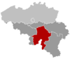 | |
| Namur | ||
| Philippeville | ||
This article is issued from
Wikipedia.
The text is licensed under Creative Commons - Attribution - Sharealike.
Additional terms may apply for the media files.