Gedinne
| Gedinne | |
|---|---|
| Municipality | |
 Gedinne: the church of Our Lady of the Nativity | |
 Gedinne Location in Belgium
Location of Gedinne in Namur province 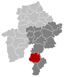 | |
| Coordinates: 49°59′N 04°56′E / 49.983°N 4.933°ECoordinates: 49°59′N 04°56′E / 49.983°N 4.933°E | |
| Country | Belgium |
| Community | French Community |
| Region | Wallonia |
| Province | Namur |
| Arrondissement | Dinant |
| Government | |
| • Mayor | Vincent Massinon |
| Area | |
| • Total | 151.56 km2 (58.52 sq mi) |
| Population (1 January 2017)[1] | |
| • Total | 4,570 |
| • Density | 30/km2 (78/sq mi) |
| Postal codes | 5575 |
| Area codes | 061 |
| Website | www.gedinne.be |
Gedinne (French pronunciation: [ʒə.din]) is a Walloon municipality located in the Belgian province of Namur. On 1 January 2006 the municipality had 4,405 inhabitants. The total area is 151.56 km², giving a population density of 29 inhabitants per km².
It is situated in the Ardennes east of Meuse valley. The western limit of the municipality is the French border.
The municipality consists of the town of Gedinne and eleven villages: (number of inhabitants in brackets)
- Gedinne (1,124, administrative centre)
- Bourseigne-Neuve (137)
- Bourseigne-Vieille (106)
- Houdremont (233)
- Louette-Saint-Denis (331)
- Louette-Saint-Pierre (270)
- Malvoisin (298)
- Patignies (242)
- Rienne (736)
- Sart-Custinne (169)
- Vencimont (499)
- Willerzie (319)
See also
- List of protected heritage sites in Gedinne
- Tour du Millénaire, a remarkable timber and steel observation tower, built in 2001.
References
- ↑ Population per municipality as of 1 January 2017 (XLS; 397 KB)
External links

- Official website (in French)
Places adjacent to Gedinne | ||||||||||
|---|---|---|---|---|---|---|---|---|---|---|
| ||||||||||
Municipalities in the Province of Namur | ||
|---|---|---|
| Dinant | 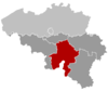 | |
| Namur | ||
| Philippeville | ||
This article is issued from
Wikipedia.
The text is licensed under Creative Commons - Attribution - Sharealike.
Additional terms may apply for the media files.