Harting
| Harting | |
|---|---|
 South Harting seen from Harting Down | |
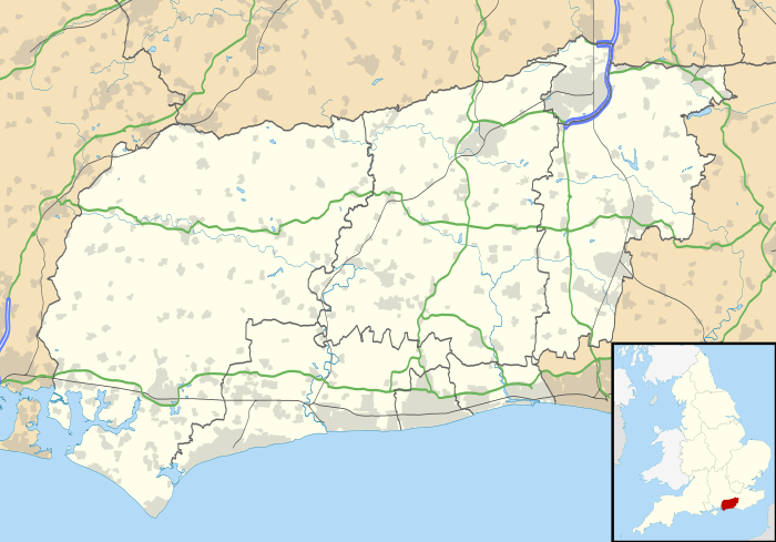 Harting Harting shown within West Sussex | |
| Area | 32.16 km2 (12.42 sq mi) [1] |
| Population | 1,451 (2011)[2] |
| • Density | 44/km2 (110/sq mi) |
| OS grid reference | SU786215 |
| • London | 48 miles (77 km) NE |
| Civil parish |
|
| District | |
| Shire county | |
| Region | |
| Country | England |
| Sovereign state | United Kingdom |
| Post town | PETERSFIELD |
| Postcode district | GU31 |
| Dialling code | 01730 |
| Police | Sussex |
| Fire | West Sussex |
| Ambulance | South East Coast |
| EU Parliament | South East England |
| UK Parliament | |
| Website | Parish Council |
Harting is a civil parish in the Chichester District of West Sussex, England. It is situated on the northern flank of the South Downs, around 3.5 miles (5.6 km) southeast of Petersfield in Hampshire. It comprises the village of South Harting and the hamlets of East Harting, West Harting and Nyewood.
The area of the parish is 3,216 hectares (7,950 acres). At the 2011 Census, the population was 1,451, an increase from 1,407 at the 2001 Census.[3]
History
Harting is mentioned in the Domesday Book as the Manor of Hertinges. Apart from three generations of the Earls Montgomery the manor was in the possession of the Crown until 1610 when it was granted to the Caryll family. In 1746 the manor was purchased by the Featherstonhaugh /ˈfænʃɔː/ family, in whose possession it remains.[4]
Harting Down
The villages are overlooked by Harting Down, a 550-acre (2.2 km2) common owned by the National Trust and part of the Sussex Downs Area of Outstanding Natural Beauty. Rising to 229 metres (751 ft), it offers panoramic views over the Weald to the north, to the English Channel and the Isle of Wight to the south.
Archaeological evidence has suggested that Harting Down was first occupied around 5000 years ago. Neighbouring Beacon Hill is home to a hillfort from the Iron Age, built around 500 BC as an animal enclosure and refuge. In addition, a cross ridge dyke was built around the same time, may have been used to control movement of people and animals along the ridgeway.[5]
Because of its elevation Beacon Hill, just to the east of Harting Down, hosted a station in the shutter telegraph chain, from 1796 to 1816, which connected the Admiralty in London to its naval ships in Portsmouth and Plymouth. This was replaced in 1822 by a semaphore station which operated on a slightly different route until 1847. Bertrand Russell and his wife Dora founded the experimental Beacon Hill School[6] at Telegraph House, which was their residence in 1927.[7]
West of Beacon Hill is Tower hill, on top of which is the Vandalian Tower, a folly dating to the 18th century which is in the grounds of Uppark house. It was built to celebrate the founding of the American colony of Vandalia in 1774, though the events of the American Revolution meant that the colony never got off the ground. The tower is in ruins and cannot be entered, but can be seen from outside.
A large portion of the down has never been used for modern intensive farming and is thus an important site representing the chalk grassland that once covered the downs. Plants found on the site include quaking grass and the common spotted orchid. The down supports animals such as adders, skylarks and several species of butterfly.
Governance
An electoral ward of the same name covers this parish and the neighbouring parishes of Elsted and Treyford and Trotton with Chithurst. The ward's population at the 2011 Census was 2,026.[8]
See also
References
- ↑ "2001 Census: West Sussex – Population by Parish" (PDF). West Sussex County Council. Archived from the original (PDF) on 8 June 2011. Retrieved 12 April 2009.
- ↑ "Harting (Parish): Key Figures for 2011 Census". Neighbourhood Statistics. Office for National Statistics. Retrieved 15 October 2015.
- ↑ "Harting (Parish): Key Figures for 2001 Census". Neighbourhood Statistics. Office for National Statistics. Retrieved 26 April 2017.
- ↑ "GENUKI - Harting". Retrieved 29 September 2014.
- ↑ National Trust - Harting Down
- ↑ David Harley Beacon Hill School
- ↑ Kenneth Blackwell and Sheila Turcon Russell's Addresses
- ↑ "Harting (Ward): Key Figures for 2011 Census". Neighbourhood Statistics. Office for National Statistics. Retrieved 26 April 2017.
External links
![]()
| Next station upwards | Admiralty Shutter telegraph line 1795 | Next station downwards |
| Blackdown | Beacon Hill | Portsdown Hill |
| Next station upwards | Admiralty Semaphore line 1822 | Next station downwards |
| Holder Hill | Beacon Hill | Compton Down, Compton |