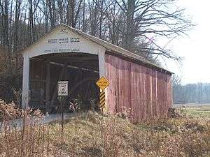
Harry Evans Covered Bridge
| Harry Evans Covered Bridge | |
| National Register of Historic Places | |
 | |
| Official name: Harry Evans Covered Bridge | |
| Named for: Harry Evans | |
| Country | |
|---|---|
| State | |
| County | Parke |
| Township | Florida Township, Indiana |
| Road | C.R. 325W |
| City | Florida Township, Indiana |
| Crosses | Rock Run (Indiana) |
| Coordinates | 39°39′43.62″N 87°17′40.07″W / 39.6621167°N 87.2944639°WCoordinates: 39°39′43.62″N 87°17′40.07″W / 39.6621167°N 87.2944639°W |
| Length | 81 ft (25 m) 65ft +8ft overhangs on each end |
| Width | 16 ft (5 m) |
| Clearance | 13 ft (4 m) |
| Builder | Joseph A. Britton |
| Design | Burr arch truss bridge |
| Material | Wood |
| Built | 1908 |
| - rebuilt | 1977 |
| Owner | Parke County Commissioners Parke County |
| NBI Number | 6100050[1] |
| WGCB Number | #14-61-10 [2] |
| Load | 6 short tons (5.4 t) |
| Added to NRHP | December 22, 1978 |
| NRHP Ref# | 78000392 [3] |
| MPS | Parke County Covered Bridges TR |
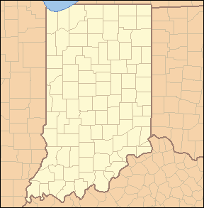 Location of Harry Evans Covered Bridge in Indiana | |
 Location of Indiana in the United States | |
The Harry Evans Covered Bridge is a single span Burr Arch Truss structure that crosses Rock Run built in 1908 by J.A. Britton 1⁄2 mi (0.80 km) north of Coxville, Indiana.[2]
History
The story goes that one of the former neighbors of the bridge was incensed over naming the bridge after local resident Harry Evans. He claimed that because Harry lived at the top of the hill that it was named after another Evans who lived in the valley. However, county records show that Harry Evans owned the land near the bridge. The land stayed in the Evans name until the 1960s.[4]
It was added to the National Register of Historic Places in 1978.[3] The hills near the bridge are also riddled with numerous, and dangerous, old coal mines.[2]
Gallery
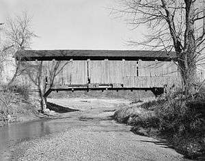
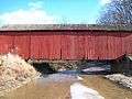 Side view of the Harry Evans Bridge
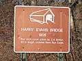 Information Plaque
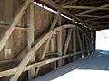 Interior of the Harry Evans Bridge
See also
References
- ↑ http://nationalbridges.com/
- 1 2 3 "Harry Evans Covered Bridge (#19)". coveredbridges.com. Parke County Incorporated /Parke County Convention and Visitors Commission. Retrieved 20 September 2016.
- 1 2 National Park Service (2007-01-23). "National Register Information System". National Register of Historic Places. National Park Service.
- ↑ "Indiana State Historic Architectural and Archaeological Research Database (SHAARD)" (Searchable database). Department of Natural Resources, Division of Historic Preservation and Archaeology. Retrieved 2016-06-01. Note: This includes Charles Felkner (December 1977). "National Register of Historic Places Inventory Nomination Form: Parke County Covered Bridge Historic District" (PDF). Retrieved 2016-06-01. , Site map, and Accompanying photographs.
External links

This article is issued from
Wikipedia.
The text is licensed under Creative Commons - Attribution - Sharealike.
Additional terms may apply for the media files.