Harrison Township, Gallia County, Ohio
| Harrison Township, Gallia County, Ohio | |
|---|---|
| Township | |
 Agricultural scene south of Northup | |
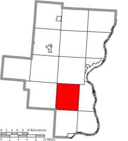 Location of Harrison Township in Gallia County | |
| Coordinates: 38°43′19″N 82°17′43″W / 38.72194°N 82.29528°WCoordinates: 38°43′19″N 82°17′43″W / 38.72194°N 82.29528°W | |
| Country | United States |
| State | Ohio |
| County | Gallia |
| Area | |
| • Total | 31.3 sq mi (81.0 km2) |
| • Land | 31.2 sq mi (80.8 km2) |
| • Water | 0.1 sq mi (0.3 km2) |
| Elevation[1] | 853 ft (260 m) |
| Population (2010) | |
| • Total | 1,063 |
| • Density | 34/sq mi (13.2/km2) |
| Time zone | UTC-5 (Eastern (EST)) |
| • Summer (DST) | UTC-4 (EDT) |
| FIPS code | 39-33824[2] |
| GNIS feature ID | 1086139[1] |
Harrison Township is one of the fifteen townships of Gallia County, Ohio, United States. As of the 2010 census the population was 1,063.[3]
Geography
Located in the southern part of the county, it borders the following townships:
- Green Township - north
- Clay Township - east
- Ohio Township - southeast corner
- Guyan Township - south
- Mason Township, Lawrence County - southwest corner
- Walnut Township - west
- Perry Township - northwest corner
No municipalities are located in Harrison Township.
Name and history
It is one of nineteen Harrison Townships statewide.[4]
Government
The township is governed by a three-member board of trustees, who are elected in November of odd-numbered years to a four-year term beginning on the following January 1. Two are elected in the year after the presidential election and one is elected in the year before it. There is also an elected township fiscal officer,[5] who serves a four-year term beginning on April 1 of the year after the election, which is held in November of the year before the presidential election. Vacancies in the fiscal officership or on the board of trustees are filled by the remaining trustees.
Public services
Education
The bulk of the township is served by the Gallia County Local School District, except for a small area in the northern extremity of the township, which lies within the Gallipolis City School District.
Transportation
The township is served by State Routes 218 and 790. Hannan Trace Road, one of the oldest roads in Ohio, having originally been laid out in 1798 by Thomas Hannan under contract with the federal government, is also one of the main roads in the township. It was originally one of the main highways connecting Chillicothe and points east during the time period when Chillicothe served as the capital of the Northwest Territory and the first capital of Ohio.
References
- 1 2 "US Board on Geographic Names". United States Geological Survey. 2007-10-25. Retrieved 2008-01-31.
- ↑ "American FactFinder". United States Census Bureau. Retrieved 2008-01-31.
- ↑ "Geographic Identifiers: 2010 Demographic Profile Data (G001): Harrison township, Gallia County, Ohio". American Factfinder. U.S. Census Bureau. Retrieved January 12, 2017.
- ↑ "Detailed map of Ohio" (PDF). United States Census Bureau. 2000. Retrieved 2007-02-16.
- ↑ §503.24, §505.01, and §507.01 of the Ohio Revised Code. Accessed 4/30/2009.
External links
Municipalities and communities of Gallia County, Ohio, United States | ||
|---|---|---|
| Villages | 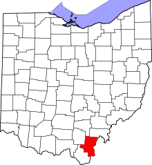 | |
| Townships | ||
| CDP | ||
| Unincorporated communities | ||