Harmony Township, Hancock County, Illinois
| Harmony Township | |
|---|---|
| Township | |
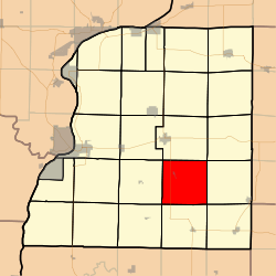 Location in Hancock County | |
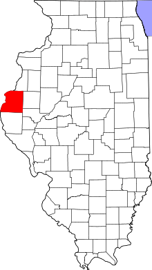 Hancock County's location in Illinois | |
| Coordinates: 40°19′48″N 91°04′53″W / 40.33000°N 91.08139°WCoordinates: 40°19′48″N 91°04′53″W / 40.33000°N 91.08139°W | |
| Country |
|
| State |
|
| County | Hancock |
| Established | September 12, 1854 |
| Area | |
| • Total | 37.58 sq mi (97.3 km2) |
| • Land | 37.58 sq mi (97.3 km2) |
| • Water | 0.01 sq mi (0.03 km2) 0.03% |
| Elevation | 666 ft (203 m) |
| Population (2010) | |
| • Estimate (2016)[1] | 318 |
| • Density | 8.7/sq mi (3.4/km2) |
| Time zone | UTC-6 (CST) |
| • Summer (DST) | UTC-5 (CDT) |
| ZIP codes | 62316, 62321, 62367 |
| FIPS code | 17-067-32993 |
Harmony Township is one of twenty-four townships in Hancock County, Illinois, USA. As of the 2010 census, its population was 326 and it contained 153 housing units.[2] It was formed from Carthage and Chili townships on September 12, 1854.
Geography
According to the 2010 census, the township has a total area of 37.58 square miles (97.3 km2), of which 37.58 square miles (97.3 km2) (or 100%) is land and 0.01 square miles (0.026 km2) (or 0.03%) is water.[2]
Cities, towns, villages
Unincorporated towns
(This list is based on USGS data and may include former settlements.)
Cemeteries
The township contains these seven cemeteries: Browning, Denver, Harmony, Immanuel Lutheran, Mount Pleasant, Ramsey and Scott.
Major highways
Airports and landing strips
- Mabry Landing Strip
- McPherson Airport
Demographics
| Historical population | |||
|---|---|---|---|
| Census | Pop. | %± | |
| Est. 2016 | 318 | [1] | |
| U.S. Decennial Census[3] | |||
School districts
- Southeastern Community Unit School District 337
Political districts
- Illinois's 18th congressional district
- State House District 94
- State Senate District 47
References
- United States Census Bureau 2008 TIGER/Line Shapefiles
- "Harmony Township". Geographic Names Information System. United States Geological Survey. Retrieved 2009-09-20.
- United States National Atlas
- 1 2 "Population and Housing Unit Estimates". Retrieved June 9, 2017.
- 1 2 "Population, Housing Units, Area, and Density: 2010 - County -- County Subdivision and Place -- 2010 Census Summary File 1". United States Census. Retrieved 2013-05-28.
- ↑ "Census of Population and Housing". Census.gov. Retrieved June 4, 2016.
External links
Places adjacent to Harmony Township, Hancock County, Illinois | |
|---|---|
Municipalities and communities of Hancock County, Illinois, United States | ||
|---|---|---|
| Cities | ||
| Town | ||
| Villages | ||
| Townships | ||
| Unincorporated communities | ||
| Footnotes | ‡This populated place also has portions in an adjacent county or counties | |
This article is issued from
Wikipedia.
The text is licensed under Creative Commons - Attribution - Sharealike.
Additional terms may apply for the media files.