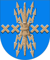
Harjavalta
| Harjavalta | ||
|---|---|---|
| Town | ||
| Harjavallan kaupunki | ||
| ||
 Location of Harjavalta in Finland | ||
| Coordinates: 61°19′0″N 22°08′1″E / 61.31667°N 22.13361°ECoordinates: 61°19′0″N 22°08′1″E / 61.31667°N 22.13361°E | ||
| Country |
| |
| Region | Satakunta | |
| Sub-region | Pori sub-region | |
| Charter | 1869 | |
| Market town | 1968 | |
| Town privileges | 1977 | |
| Government | ||
| • Town manager | Jaana Karrimaa | |
| Area (2018-01-01)[1] | ||
| • Total | 127.74 km2 (49.32 sq mi) | |
| • Land | 123.46 km2 (47.67 sq mi) | |
| • Water | 4.28 km2 (1.65 sq mi) | |
| Area rank | 288th largest in Finland | |
| Elevation | 38 m (125 ft) | |
| Population (2017-08-31)[2] | ||
| • Total | 7,189 | |
| • Rank | 135th largest in Finland | |
| • Density | 58.23/km2 (150.8/sq mi) | |
| Population by native language[3] | ||
| • Finnish | 98.5% (official) | |
| • Swedish | 0.3% | |
| • Others | 1.3% | |
| Population by age[4] | ||
| • 0 to 14 | 14.9% | |
| • 15 to 64 | 62.9% | |
| • 65 or older | 22.2% | |
| Time zone | UTC+2 (EET) | |
| • Summer (DST) | UTC+3 (EEST) | |
| Municipal tax rate[5] | 18.75% | |
| Climate | Dfc | |
| Website | www.harjavalta.fi | |
Harjavalta is a town and municipality of Finland.
It is located in the province of Western Finland and is part of the Satakunta region. The town has a population of 7,189 (31 August 2017)[2] and covers an area of 127.74 square kilometres (49.32 sq mi) of which 4.28 km2 (1.65 sq mi) is water.[1] The population density is 58.23 inhabitants per square kilometre (150.8/sq mi).
Today people in the town are employed in the copper and nickel smelting industries. Today's most used metal recovery method, the flash smelting method, was developed at Harjavalta and implemented in 1949. Originally part of Outokumpu, a Finnish company, the copper business is now owned by Boliden and the nickel business by Norilsk Nickel.
Hiittenharju is a valuable area for its archaeology and cultural history. You can visit the banks of the ancient Litorina Sea on the fringes of the ridge Hiittenharju and the graves of the Bronze Age, called barrows. In Hiittenharju there is also a historical route called Huovintie running through Harjavalta.
The river Kokemäenjoki river runs through the town.
The municipality is unilingually Finnish.
History
Earliest signs of habitation on the area have been dated to 1200 BC. Various different writings of the name in documents of the 15th century at the Turku Cathedral are Harianwalta, Hariawalta, Hariaualdastha, Harianwaltha ja Harianwaltaby. The name is supposed to originate from the speculative Proto Germanic name *Harjawaldaz, composed of the speculative words *harjaz ("army") and *waldaz ("authority"). It is believed that either a person named Harjawaldaz or a warrior band settled or lived in the area. The earliest known written occurrence of the name is from Tacitus on the first century, Chariovalda.[6] Different adoptions of the same name are Harald, Hérault and Harold, but Harjavalta is closest to the reconstructed original.
Politics

Results of the Finnish parliamentary election, 2011 in Harjavalta:
- Social Democratic Party 27.1%
- True Finns 21.2%
- Left Alliance 19.9%
- National Coalition Party 15.7%
- Centre Party 9.9%
- Christian Democrats 3.5%
- Green League 2.3%
Town twinning
Harjavalta is twinned with:
References
- 1 2 "Area of Finnish Municipalities 1.1.2018" (PDF). National Land Survey of Finland. Retrieved 30 January 2018.
- 1 2 "Ennakkoväkiluku sukupuolen mukaan alueittain, elokuu 2017" (in Finnish). Statistics Finland. Retrieved 18 October 2017.
- ↑ "Population according to language and the number of foreigners and land area km2 by area as of 31 December 2008". Statistics Finland's PX-Web databases. Statistics Finland. Retrieved 29 March 2009.
- ↑ "Population according to age and gender by area as of 31 December 2008". Statistics Finland's PX-Web databases. Statistics Finland. Retrieved 28 April 2009.
- ↑ "List of municipal and parish tax rates in 2011". Tax Administration of Finland. 29 November 2010. Retrieved 13 March 2011.
- ↑ Tacitus, The Annals 2.11
External links
![]()
- Town of Harjavalta – Official website
| Municipalities |  | |
|---|---|---|
| Former municipalities | ||