Ahlainen
| Ahlainen | ||
|---|---|---|
| Former municipality | ||
| Ahlaisten kunta | ||
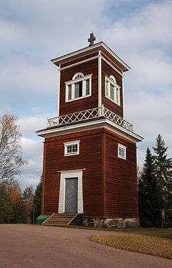 Bell tower of Ahlainen Church, drawn by C. L. Engel (1832) | ||
| ||
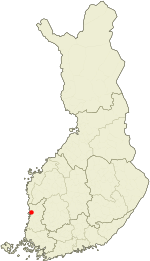 Location of Ahlainen in Finland | ||
| Coordinates: 60°40′30″N 021°37′14″E / 60.67500°N 21.62056°ECoordinates: 60°40′30″N 021°37′14″E / 60.67500°N 21.62056°E | ||
| Country | Finland | |
| Region | Satakunta | |
| Consolidated | 1972 | |
| Area | ||
| • Land | 183.6 km2 (70.9 sq mi) | |
| Population (1971)[1] | ||
| • Total | 2,445 | |
| • Density | 13.32/km2 (34.5/sq mi) | |
| Time zone | UTC+2 (EET) | |
| • Summer (DST) | UTC+3 (EEST) | |
| Climate | Dfc | |

Ahlainen (Swedish: Vittisbofjärd) is a former municipality in the province of Satakunta, Finland. It was annexed with the city of Pori in 1972. Population of Ahlainen was 2,445 in 1971.[1]
References
- 1 2 Statistical Yearbook of Finland 1971 Statistics Finland. Retrieved 29 November 2013.
External links

| Municipalities |  | |
|---|---|---|
| Former municipalities | ||
This article is issued from
Wikipedia.
The text is licensed under Creative Commons - Attribution - Sharealike.
Additional terms may apply for the media files.