Handsacre
| Handsacre | |
|---|---|
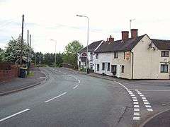 The A513 and the Crown Public house at Handsacre | |
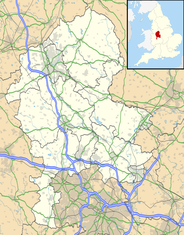 Handsacre Handsacre shown within Staffordshire | |
| OS grid reference | SK0916 |
| District | |
| Shire county | |
| Region | |
| Country | England |
| Sovereign state | United Kingdom |
| Post town | RUGELEY |
| Postcode district | WS15 |
| Police | Staffordshire |
| Fire | Staffordshire |
| Ambulance | West Midlands |
| EU Parliament | West Midlands |
| UK Parliament | |
Handsacre is a village in the English county of Staffordshire, England.[1][2] Population details taken at the 2011 census can be found under Armitage with Handsacre
Location
The village lies east of the larger village of Armitage. The village is 5.5 miles (8.9 km) north of the city of Lichfield and is 3.5 miles (5.6 km) south east of Rugeley. The village sits astride of the A513 road which runs from Tamworth to Stafford.[3]
Village Services
Handsacre has One shop, which is a convenience store. There is also a Chinese food take-away and a fish and chip shop. There are two pubs in within the village. The public housese are called The Old Peculiar[4] and The Crown.[5] The Crown is adjacent to the canal and has a beer garden. The Old Peculiar is on the corner of Hall Road. The Poplar's Pub on Tuppenhurst Lane closed in 2008 and was demolished in June 2010. As of June 2011, twenty houses have been built and are currently occupied.
Schools
The village school is called Hayes Meadow Primary School.[6] The school cater for children from the age of 3 plus, who attend the purpose built nursery unit, to the age of 11. The Headteacher is B J Luck (retrieved 11 April 2013)[6] The school is also home to its PTA organisation, The Friends of Hayes Meadow (Charity number 1087977). The charity organises events such as Summer Fayres, BBQ's, Craft Fairs and the most successful fundraiser, the Santa Float. Events like these allow the charity to provide students with extra things such as climbing frames, play equipment, selection boxes etc.
Playgrounds
There is a children's play park at the end of Harvey Road on St Barbara's Road in the north easterly part of the village. The playpark was refurbished in 2009.
Trent and Mersey Canal
The Trent and Mersey Canal skirts around the northern edge of the village. This canal was designed and built by James Brindley who died in 1777, before the canal was completed. The A513 road crosses the canal with the Crown public house next to the bridge designated bridge 56 here. This bridge is a little way west of two further bridges which cross the canal which are Grade II listed structures. these bridges are designated bridges 59[7] and 60.[8]
Rail
The West Coast Main Line runs through the village although the nearest railway station is at Rugeley which is 3.9 miles (6.3 km) to the north west. High Speed 2 rail line is planned to join with the West Coast Main line near Handsacre. [9]
Population
Handsacre has a population[10] of 5,355 people living in the ward of Armitage with Handsacre.
Gallery
- Handsacre
 Handsacre Methodist Church
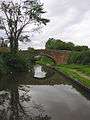 Trent and Mersey Canal at Handsacre
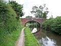 Grade II listed Bridge 59
References
- ↑ OS Explorer Map 244: Cannock Chase & Chasewater: (1:25 000) : ISBN 0 319 46269 2
- ↑ Map Details retrieved 11 April 2013
- ↑ - Staffordshire A-Z County Atlas: 2011 Edition: Scale:3.8 inches to 1 mile (5.9cm to 1km) ISBN 978 1 84348 748 7
- ↑ The Old Peculiar website Archived 2013-07-25 at the Wayback Machine. retrieved 11 April 2013
- ↑ Crown Inn website Archived 2012-11-04 at the Wayback Machine. retrieved 11 April 2013
- 1 2 school website retrieved 11 April 2013
- ↑ Listed Structure status-Bridge 59 retrieved 11 April 2013
- ↑ Listed Structure status-Bridge 60 retrieved 11 April 2013
- ↑ "HIGH SPEED TWO PHASE ONE INFORMATION PAPER A1: DEVELOPMENT OF THE HS2 PROPOSED SCHEME" (PDF). HS2 Ltd. p. 19. Retrieved 15 November 2017.
- ↑ Key Population statistics retrieved 11 April 2013
| Wikimedia Commons has media related to Handsacre. |