Halton, Leeds
| Halton | |
|---|---|
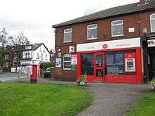
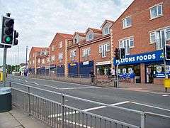 Shops on Selby Road | |
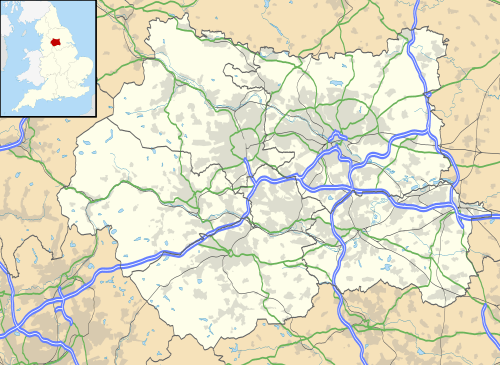 Halton Halton shown within West Yorkshire | |
| Population | 7,845 (Halton and Whitkirk combined[1]) |
| Metropolitan borough | |
| Metropolitan county | |
| Region | |
| Country | England |
| Sovereign state | United Kingdom |
| Post town | LEEDS |
| Postcode district | LS15 |
| Dialling code | 0113 |
| Police | West Yorkshire |
| Fire | West Yorkshire |
| Ambulance | Yorkshire |
| EU Parliament | Yorkshire and the Humber |
| UK Parliament | |
Halton is a district of east Leeds, West Yorkshire, England, situated between Cross Gates to the north, Halton Moor to the west, Colton to the east and Whitkirk to the South. Temple Newsam lies directly south of the estate. At the 2011 Census the district fell within the Temple Newsam ward of the Leeds City Council.
History
Halton was originally developed as a village on the main road linking Leeds and Selby. Development immediately before and after the Second World War, saw Halton grow substantially into a suburb of Leeds.
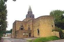
St Wilfrid's Church in Halton is a grade II* listed church built in 1939 at a cost of £11,700 and designed by A. Randall Wells.[2] The church is in the Arts and Crafts style and still has many of the original fittings designed by Wells as well as contemporary art by Eric Gill.[3]
Demographics
Halton is a suburban area of mainly owner-occupied housing of which almost three-quarters is semi detached or detached. The area compares favourably with Leeds as a whole in relation to indicators of deprivation, with relatively low levels of crime and anti-social behaviour, low levels of households in receipt of means-tested and out-of-work benefits and high levels of educational attainment. The area has a low level of people from BME backgrounds.[4]
Local facilities and attractions
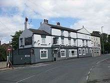
The main Public Houses of Halton were the Irwin Arms (now demolished), The Travellers Rest(now demolished) and The Woodman.
There is a Lidl, Tesco Express and Fultons supermarkets.
The local Primary School is named Templenewsam Halton Primary School, with Whitkirk Primary also being within the local area.
The area is 3.5 miles (5.6 km) to the east of Leeds city centre and is close to the A63 dual carriageway.
Notable people
- Beryl Burton[5] – cyclist
- Christabel Burniston[6] – founder of the English Speaking Board
Location grid
Halton, Leeds | |
|---|---|
References
- ↑ Leeds Neighbourhood Index: Halton and Whitkirk Archived 2011-09-29 at the UK Government Web Archive
- ↑ Historic England. "Church of St Wilfrid (1256092)". National Heritage List for England. Retrieved 6 December 2012.
- ↑ Halton St Wilfrid: Our history and architecture
- ↑ Leeds Neighbourhood Index: Halton and Whitkirk Archived 2011-09-29 at the UK Government Web Archive
- ↑ "Interview: Beryl Burton". Bike Culture. Cyclorama. Retrieved 4 October 2015.
- ↑ "Christabel Burniston MBE". Yorkshire Post. 4 November 2006. Retrieved 4 October 2015.
Further reading
- John Gilleghan (2004) Halton The Story of an East Leeds Village (Kingsway Press) ISBN 978-1412029452
External links
- "The Ancient Parish of Whitkirk". GENUKI. Retrieved 29 October 2007. - Halton was in this parish
| About Leeds | |
|---|---|
| Parliamentary constituencies | |
| Government | |
| Areas (List) |
|
| |