Guysborough County, Nova Scotia
| Guysborough County | |
|---|---|
| County | |
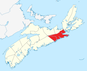 Location of Guysborough County, Nova Scotia | |
| Coordinates: 45°18′N 61°48′W / 45.3°N 61.8°WCoordinates: 45°18′N 61°48′W / 45.3°N 61.8°W | |
| Country |
|
| Province |
|
| District municipalities | Guysborough / St. Mary's |
| Towns | Mulgrave |
| Established | 1836 |
| Electoral Districts Federal |
Central Nova / Cape Breton—Canso |
| Provincial | Guysborough–Eastern Shore–Tracadie |
| Area[1] | |
| • Land | 4,044.22 km2 (1,561.48 sq mi) |
| Population [1][2] | |
| • Total | 8,143 |
| • Density | 2.0/km2 (5/sq mi) |
| • Change 2006-11 |
|
| • Census Rankings - District municipalities Guysborough St. Mary's - Town Mulgrave |
4,681 (721 of 5,008) 2,587 (1,110 of 5,008) 879 (2,234 of 5,008) |
| 2011 | |
| Time zone | UTC-4 (AST) |
| • Summer (DST) | UTC-3 (ADT) |
| Area code(s) | 902 |
| Dwellings | 5,377 |
| Median Income* | $34,894 |
| |
Guysborough County is a county in the Canadian province of Nova Scotia.
History
Taking its name from the Township of Guysborough, which was named in honour of Sir Guy Carleton, Guysborough County was created when Sydney County (Antigonish County) was divided in 1836.
In 1840, Guysborough County was subdivided into two districts for court sessisonal purposes – Guysborough and St. Mary's. In 1863, the boundary between Halifax County and Guysborough County was altered and a polling district was added to Guysborough County. In 1879, the two districts were incorporated as district municipalities.
Demographics
As a census division in the 2016 Census of Population conducted by Statistics Canada, Guysborough County recorded a population of 7,625 living in 3,549 of its 5,190 total private dwellings, a change of −6.4% from its 2011 population of 8,143. With a land area of 4,044.15 km2 (1,561.46 sq mi), it had a population density of 1.9/km2 (4.9/sq mi) in 2016.[3]
|
Mother tongue language (2011)[6]
|
Ethnic Groups (2006)[7]
|
Communities
- Towns
- District municipalities
Access routes
Highways and numbered routes that run through the county, including external routes that start or finish at the county limits:[8]
See also
References
- 1 2 2006 Statistics Canada Community Profile: Guysborough County, Nova Scotia
- ↑ Statistics Canada Population and dwelling counts, for Canada and census subdivisions (municipalities), 2006 and 2001 censuses - 100% data
- ↑ "Population and dwelling counts, for Canada, provinces and territories, and census divisions, 2016 and 2011 censuses – 100% data (Nova Scotia)". Statistics Canada. February 8, 2017. Retrieved February 12, 2017.
- ↑ Censuses 1871-1941
- ↑ Statistics Canada: 1996, 2001, 2006 census
- ↑ Statistics Canada: 2011 census
- ↑ 2006 Statistics Canada Census Ethnocultural Portrait of Canada: GuysboroughCounty, Nova Scotia
- ↑ Atlantic Canada Back Road Atlas ISBN 978-1-55368-618-7 Pages 56, 70-73, 83
External links
| Wikimedia Commons has media related to Guysborough County, Nova Scotia. |
- Photographs of historic monuments in Guysborough County
- Melford International Terminal
- Authentic Seacoast Properties
Places adjacent to Guysborough County, Nova Scotia | |
|---|---|
| Historical counties | |
|---|---|
| Economic regions | |
| Regional municipalities | |
| County municipalities | |
| District municipalities | |
| Towns | |
| Villages | |
| Lists | |
| |