Nova Scotia Trunk 16
| ||||
|---|---|---|---|---|
| Route information | ||||
| Length | 79 km (49 mi) | |||
| Major junctions | ||||
| East end | Canso | |||
|
| ||||
| Northwest end |
| |||
| Location | ||||
| Counties | Antigonish, Guysborough | |||
| Towns | Guysborough | |||
| Highway system | ||||
|
Provincial highways in Nova Scotia
| ||||

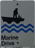
Part of Marine Drive
Trunk 16 is part of the Canadian province of Nova Scotia's system of trunk highways. The road runs from an intersection with Trunk 4 in Monastery to Canso, a distance of 79 kilometres.
From Monastery, Trunk 16 follows the Tracadie River south to Boylston, where it crosses the Milford Haven River. The road then runs along the west bank of the river to its mouth at Guysborough, where it continues eastward along the coast of Chedabucto Bay to the road's end in Canso.
References
| Preceded by |
Trunk 16 Nova Scotia |
Succeeded by Union Street Canso |
This article is issued from
Wikipedia.
The text is licensed under Creative Commons - Attribution - Sharealike.
Additional terms may apply for the media files.