Gryfice
| Gryfice | |||
|---|---|---|---|
 Victory Square and Saint Mary's Church | |||
| |||
 Gryfice | |||
| Coordinates: 53°54′53″N 15°11′55″E / 53.91472°N 15.19861°E | |||
| Country |
| ||
| Voivodeship | West Pomeranian | ||
| County | Gryfice County | ||
| Gmina | Gmina Gryfice | ||
| City rights | 1262 | ||
| Government | |||
| • Mayor | Andrzej Wacław Szczygieł | ||
| Area | |||
| • Total | 12.4 km2 (4.8 sq mi) | ||
| Population (2008) | |||
| • Total | 16,632 | ||
| • Density | 1,300/km2 (3,500/sq mi) | ||
| Time zone | UTC+1 (CET) | ||
| • Summer (DST) | UTC+2 (CEST) | ||
| Postal code | 72-300 | ||
| Car plates | ZGY | ||
| Website | http://www.urzad.gryfice.eu/ | ||

Gryfice ([ɡrɨˈfʲit͡sɛ] (![]()
History

The Battle of Niekładź took place in the area of Gryfice in 1121, in which Polish ruler Bolesław III Wrymouth defeated Wartislaw I, Duke of Pomerania and Swantopolk I, Duke of Pomerania.[2][3]
In 1262, throughout the German Ostsiedlung, Wartislaw III, Duke of Pomerania founded a town under Lübeck law on the Rega river. After his death, his successor, Barnim I, Duke of Pomerania, named the settlement Civitat Griphemberch super Regam (Griffinsmountain) after the coat of arms symbol of the Dukes of Pomerania. In 1365 the town entered the Hanseatic League and prospered due to the right of free navigation on the Rega.
A town wall was built and at the end of the 13th century the construction of the St. Mary’s church was begun. In a document of 1386 a Latin school is mentioned, which is generally called the oldest in Pomerania. After the death of the last Pomeranian Duke and by the Treaty of Westphalia Greifenberg became part of Brandenburg-Prussia in 1648 and part of Imperial Germany in 1871. In 1818 the town became the capital of the Greifenberg district (Kreis Greifenberg).
In 1894 the town was connected to the railway line Altdamm - Kolberg. On July 1, 1896 the Greifenberger Kleinbahn was opened, a narrow-gauge railway today used as a railway Museum.
At the end of World War II the Soviet Red Army conquered the town and approximately 40 percent of the town was destroyed. Following the post-war boundary changes, Greifenberg was renamed Gryfice and became part of Poland. Its German population was expelled and the town was populated with Poles, many of them expellees themselves from Polish areas annexed by the Soviet Union.


Demographics
Before the end of World War II the (then-German) inhabitants were predominantly Protestant. With the transformation into a Polish town after World War II, the majority of its population has been composed of Catholics.
| Year | Inhabitants | Notes |
|---|---|---|
| 1740 | 1,724[4] | |
| 1782 | 1,890 | incl. 20 Jews.[4] |
| 1794 | 2,138 | incl. 19 Jews.[4] |
| 1812 | 2,445 | incl. 15 Catholics and 35 Jews.[4] |
| 1816 | 2,610 | incl. 44 Catholics and 35 Jews.[4] |
| 1831 | 3,272 | incl. 13 Catholics and 82 Jews.[4] |
| 1843 | 4,027 | incl. 9 Catholics and 132 Jews.[4] |
| 1852 | 4,886 | incl. 15 Catholics and 129 Jews.[4] |
| 1861 | 5,361 | incl. 31 Catholics, and 134 Jews.[4] |
| 1900 | 6,477[5] | |
| 1925 | 8,370 | incl. 110 Catholics, 80 Jews and 630 others.[6] |
| 1939 | 10,800 | |
| 1946 | 4,900 | after expulsion of Germans after World War II and war losses |
| 1950 | 8,700 | |
| 1960 | 11,600 | |
| 1970 | 13,200 | |
| 1980 | 15,300 | |
| 1990 | 17,600 | |
| 2000 | 17,300 |

Notable residents
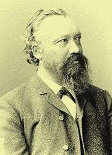
.jpg)
- David Christiani (1610–1688), a German mathematician, philosopher and Lutheran theologian
- Karl Wilhelm Gottlob Kastner, (1783–1857) a German chemist, natural scientist and a professor of physics and chemistry
- Gustav von Struensee (1803–1875) a German writer.
- Herman Schatz (1843–1906) an American politician and blacksmith emigrated to the USA in 1851
- Friedrich Heinrich Albert Wangerin (1844–1933) a German mathematician.
- Richard C. H. Lenski (1864−1936), Lutheran scholar, emigrated to the USA in 1872
- Conrad Pochhammer (1873–1932) a German physician and surgeon
- Rita von Gaudecker (1879-1968) a German author of books for children and young people
- Moritz Seeler (1896–1942) a German poet, writer, film producer and victim of the Holocaust.
- Ehrengard Schramm (1900–1985) a German politician and writer
- Krzysztof Linkowski (born 1949) a retired Polish runner who specialized in the 800 metres
- Bartosz Nowicki (born 1984) a Polish middle distance runner.
- Grzegorz Krychowiak (born 1990) a Polish footballer, played over 50 games for Poland
International relations
Twin towns — Sister cities
Gryfice is twinned with:
Notes
- ↑ "

- ↑ Rodowód książat pomorskich Szczecin 2005 page 94-95, 98
- ↑ Richard Roepell: Geschichte Polens, vol. I, Hamburg 1840, pp. 267-268 (in German)
- 1 2 3 4 5 6 7 8 9 Kratz (1965), p. 176.
- ↑ Meyers Konversations-Lexikon. 6th edition, vol. 8, Leipzig and Vienna 1907, p. 272.
- ↑ Der Große Brockhaus. 15th edition, vol. 2, Leipzig 1929, p. 488.
Literature
- Gustav Kratz: Die Städte der Provinz Pommern - Abriß ihrer Geschichte, zumeist nach Urkunden. Berlin 1865 (reprinted in 1996 by Sändig Reprint Verlag, Vaduz/Liechtenstein, ISBN 3-253-02734-1; reprinted in 2011 by Kessinger Publishing, U.S.A., ISBN 1-161-12969-3), pp. 32–38 (online).
External links
| Wikimedia Commons has media related to Gryfice. |
![]()
- Official website (in Polish)
- narrow-gauge railway museum (in German)
- Jewish Community in Gryfice on Virtual Shtetl
Coordinates: 53°54′53″N 15°11′55″E / 53.91472°N 15.19861°E
| Seat |  | |
|---|---|---|
| Villages | ||
Seat: Gryfice | ||
| Urban-rural gminas |  | |
| Rural gminas | ||