Greensboro, Maryland
| Greensboro, Maryland | |
|---|---|
| Town | |
 Location of Greensboro, Maryland | |
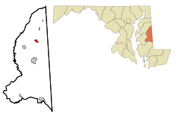
 Greensboro Location within the U.S. state of Maryland  Greensboro Greensboro (the US) | |
| Coordinates: 38°58′32″N 75°48′25″W / 38.97556°N 75.80694°WCoordinates: 38°58′32″N 75°48′25″W / 38.97556°N 75.80694°W | |
| Country |
|
| State |
|
| County |
|
| Incorporated | 1826[1] |
| Area[2] | |
| • Total | 1.05 sq mi (2.72 km2) |
| • Land | 1.05 sq mi (2.72 km2) |
| • Water | 0 sq mi (0 km2) |
| Elevation | 16 ft (5 m) |
| Population (2010)[3] | |
| • Total | 1,931 |
| • Estimate (2016)[4] | 1,882 |
| • Density | 1,800/sq mi (710/km2) |
| Time zone | UTC-5 (Eastern (EST)) |
| • Summer (DST) | UTC-4 (EDT) |
| ZIP code | 21639 |
| Area code(s) | 410 |
| FIPS code | 24-35200 |
| GNIS feature ID | 0590381 |
Greensboro is a town located on the banks of the Choptank River in Caroline County, Maryland. The population was 1,931 at the 2010 United States Census. The ZIP code is 21639. The primary phone exchange is 482 and the area code is 410. The town is served by Maryland Routes 480 and 313. It may have been named for Revolutionary War hero Nathanael Greene.
Greensboro hosts the Caroline County Softball League, which has produced both state and national champions.
Willow Grove was listed on the National Register of Historic Places in 1972.[5] Leonard House was listed in 1988 and Brick House Farm in 2009.[5]
Geography
Greensboro is located at 38°58′32″N 75°48′25″W / 38.975441°N 75.806982°W.[6]
According to the United States Census Bureau, the town has a total area of 1.05 square miles (2.72 km2), all of it land.[2]
Demographics
| Historical population | |||
|---|---|---|---|
| Census | Pop. | %± | |
| 1860 | 406 | — | |
| 1870 | 561 | 38.2% | |
| 1880 | 684 | 21.9% | |
| 1890 | 902 | 31.9% | |
| 1900 | 641 | −28.9% | |
| 1910 | 609 | −5.0% | |
| 1920 | 668 | 9.7% | |
| 1930 | 760 | 13.8% | |
| 1940 | 737 | −3.0% | |
| 1950 | 1,181 | 60.2% | |
| 1960 | 1,160 | −1.8% | |
| 1970 | 1,173 | 1.1% | |
| 1980 | 1,253 | 6.8% | |
| 1990 | 1,441 | 15.0% | |
| 2000 | 1,632 | 13.3% | |
| 2010 | 1,931 | 18.3% | |
| Est. 2016 | 1,882 | [4] | −2.5% |
| U.S. Decennial Census[7] | |||
2010 census
As of the census[3] of 2010, there were 1,931 people, 703 households, and 477 families residing in the town. The population density was 1,839.0 inhabitants per square mile (710.0/km2). There were 798 housing units at an average density of 760.0 per square mile (293.4/km2). The racial makeup of the town was 75.8% White, 13.6% African American, 0.9% Native American, 0.8% Asian, 1.4% Pacific Islander, 4.0% from other races, and 3.6% from two or more races. Hispanic or Latino of any race were 9.4% of the population.
There were 703 households of which 42.4% had children under the age of 18 living with them, 42.0% were married couples living together, 18.3% had a female householder with no husband present, 7.5% had a male householder with no wife present, and 32.1% were non-families. 27.3% of all households were made up of individuals and 12.4% had someone living alone who was 65 years of age or older. The average household size was 2.74 and the average family size was 3.30.
The median age in the town was 30.2 years. 30% of residents were under the age of 18; 10.5% were between the ages of 18 and 24; 30.2% were from 25 to 44; 19.5% were from 45 to 64; and 9.8% were 65 years of age or older. The gender makeup of the town was 46.5% male and 53.5% female.
2000 census
As of the census[8] of 2000, there were 1,632 people, 616 households, and 407 families residing in the town. The population density was 2,451.3 people per square mile (940.5/km²). There were 674 housing units at an average density of 1,012.4 per square mile (388.4/km²). The racial makeup of the town was 78.86% White, 16.91% African American, 0.06% Native American, 0.67% Asian, 1.78% from other races, and 1.72% from two or more races. Hispanic or Latino of any race were 2.63% of the population.
There were 616 households out of which 40.6% had children under the age of 18 living with them, 41.7% were married couples living together, 19.6% had a female householder with no husband present, and 33.9% were non-families. 29.1% of all households were made up of individuals and 13.6% had someone living alone who was 65 years of age or older. The average household size was 2.64 and the average family size was 3.28.
In the town, the population was spread out with 32.4% under the age of 18, 9.4% from 18 to 24, 29.4% from 25 to 44, 16.5% from 45 to 64, and 12.3% who were 65 years of age or older. The median age was 31 years. For every 100 females, there were 85.0 males. For every 100 females age 18 and over, there were 80.8 males.
The median income for a household in the town was $31,397, and the median income for a family was $36,083. Males had a median income of $27,092 versus $20,729 for females. The per capita income for the town was $13,787. About 15.6% of families and 16.5% of the population were below the poverty line, including 21.6% of those under age 18 and 17.1% of those age 65 or over.
Town Officials
Mayor: Joseph Noon
Commissioners:
Kevin Reichart
Joseph Williamson
Angelo DeSimone
Michael Mackey
Vice Mayor: Michael Mackey
Town Manager: Jeanette DeLude
Clerk/Treasurer: Amber Korrell
Asst. Clerk/Treasurer:
Assistant Clerk II:
Police Chief: Michael Petyo
Public Works Director: David Kibler
Communities
- Maple Village
- Foxgrape Farm
- Cedar Run
- Spring Branch
- Holly Corner
- Choptank Overlook
- Four Corners
- Three Corners
- Bowen Estates
- Choptank Ponds
- East Cherry
- Kinnamon Meadows (Under Construction)
- Greensboro Farms
- Caroline Farms
Notable people
- T. Alan Goldsborough, jurist
- William Hersey Hopkins, college administrator
References
- ↑ "Greensboro". Maryland Manual. Retrieved 25 June 2017.
- 1 2 "US Gazetteer files 2010". United States Census Bureau. Archived from the original on 2012-01-24. Retrieved 2013-01-25.
- 1 2 "American FactFinder". United States Census Bureau. Retrieved 2013-01-25.
- 1 2 "Population and Housing Unit Estimates". Retrieved June 9, 2017.
- 1 2 National Park Service (2009-03-13). "National Register Information System". National Register of Historic Places. National Park Service.
- ↑ "US Gazetteer files: 2010, 2000, and 1990". United States Census Bureau. 2011-02-12. Retrieved 2011-04-23.
- ↑ "Census of Population and Housing". Census.gov. Archived from the original on May 12, 2015. Retrieved June 4, 2015.
- ↑ "American FactFinder". United States Census Bureau. Archived from the original on 2013-09-11. Retrieved 2008-01-31.
External links
Municipalities and communities of Caroline County, Maryland, United States | ||
|---|---|---|
| Towns | 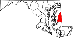 | |
| CDPs | ||
| Unincorporated communities | ||
| Footnotes | ‡This populated place also has portions in an adjacent county or counties | |