Greater Binghamton Airport
| Greater Binghamton Airport Edwin A. Link Field | |||||||||||||||
|---|---|---|---|---|---|---|---|---|---|---|---|---|---|---|---|
|
| |||||||||||||||
| Summary | |||||||||||||||
| Airport type | Public | ||||||||||||||
| Owner | Broome County | ||||||||||||||
| Serves | Binghamton, New York | ||||||||||||||
| Location | Maine, New York | ||||||||||||||
| Elevation AMSL | 1,636 ft / 499 m | ||||||||||||||
| Coordinates | 42°12′31″N 075°58′47″W / 42.20861°N 75.97972°WCoordinates: 42°12′31″N 075°58′47″W / 42.20861°N 75.97972°W | ||||||||||||||
| Website | www.FlyBGM.com | ||||||||||||||
| Map | |||||||||||||||
 BGM Location in New York  BGM BGM (the US) | |||||||||||||||
| Runways | |||||||||||||||
| |||||||||||||||
| Statistics (2011) | |||||||||||||||
| |||||||||||||||
Greater Binghamton Airport (IATA: BGM, ICAO: KBGM, FAA LID: BGM) is a county-owned airport eight miles north of Binghamton, in Broome County, New York.[1] It is in East Maine, New York and serves the Southern Tier of New York.
The airport was Broome County Airport through the 1970s. It was renamed Edwin A. Link Field-Broome County Airport to honor the inventor of the aircraft instrument simulator, the Link Trainer, a name it kept until the 1990s when it was again renamed as Binghamton Regional Airport. The name Greater Binghamton Airport was chosen in 2003. The field is still named in Link's honor.
The National Plan of Integrated Airport Systems for 2011–2015 categorized it as a primary commercial service airport (more than 10,000 enplanements per year).[2] Federal Aviation Administration records say the airport had 108,325 passenger boardings (enplanements) in calendar year 2008,[3] 98,090 in 2009 and 108,988 in 2010.[4]
History
The Greater Binghamton Airport (BGM) (originally Broome County Airport) has served Binghamton for six decades. Development started in 1945, due to the overwhelming night operations at the Tri-Cities Airport in Endicott, New York during World War II. Broome County Airport opened in 1951 with a 5,600-foot main Runway 16/34, and a 5,002-foot crosswind Runway 10/28.
To accommodate larger aircraft, the main runway was extended 700 feet in 1969. In the early 1980s the field was renamed Edwin A. Link Field-Broome County Airport in honor of Edwin A. Link a well-known inventor and aviation pioneer in the Binghamton area. Mr. Link was known for the creation of the Link Trainer, which became the first trainer that taught pilots how to fly in instrument meteorological conditions using only the instruments inside the cockpit ("Facility Orientation Guide", n.d.).
In the 1950s Mohawk, TWA and Colonial-then-Eastern stopped at BGM; TWA left in 1965–66 and Eastern left around 1970. Mohawk's successors' jets still stopped in the 1990s.
Ultimately, the airport was a hub for a commuter airline, Brockway Air, which had a fleet of Beechcraft 1900s and Fokker F-27s in the 1980s. Brockway Air did short haul flights to Broome County airport from Syracuse, Boston, Albany, Keene, NH, Worcester, Burlington, and Rutland. The airport began extending the north end of the main runway 16/34 in 1988; the extension from 6,298 to 7,500 feet was completed in October 1990. In 1991 the airport was again renamed to Binghamton Regional Airport.
In 2002 Runway 16/34 was shortened to 7,100 feet to make room for an Engineered Material Arresting System (EMAS). The EMAS is a bed of material that will crush under the weight of an aircraft, stopping the aircraft in the event of a runway overrun.
In 2003 the airport was again renamed to the Greater Binghamton Airport. The airport's old linear terminal was unable to keep up with regional jet traffic, and four new jet bridges opened in July 2004. BGM got a 12.3 million dollar federal grant in September 2011 to replace the old EMAS system installed in 2002 and extend Runway 16 and 34 to 7,304 feet. The extension project was completed in November 2012 and implemented a displaced threshold on Runway 34.
Facilities
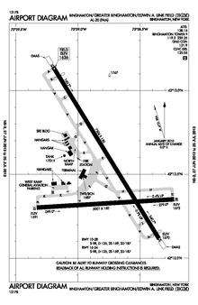
The airport covers 1,199 acres (485 ha) at an elevation of 1,636 feet (499 m). It has two asphalt runways: 16/34 is 7,304 by 150 feet (2,226 x 46 m) and 10/28 is 5,001 by 150 feet (1,524 x 46 m).[1]
In 2011 the airport had 21,542 aircraft operations, average 59 per day: 56% general aviation, 38% air taxi, 6% military, and <1% airline. 34 aircraft were then based at the airport: 62% single-engine, 18% multi-engine, 12% helicopter, and 9% jet.[1]
Airline and destination
| Airlines | Destinations |
|---|---|
| Delta Connection | Detroit |
Top destinations
| Rank | City | Passengers | Carriers |
|---|---|---|---|
| 1 | Detroit, MI | 28,420 | Delta |
| 2 | Philadelphia, PA | 13,810 | American |
| 3 | Newark, NJ | 9,400 | United |
Ground transportation
Rental car agencies
Public transport
- Licensed taxis to all points in Broome County
- Uber and Lyft [6]
Incidents
- In June 1952 a U.S. Navy North American SNJ Texan trainer crashed 250 yards east of the airport. The pilot suffered minor injuries.[7]
- On July 23, 1955, a U.S. Naval Reserve Grumman TBM Avenger crashed short of the runway. The pilot suffered minor injuries.[8]
- On September 4, 1957, a U.S. Air Force Douglas C-124A Globemaster II en route from Larson AFB, Washington crashed while attempting a landing. The plane was delivering 20 tons of equipment for Link Aviation. The crew of 9 survived.[9][10]
- On Wednesday, November 24, 2010, United Airlines Flight 7823, a United Express Saab 340 turboprop operated by Colgan Air made an emergency landing after the crew received a fire indication in the left engine while passing through 10,000 feet. The flight was bound for Washington Dulles International Airport. On landing in Binghamton, 16 minutes after takeoff, all 33 passengers evacuated via over-wing emergency exits. None required medical attention. Maintenance determined the cause of the fire indication was a faulty sensor. Passengers continued to Washington after about a five-hour delay.[11][12]
References
- 1 2 3 4 FAA Airport Master Record for BGM (Form 5010 PDF). Federal Aviation Administration. Effective November 15, 2012.
- ↑
"2011–2015 NPIAS Report, Appendix A" (PDF). National Plan of Integrated Airport Systems. Federal Aviation Administration. October 4, 2010. Archived from the original (PDF, 2.03 MB) on October 27, 2012. External link in
|work=(help) - ↑
"Enplanements for CY 2008" (PDF, 1.0 MB). CY 2008 Passenger Boarding and All-Cargo Data. Federal Aviation Administration. December 18, 2009. External link in
|work=(help) - ↑
"Enplanements for CY 2010" (PDF, 189 KB). CY 2010 Passenger Boarding and All-Cargo Data. Federal Aviation Administration. October 4, 2011. External link in
|work=(help) - ↑ http://www.transtats.bts.gov/airports.asp?pn=1&Airport=BGM&Airport_Name=Binghamton,%20NY:%20Greater%20Binghamton/Edwin%20A.%20Link%20Field&carrier=FACTS
- ↑ "New bill: Uber, Lyft drivers can't be sex offenders". Pressconnects. Retrieved 2017-06-08.
- ↑ "Crash First Major Accident in 6-Year History of Airport". Binghamton Press. Binghamton. September 5, 1957. p. 22.
- ↑ "Crash Injures Endicott Pilot". Binghamton Press. Binghamton. July 24, 1955. p. 1.
- ↑ Handte, Jerry (September 5, 1957). "Co-Pilot Tells How Plane Crashed". Binghamton Press. Binghamton. p. 1.
- ↑ http://aviation-safety.net/database/record.php?id=19570904-0
- ↑ "Incident: Colgan SF34 at Binghamton on Nov 24th 2010, engine fire indication".
- ↑ http://www.pressconnects.com/apps/pbcs.dll/article?AID=201011240392
External links
- Greater Binghamton Airport, official site
- Web archive for BGM Website
- "New York State DOT Airport Diagram" (PDF).
- Aerial image as of May 1994 from USGS The National Map
- FAA Airport Diagram (PDF), effective October 11, 2018
- FAA Terminal Procedures for BGM, effective October 11, 2018
- Resources for this airport:
- AirNav airport information for KBGM
- ASN accident history for BGM
- FlightAware airport information and live flight tracker
- NOAA/NWS latest weather observations
- SkyVector aeronautical chart for KBGM
- FAA current BGM delay information
| City neighborhoods |
|  |
|---|---|---|
| Surrounding municipalities | ||
| Higher education | ||
| Sports teams and events | ||
| Parks and entertainment |
| |
| Transportation | ||
| Businesses and institutions |
| |
| ||