Golfo San Jorge Basin
| Golfo San Jorge Basin | |
|---|---|
| Cuenca del Golfo San Jorge | |
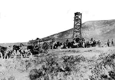
 Oil well near the port city of Comodoro Rivadavia | |
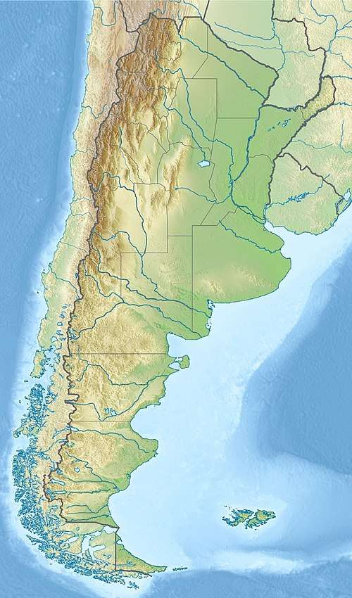 Location of the basin in Argentina | |
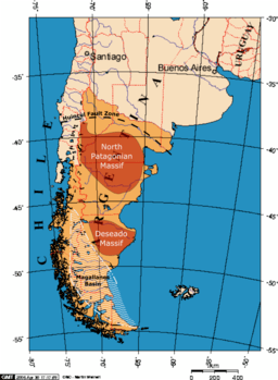 The Golfo San Jorge Basin is located between the North Patagonian and Deseado Massifs | |
| Coordinates | 45°00′S 67°50′W / 45.000°S 67.833°W |
| Etymology | San Jorge Gulf |
| Location | Southern South America |
| Region | Patagonia |
| Country |
|
| State(s) | Chubut, Santa Cruz |
| Cities | Comodoro Rivadavia |
| Characteristics | |
| On/Offshore | Both |
| Boundaries | North Patagonian Massif, Deseado Massif, Andes |
| Part of | Southern Atlantic rift basins |
| Area | 170,000 km2 (66,000 sq mi) |
| Hydrology | |
| Sea(s) | South Atlantic |
| River(s) | Chico River |
| Lake(s) | Lake Musters and Lake Colhué Huapí |
| Geology | |
| Basin type | Rift |
| Plate | South American |
| Orogeny | Opening of the South Atlantic |
| Age | Early Jurassic-Pleistocene |
| Stratigraphy | Stratigraphy |
| Field(s) | Cañadón León, Cerro Dragón, Diadema, El Tordillo |
The Golfo San Jorge Basin (Spanish: Cuenca del Golfo San Jorge) is a hydrocarbon-rich sedimentary basin located in eastern Patagonia, Argentina. The basin covers the entire San Jorge Gulf and an inland area west of it, having one half located in Santa Cruz Province and the other in Chubut Province. The northern boundary of the basin is the North Patagonian Massif while the Deseado Massif forms the southern boundary of the basin. The basin has largely developed under condition of extensional tectonics, including rifting.[1]
At the center of the basin accumulated sediments reach more than 8,000 metres (26,000 ft) of thickness. Oil was first discovered in 1907 and over the years it has become the second most productive hydrocarbon basin in Argentina after Neuquén Basin.[1]
Stratigraphy
The stratigraphy of the Golfo San Jorge Basin covers the following units:[1][2]
| Group | Formation | Age bold is SALMA type | Tectonic regime | Depositional environment | Thickness (m) | Petroleum geology |
|---|---|---|---|---|---|---|
| Tehuelche Shingle | Pleistocene | Glacio-fluvial | 40 | |||
| Río Mayo | Mayoan | |||||
| Santa Cruz | Santacrucian | Fluvio-deltaic | 200 | |||
| Patagonia | Shallow marine | 280 | ||||
| Sarmiento Colhué Huapí Mb. Chenque | Colhuehuapian | Fluvio-lacustrine | 120 | |||
| Deseadan | ||||||
| Tinguirirican | ||||||
| Río Chico | Koluel Kaike | Divisaderan | Lacustrine | 42 | ||
| Mustersan | ||||||
| Casamayor Las Flores | Casamayoran | Fluvio-lacustrine | 44 | |||
| Peñas Coloradas | Riochican | Fluvial | 42 | |||
| Itaboraian | ||||||
| Las Violetas | Peligran | 25 | ||||
| Salamanca | Peligran | Shallow marine-deltaic-fluvial | 200 | RES | ||
| Tiupampan | ||||||
| Yacimiento El Trébol Meseta Espinosa Bajo Barreal Laguna Palacios | Maastrichtian Aptian | Late sag | Deltaic Fluvio-lacustrine | 4000+ | RES | |
| Cañadón Seco Comodoro Rivadavia Bajo Barreal | Alluvial-fluvial-lacustrine | RES | ||||
| Mina El Carmen Castillo | Fluvio-lacustrine | RES | ||||
| Pozo D-129 Matasiete | Early sag | 1500+ | SR, RES | |||
| Pozo Cerro Guadal | Neocomian | Late rift | Fluvio-lacustrine | 560 | ||
| Pozo Anticlinal Aguada Bandera | Lacustrine | 1700+ | SR | |||
| Bahía Laura Lonco Trapial | Late Jurassic | Early rift | Volcaniclastic | 1300+ | ||
| Early Jurassic | Pre-rift | Shallow marine | 700+ | |||
| Basement | Paleozoic | |||||
See also
References
- 1 2 3 Sylwan, Caudio A. (2001). "Geology of the Golfo San Jorge Basin, Argentina". Journal of Iberian Geology. 27: 123–157. Retrieved 4 December 2015.
- ↑ Raigemborn et al., 2010, p.243
Bibliography
- Raigemborn, María Sol; Javier M. Krause; Eduardo Bellosi, and Sergio D. Matheos. 2010. Redefinición estratigráfica del Grupo Río Chico (Paleógeno inferior), en el norte de la Cuenca del Golfo San Jorge, Chubut. Revista de la Asociación Geológica Argentina 67. 239–256. Accessed 2018-09-04.
Further reading
- Bally, A.W., and S. Snelson. 1980. Realms of subsidence. Canadian Society for Petroleum Geology Memoir 6. 9-94.
- Kingston, D.R.; C.P. Dishroon, and P.A. Williams. 1983. Global Basin Classification System. AAPG Bulletin 67. 2175-2193. Accessed 2017-06-23.
- Klemme, H.D. 1980. Petroleum Basins - Classifications and Characteristics. Journal of Petroleum Geology 3. 187-207. Accessed 2017-06-23.
Major South American geological features | |||||
|---|---|---|---|---|---|
| Tectonic plates |  | ||||
| Cratons and shields | |||||
| Structures undergoing subduction | |||||
| Faults and shear zones | |||||
| Rifts and grabens |
| ||||
| Sedimentary basins |
| ||||
| Orogenies |
| ||||
| Metallogenetic provinces | |||||
| Volcanism |
| ||||
Sedimentary basins of Argentina | ||||||
|---|---|---|---|---|---|---|
| Onshore |
| | ||||
| Offshore |
| |||||
| Sources |
| |||||