Glenelg Parish, New Brunswick
| Glenelg | |
|---|---|
| Parish | |
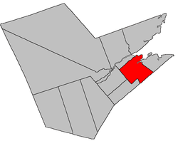 Location within Northumberland County, New Brunswick | |
| Coordinates: 47°00′N 65°17′W / 47.0°N 65.29°W | |
| Country |
|
| Province |
|
| County | Northumberland |
| Established | 1814 |
| Area[1] | |
| • Land | 505.22 km2 (195.07 sq mi) |
| Population (2011)[1] | |
| • Total | 1,610 |
| • Density | 3.2/km2 (8/sq mi) |
| • Pop 2006-2011 |
|
| • Dwellings | 735 |
| Time zone | UTC-4 (AST) |
| • Summer (DST) | UTC-3 (ADT) |
Glenelg is a Canadian parish in Northumberland County, New Brunswick.[2]
Its population in the 2011 Census was 1,610.
Delineation
Glenelg Parish is defined in the Territorial Division Act[3] as being bounded:
- Southwest by Nelson Parish and the southeasterly prolongation of the northeastern line of Nelson Parish to the northern line of a 100 acre lot granted to John Townley, at the mouth of Big Hovel Brook; thence along the said line of the said grant easterly to Bay du Vin River; thence across the said river to the southern bank thereof; thence down the said Bay du Vin River in an easterly direction to the northwest angle of lot letter C, granted to the rector, church wardens and vestry of Saint Paul’s Church, Chatham;[lower-alpha 1] thence southerly along the west line of said lot letter C and the southern prolongation thereof to the Kent county line; northwest and north by Chatham Parish, Napan River, and Miramichi Bay; southeast by the County line; northeast by a line commencing at the mouth of Black River; thence extending up the middle of the said river, following the several courses thereof, to the mouth of Little Black River; thence up the middle of the said Little Black River, following the several courses thereof until it comes to the line separating the property of George Fowlie from the lot number five, granted to Duncan McNaughton, being the upper side line of the said lot numbered five, thence by the said line and the southerly prolongation thereof to the County line.
Communities
Parish population total does not include incorporated municipalities (in bold):
|
|
|
Demographics
See also
Footnotes
- ↑ Chatham here refers to the civil parish as the church is in Bushville.
References
- 1 2 2011 Statistics Canada Census Profile: Glenelg Parish, New Brunswick
- ↑ New Brunswick Provincial Archives - Glenelg Parish
- ↑ "Territorial Division Act (R.S.N.B. 1973, c. T-3)". Government of New Brunswick website. Retrieved 22 August 2016.
- ↑ Statistics Canada: 1996, 2001, 2006 census
- ↑ 2006 Statistics Canada Community Profile: Glenelg Parish, New Brunswick
Places adjacent to Glenelg Parish, New Brunswick | |
|---|---|
| Subdivisions | |
|---|---|
| Cities | |
| Counties | |
| |
Coordinates: 47°00′00″N 65°17′24″W / 47.00000°N 65.29000°W
This article is issued from
Wikipedia.
The text is licensed under Creative Commons - Attribution - Sharealike.
Additional terms may apply for the media files.