Glendale, Kansas
| Glendale, Kansas | |
|---|---|
| Unincorporated community | |
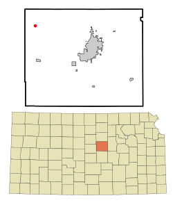 Location within Saline County and Kansas | |
 KDOT map of Saline County (legend) | |
| Coordinates: 38°53′54″N 97°52′30.1″W / 38.89833°N 97.875028°WCoordinates: 38°53′54″N 97°52′30.1″W / 38.89833°N 97.875028°W | |
| Country | United States |
| State | Kansas |
| County | Saline |
| Government | |
| • Type | Unincorporated community |
| Elevation | 1,387 ft (423 m) |
| Time zone | UTC-6 (Central Standard Time) |
| • Summer (DST) | UTC-5 (Central Daylight Time) |
| ZIP code | 67425 |
| Area code | 785 |
Glendale is an unincorporated community in northwestern Saline County, Kansas, United States.[1] It lies at 38°53′54″N 97°52′30.1″W / 38.89833°N 97.875028°W, or about 15 miles northwest of Salina, the county seat of Saline County.[1]
As a part of Saline County, Glendale is a part of the Salina micropolitan area.[2]
Education
Primary and secondary education
Glendale is part of Unified School District 240.[3][4][5]
Further reading
References
- 1 2 Saline County Planning Department. "Web mapping application". Saline County planning map. Archived from the original on February 13, 2010. Retrieved 2010-04-06.
- ↑ Nussle, Jim (2008-11-20). "Micropolitan Statistical Areas" (PDF). List 1-9. Office of Management and Budget, Executive Office of the President. p. 97. Retrieved 2010-04-02.
- ↑ USD 240
- ↑ Kansas School District Boundary Map Archived July 21, 2011, at the Wayback Machine.
- ↑ Saline County School District Map Archived July 27, 2011, at the Wayback Machine.
External links
| Wikimedia Commons has media related to Glendale, Kansas. |
Municipalities and communities of Saline County, Kansas, United States | ||
|---|---|---|
| Cities | 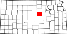 | |
| CDPs | ||
| Unincorporated communities | ||
| Townships |
| |
| Footnotes | ‡This populated place also has portions in an adjacent county or counties | |
This article is issued from
Wikipedia.
The text is licensed under Creative Commons - Attribution - Sharealike.
Additional terms may apply for the media files.