Gir Gadhada
| Gir Gadhada ગીર ગઢડા | |
|---|---|
| Village | |
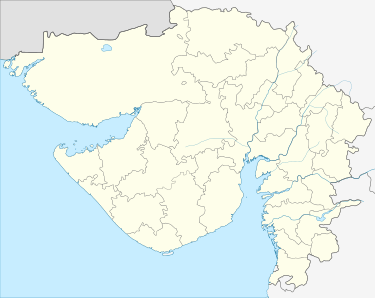
 Gir Gadhada Location in Gujarat, India  Gir Gadhada Gir Gadhada (India) | |
| Coordinates: 20°55′23″N 70°55′17″E / 20.923121°N 70.921362°ECoordinates: 20°55′23″N 70°55′17″E / 20.923121°N 70.921362°E | |
| Country |
|
| State | Gujarat |
| District | Gir Somnath |
| Taluka | Gir Gadhada |
| Government | |
| • Type | Panchayati raj (India) |
| • Body | Gram panchayat |
| Area[1] | |
| • Total | 2,144.11 ha (5,298.21 acres) |
| Population (2011) | |
| • Total | 9,631[1][2] |
| Sex ratio 4781/4850♂/♀[1] | |
| Languages | |
| • Official | Gujarati |
| Time zone | UTC+5:30 (IST) |
| PIN | 362530[2] |
| Vehicle registration | GJ |
| Census code of Gir Gadhada | 515255[1] |
| Nearest city | Gir Gadhada, Una |
| Website |
girsomnathdp |
Gir Gadhada (Gujarati: ગીર ગઢડા) is a mid city town in Gir Somnath district in the state of Gujarat, India. Before 2013, it was a village of Una Taluka in Junagadh District, Now it has become the administrative headquarters for 42 villages[3] when that taluka was created as part of the new Gir Somnath District in August of that year.[4][5] Newly built BAPS Shree Swaminarayana Mandir is a popular place of worship and spiritual activities here.[6] There is another older Swaminarayan mandir nearby. Other temples in the town are Shree Khodiyar Mandir and Shree ramji Mandir.
Demographics
According to the 2011 census of India, Gir Gadhada has 1849 households. The effective literacy rate (i.e. the literacy rate of population excluding children aged 6 and below) is 71.28% [1]
| Total | Male | Female | |
|---|---|---|---|
| Population | 9631 | 4781 | 4850 |
| Children aged below 6 years | 1226 | 615 | 611 |
| Scheduled caste | 872 | 441 | 431 |
| Scheduled tribe | 9 | 6 | 3 |
| Literates | 5991 | 3342 | 2649 |
| Illiterates | 3640 | 1439 | 2201 |
| Total Workers | 4070 | 2786 | 1284 |
| Main workers | 3486 | 2679 | 807 |
| Main workers: Cultivators | 733 | 604 | 129 |
| Main workers: Agricultural labourers | 1483 | 926 | 557 |
| Main workers: Household industry workers | 26 | 20 | 6 |
| Main workers: Other | 1244 | 1129 | 115 |
| Marginal workers (total) | 584 | 107 | 477 |
| Marginal workers: Cultivators | 245 | 15 | 230 |
| Marginal workers: Agricultural labourers | 269 | 54 | 215 |
| Marginal workers: Household industry workers | - | - | - |
| Marginal workers: Others | 70 | 38 | 32 |
| Non-workers | 5561 | 1995 | 3566 |
List of Villages in Gir Gadhada Taluka[7]
Below is the Revenue records list of forty-three villages of Gir Gadhada Taluka including Gir Gadhada village.[7]
- Ambavad
- Ankolali
- Babariya
- Bediya
- Bhakha
- Bhiyal
- Bodidar
- Dhokadva
- Dhrabavad
- Dron
- Fareda
- Fatsar
- Fulka
- Gir Gadhada
- Harmadiya
- Itvaya
- Jamvala
- Jaragli
- Jhanjhariya
- Jhudvadli
- Juna Ugla
- Kanakiya
- Kaneri
- Kansariya
- Khilavad
- Kodiya
- Mahobatpara
- Motisar
- Nagadiya
- Nava Ugla
- Nitli
- Panderi
- Rasulpara
- Sanosri
- Sanvav
- Sonariya
- Sonpura
- Thordi
- Umedpara
- Undari
- Vadli
- Vadviyala
- Velakot
See also
Notes and references
- 1 2 3 4 5 6 "Page no. 244 to 249 - District Census Handbook - Junagadh" (PDF). 2011 Census of India. Directorate of Census Operations, Gujarat.
- 1 2 "wikivillage article of Gir Gadhada". 2011 Census of India. Wikivillage.in.
- ↑ "Notification: Gujarat Land Revenue Code 1879: Schedule B Villages of Girgadhada Taluka" (PDF). The Gujarat Government Gazette. 54 (Extra No. 282). 9 September 2013. Archived (PDF) from the original on 13 April 2014.
- ↑ "Promises Delivered! Gujarat Cabinet approves creation of 7 New Districts and 22 New Talukas". Narendra Modi. 25 January 2013. Archived from the original on 15 April 2015.
- ↑ "Maps of Gujarat's new 7 districts and changes in existing districts". Desh Gujarat. 13 August 2013. Archived from the original on 16 August 2013.
- ↑ http://www.baps.org/News/2015/Murti-Pratishtha-Mahotsav-of-BAPS-Shri-Swaminarayan-Mandir-9358.aspx
- 1 2 "Notification: Gujarat Land Revenue Code 1879: Schedule B Villages of Girgadhada Taluka" (PDF). The Gujarat Government Gazette. 54 (Extra No. 282). 9 September 2013. Archived (PDF) from the original on 13 April 2014.