German Mills Creek
| German Mills Creek | |
| River | |
| Name origin: Named after the pioneer settlement German Mills | |
| Country | Canada |
|---|---|
| Province | Ontario |
| Region | Greater Toronto Area |
| Municipalities | Toronto, Markham, Richmond Hill, Vaughan |
| Part of | Great Lakes Basin |
| Tributaries | |
| - left | Duncan Woods Creek |
| Source | |
| - location | Vaughan |
| - elevation | 316 m (1,037 ft) |
| - coordinates | 43°54′42″N 79°28′54″W / 43.91167°N 79.48167°W |
| Mouth | Don River |
| - location | Toronto |
| - elevation | 152 m (499 ft) |
| - coordinates | 43°47′48″N 79°22′56″W / 43.79667°N 79.38222°WCoordinates: 43°47′48″N 79°22′56″W / 43.79667°N 79.38222°W |
| Length | 10 km (6 mi) |
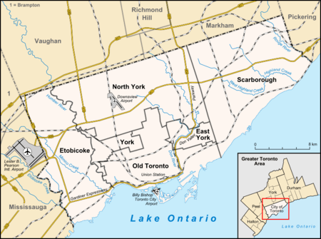 Location of the mouth of the creek in Toronto | |
German Mills Creek is a river in the municipalities of Markham, Richmond Hill, Toronto and Vaughan in the Greater Toronto Area of Ontario, Canada.[1] It is part of the Great Lakes Basin and is a left tributary of the East Branch Don River. It originates in Vaughan (near Bathurst Street and the King–Vaughan Town Line), flows south through Richmond Hill and Markham, and empties into the East Branch Don River in the East Don Parklands in Toronto, south of Steeles Avenue between Bayview Avenue and Leslie Street. It is part of a number of streams, swamps and swales located near the Oak Ridges Moraine.
It is named after the pioneer settlement German Mills, founded by William Berczy in 1796. The settlement disappeared after a few years, but the creek retained the name. The Richmond Hill portions of the river snake through residential development with a very narrow greenbelt on either side of the creek. The Markham sections run through a mix of residential, commercial and light industrial areas.
Duncan Woods Creek is a small left tributary that flows northwest to German Mills Creek in Toronto, at the southeast corner of Steeles Avenue and Leslie Street.[2]
There are a few undeveloped portions along the creek, mostly as parks in Markham.
The creek's approximate length is 10 kilometres (6 mi).
| Part of a series on the |
| Don Valley |
|---|
| Rivers |
| Parks |
| History |
| Environment |
Parks
- German Mills Settlers Park, (26 hectare or 65 acre natural area park)
- Wycliffe Park, Markham, Ontario
- German Mills Creek Channel Lands, Richmond Hill, Ontario
- German Mills Creek Park, Richmond Hill, Ontario
- Bestview Park Fitness Trail, Toronto
- Bestview Park
- East Donlands Park
- Maple Valley Park
- Valley View Park
- Doncrest Valley
- Langstaff Park
- German Mills Trail
- Toll Bar Park
Communities
- Elgin Mills, Richmond Hill
- Hillsview, Richmond Hill
- Langstaff, Richmond Hill
- Doncrest, Richmond Hill
- German Mills, Markham
- Hillcrest Village, Toronto
Development
- Newark Industrial Park
- David Dunlap Observatory
- Beaver Creek Business Park
References
- ↑ "German Mills Creek". Geographical Names Data Base. Natural Resources Canada. Retrieved 2012-08-02.
- ↑ Toronto and area street guide. MapArt. 2010. pp. 103, 104, 343, 349, 355. ISBN 978-1-55198-213-7.
See also